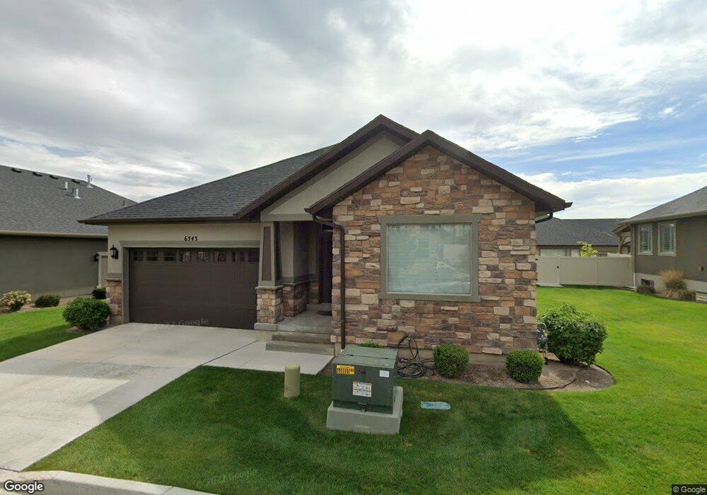
6543 W Hamilton Way Highland, UT 84003
Estimated Value: $715,000 - $840,000
3
Beds
3
Baths
3,255
Sq Ft
$234/Sq Ft
Est. Value
About This Home
This home is located at 6543 W Hamilton Way, Highland, UT 84003 and is currently estimated at $760,727, approximately $233 per square foot. 6543 W Hamilton Way is a home located in Utah County with nearby schools including Ridgeline Elementary School, Timberline Middle School, and Lone Peak High School.
Ownership History
Date
Name
Owned For
Owner Type
Purchase Details
Closed on
Sep 20, 2023
Sold by
Robert Patterson Revocable Trust
Bought by
Johnson David Allan and Johnson Aisling Joan
Current Estimated Value
Home Financials for this Owner
Home Financials are based on the most recent Mortgage that was taken out on this home.
Original Mortgage
$511,000
Outstanding Balance
$497,945
Interest Rate
5.95%
Mortgage Type
New Conventional
Estimated Equity
$262,782
Purchase Details
Closed on
Jul 26, 2017
Sold by
Patterson Robert
Bought by
Patterson Robert and Robert Patterson Revocable Tru
Purchase Details
Closed on
Feb 1, 2016
Sold by
D R Horton Inc
Bought by
Patterson Robert
Home Financials for this Owner
Home Financials are based on the most recent Mortgage that was taken out on this home.
Original Mortgage
$200,000
Interest Rate
3.98%
Mortgage Type
New Conventional
Create a Home Valuation Report for This Property
The Home Valuation Report is an in-depth analysis detailing your home's value as well as a comparison with similar homes in the area
Home Values in the Area
Average Home Value in this Area
Purchase History
| Date | Buyer | Sale Price | Title Company |
|---|---|---|---|
| Johnson David Allan | -- | Capstone Title And Escrow | |
| Patterson Robert | -- | None Available | |
| Patterson Robert | -- | Provo Land Title Co |
Source: Public Records
Mortgage History
| Date | Status | Borrower | Loan Amount |
|---|---|---|---|
| Open | Johnson David Allan | $511,000 | |
| Previous Owner | Patterson Robert | $200,000 |
Source: Public Records
Tax History Compared to Growth
Tax History
| Year | Tax Paid | Tax Assessment Tax Assessment Total Assessment is a certain percentage of the fair market value that is determined by local assessors to be the total taxable value of land and additions on the property. | Land | Improvement |
|---|---|---|---|---|
| 2025 | $2,933 | $371,745 | $205,300 | $470,600 |
| 2024 | $2,750 | $362,285 | $0 | $0 |
| 2023 | $2,535 | $366,410 | $0 | $0 |
| 2022 | $2,535 | $327,525 | $0 | $0 |
| 2021 | $2,467 | $474,700 | $140,000 | $334,700 |
| 2020 | $2,515 | $474,700 | $140,000 | $334,700 |
| 2019 | $2,350 | $464,000 | $140,000 | $324,000 |
| 2018 | $2,473 | $464,000 | $140,000 | $324,000 |
| 2017 | $2,191 | $219,450 | $0 | $0 |
| 2016 | $1,403 | $131,285 | $0 | $0 |
Source: Public Records
Map
Nearby Homes
- 12184 N Bridgegate Way
- 12219 N Bridgegate Way
- Timpani Plan at Highland Oaks
- Ballad Plan at Highland Oaks
- Bravo Plan at Highland Oaks
- Fortissimo Plan at Highland Oaks
- Anthem Plan at Highland Oaks
- Forte Plan at Highland Oaks
- Madrigal Plan at Highland Oaks
- Adagio Plan at Highland Oaks
- Octave Plan at Highland Oaks
- Harvard Plan at Highland Oaks
- Finale Plan at Highland Oaks
- 11847 N Saltaire Dr
- 6678 W Dry Creek Ln
- 11987 N Cyprus Dr
- 11825 N 6260 W
- 12179 N Creek Meadow Ct
- 6447 W Sunrise Dr
- 11572 N Maple Hollow Ct
- 6533 W Hamilton Way
- 6553 W Hamilton Way Unit 63
- 6553 W Hamilton Way
- 6538 W Brunswick Dr Unit 68
- 6548 W Brunswick Dr Unit 67
- 6542 W Hamilton Way Unit 33
- 6542 W Hamilton Way
- 6528 W Brunswick Dr
- 6536 W Hamilton Way
- 6556 W Brunswick Dr Unit 66
- 6556 W Brunswick Dr
- 6563 W Hamilton Way Unit 64
- 6556 W Hamilton Way
- 6564 W Hamilton Way Unit 30
- 6564 W Hamilton Way
- 12034 N Brunswick Dr
- 12034 N Brunswick Dr Unit 15
- 6566 W Brunswick Dr Unit 65
- 12042 N Brunswick Dr
- 6539 W Brunswick Dr