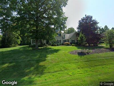
6549 Sherborne Ln Hudson, OH 44236
Estimated Value: $791,657 - $954,000
5
Beds
4
Baths
3,518
Sq Ft
$243/Sq Ft
Est. Value
About This Home
This home is located at 6549 Sherborne Ln, Hudson, OH 44236 and is currently estimated at $853,914, approximately $242 per square foot. 6549 Sherborne Ln is a home located in Summit County with nearby schools including Ellsworth Hill Elementary School, East Woods Intermediate School, and Hudson Middle School.
Ownership History
Date
Name
Owned For
Owner Type
Purchase Details
Closed on
Dec 27, 2002
Sold by
Mcfarland Paul G and Mcfarland Sara S
Bought by
Pulte Michael L and Pulte Barbara
Current Estimated Value
Home Financials for this Owner
Home Financials are based on the most recent Mortgage that was taken out on this home.
Original Mortgage
$285,000
Interest Rate
6.01%
Purchase Details
Closed on
Jul 15, 1997
Sold by
Thomas C Mac Laren
Bought by
Mcfarland Paul G and Mcfarland Sara
Home Financials for this Owner
Home Financials are based on the most recent Mortgage that was taken out on this home.
Original Mortgage
$312,850
Interest Rate
8%
Mortgage Type
New Conventional
Create a Home Valuation Report for This Property
The Home Valuation Report is an in-depth analysis detailing your home's value as well as a comparison with similar homes in the area
Home Values in the Area
Average Home Value in this Area
Purchase History
| Date | Buyer | Sale Price | Title Company |
|---|---|---|---|
| Pulte Michael L | $470,000 | Chicago Title Insurance Comp | |
| Mcfarland Paul G | $443,500 | -- |
Source: Public Records
Mortgage History
| Date | Status | Borrower | Loan Amount |
|---|---|---|---|
| Open | Pulte Michael L | $75,000 | |
| Closed | Pulte Michael L | $189,913 | |
| Closed | Pulte Michael L | $231,800 | |
| Closed | Pulte Michael L | $25,000 | |
| Closed | Pulte Michael L | $285,000 | |
| Closed | Mcfarland Paul G | $312,850 |
Source: Public Records
Tax History Compared to Growth
Tax History
| Year | Tax Paid | Tax Assessment Tax Assessment Total Assessment is a certain percentage of the fair market value that is determined by local assessors to be the total taxable value of land and additions on the property. | Land | Improvement |
|---|---|---|---|---|
| 2025 | $11,342 | $222,527 | $54,194 | $168,333 |
| 2024 | $11,342 | $222,527 | $54,194 | $168,333 |
| 2023 | $11,342 | $222,527 | $54,194 | $168,333 |
| 2022 | $9,718 | $169,964 | $41,370 | $128,594 |
| 2021 | $9,734 | $169,964 | $41,370 | $128,594 |
| 2020 | $9,563 | $169,960 | $41,370 | $128,590 |
| 2019 | $10,658 | $175,620 | $39,300 | $136,320 |
| 2018 | $10,620 | $175,620 | $39,300 | $136,320 |
| 2017 | $10,315 | $175,620 | $39,300 | $136,320 |
| 2016 | $10,389 | $165,780 | $39,300 | $126,480 |
| 2015 | $10,315 | $165,780 | $39,300 | $126,480 |
| 2014 | $10,344 | $165,780 | $39,300 | $126,480 |
| 2013 | $9,916 | $155,130 | $39,300 | $115,830 |
Source: Public Records
Map
Nearby Homes
- 6307 Paderborne Dr
- 2755 E Streetsboro Rd
- 6776 Saint Regis Blvd
- 2863 Saint George Dr
- 112 Emerald Ave
- 241 Ravenna St
- 139 Mccracken Rd
- 301 Jade Blvd
- 307 Jade Blvd
- 286 Ruby Ln
- 313 Jade Blvd
- 297 Sapphire Ln
- 2195 Victoria Pkwy
- 323 Jade Blvd
- 2483 Victoria Pkwy
- 8816 Garnet Way
- 348 Opal Ct
- 359 Jade Blvd
- 7239 Huntington Rd
- 389 Opal Ct
- 6549 Sherborne Ln
- 6535 Sherborne Ln
- 6679 Dunbarton Dr
- 6562 Hammontree Dr
- 6548 Sherborne Ln
- 6552 Hammontree Dr
- 19 Dunbarton Dr
- 6542 Hammontree Dr
- 6534 Sherborne Ln
- 6521 Sherborne Ln
- 6532 Hammontree Dr
- 6549 Thornbrook Cir
- 6575 Hammontree Dr
- 6537 Thornbrook Cir
- 6559 Hammontree Dr
- 6551 Hammontree Dr
- 6531 Blackfriars Ln
- 6521 Blackfriars Ln
- 6541 Hammontree Dr
- 6511 Blackfriars Ln