Estimated Value: $159,000 - $210,000
3
Beds
1
Bath
1,021
Sq Ft
$175/Sq Ft
Est. Value
About This Home
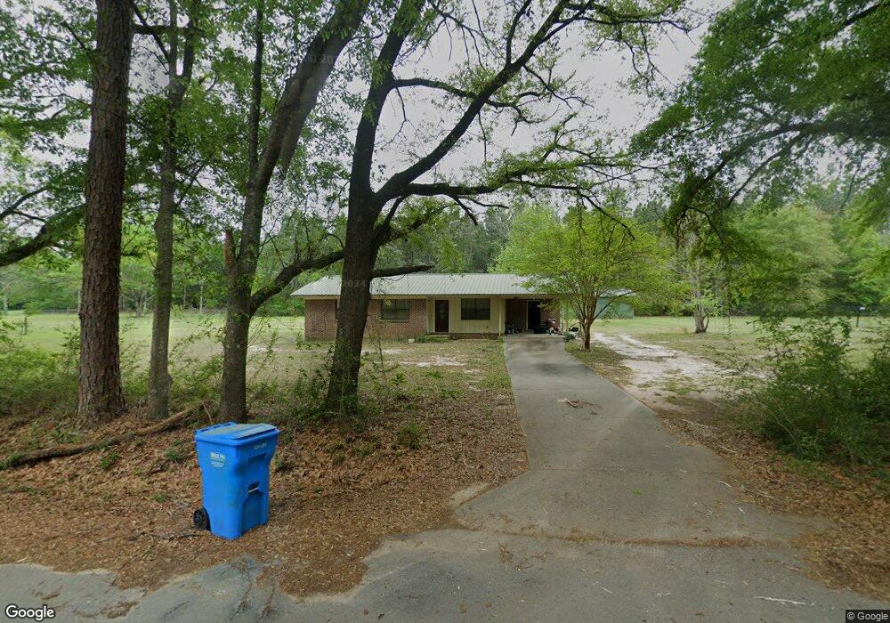
This home is located at 6549 William Gary Johnson Rd, Baker, FL 32531 and is currently estimated at $179,104, approximately $175 per square foot. 6549 William Gary Johnson Rd is a home located in Okaloosa County with nearby schools including Baker School.
Ownership History
Date
Name
Owned For
Owner Type
Purchase Details
Closed on
Nov 25, 2019
Sold by
Dubose Jessica
Bought by
Dubose Donald
Current Estimated Value
Purchase Details
Closed on
Feb 23, 2010
Sold by
Phillips Guy S and Phillips Dana O
Bought by
Dubose Donald and Dubose Jessica
Home Financials for this Owner
Home Financials are based on the most recent Mortgage that was taken out on this home.
Original Mortgage
$80,408
Outstanding Balance
$52,503
Interest Rate
5%
Mortgage Type
New Conventional
Estimated Equity
$126,601
Create a Home Valuation Report for This Property
The Home Valuation Report is an in-depth analysis detailing your home's value as well as a comparison with similar homes in the area
Purchase History
| Date | Buyer | Sale Price | Title Company |
|---|---|---|---|
| Dubose Donald | -- | Attorney | |
| Dubose Donald | $76,000 | Signet Land Title & Escrow I |
Source: Public Records
Mortgage History
| Date | Status | Borrower | Loan Amount |
|---|---|---|---|
| Open | Dubose Donald | $80,408 |
Source: Public Records
Tax History
| Year | Tax Paid | Tax Assessment Tax Assessment Total Assessment is a certain percentage of the fair market value that is determined by local assessors to be the total taxable value of land and additions on the property. | Land | Improvement |
|---|---|---|---|---|
| 2025 | $492 | $75,260 | -- | -- |
| 2024 | $460 | $73,139 | -- | -- |
| 2023 | $460 | $71,009 | $0 | $0 |
| 2022 | $453 | $68,941 | $0 | $0 |
| 2021 | $451 | $66,933 | $0 | $0 |
| 2020 | $444 | $66,009 | $0 | $0 |
| 2019 | $433 | $64,525 | $0 | $0 |
| 2018 | $431 | $63,322 | $0 | $0 |
| 2017 | $428 | $62,020 | $0 | $0 |
| 2016 | $418 | $60,744 | $0 | $0 |
| 2015 | $425 | $60,322 | $0 | $0 |
| 2014 | $424 | $59,843 | $0 | $0 |
Source: Public Records
Map
Nearby Homes
- 1318 John Riley Barnhill Rd
- 0000 N Sherman Kennedy
- 0 Homestead Rd
- 1704 Cobb Rd
- 6130 Sherman Kennedy Rd
- 1424 E F Sanford Rd
- 3.8+/- AC Cotton Creek Rd
- 924 Hwy C4a
- 1921 Cotton Creek Rd
- 6224 Old River Rd
- 6249 Highway 4 W
- 80+/- AC Old River Rd
- 5811 Monroe St
- 6251 Highway 4 W
- 5816 Jack Stokes Rd
- 1953 Cotton Creek Rd
- 1358 Georgia Ave
- 6108 Old River Rd
- 5801 Florida 189
- TBD Will Henry Ln
- 6543 William Gary Johnson Rd
- 6496 Highway 189 N
- 6496 Florida 189
- 6506 Highway 189 N
- 6535 William Gary Johnson Rd
- 6501 Highway 189 N
- 6515 Highway 189 N
- 6477 Highway 189 N
- 6467 Highway 189 N
- 6455 Highway 189 N
- 6511 Highway 189 N
- 1423 Dan Barnes Rd
- 1422 Dan Barnes Rd
- 1425 Dan Barnes Rd
- 6521 Highway 189 N
- 6449 Highway 189 N
- 6448 Highway 189 N
- 1443 Dan Barnes Rd
- 6539 Highway 189 N
- 1441 Dan Barnes Rd
Your Personal Tour Guide
Ask me questions while you tour the home.