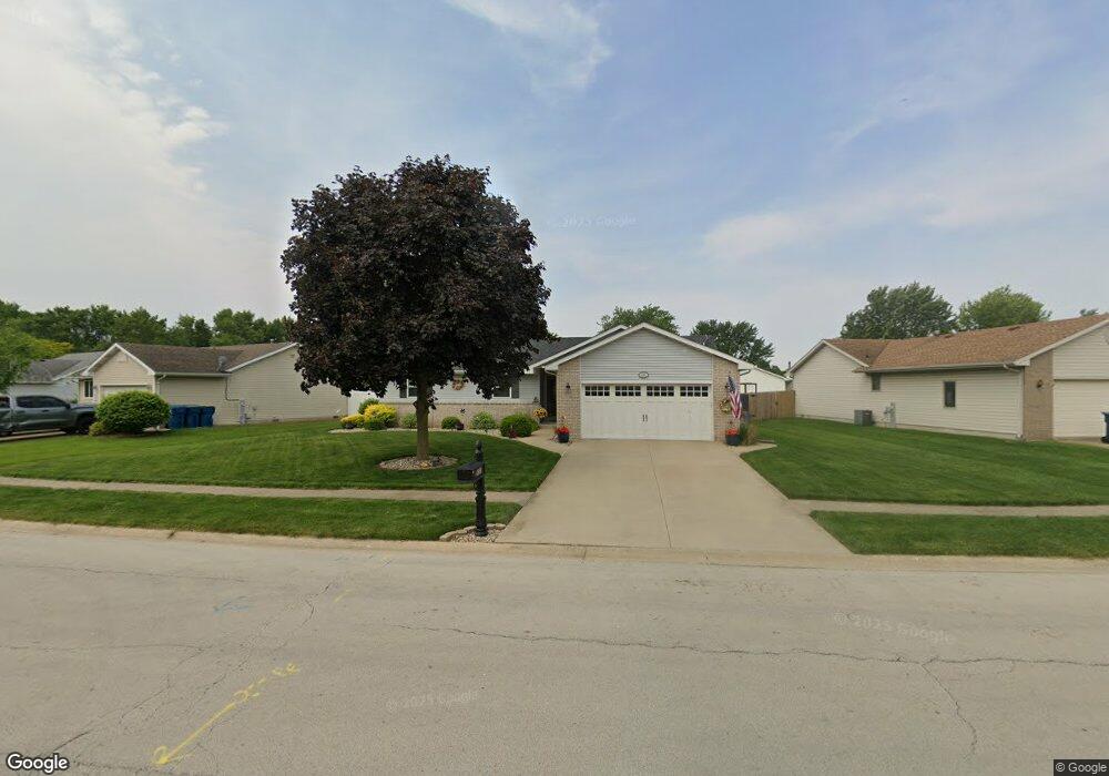
655 Cherokee Dr Bourbonnais, IL 60914
Estimated Value: $256,830 - $279,000
3
Beds
2
Baths
--
Sq Ft
11,108
Sq Ft
About This Home
This home is located at 655 Cherokee Dr, Bourbonnais, IL 60914 and is currently estimated at $268,708. 655 Cherokee Dr is a home located in Kankakee County with nearby schools including Shabbona Elementary School, Liberty Intermediate School, and Bourbonnais Upper Grade Center.
Ownership History
Date
Name
Owned For
Owner Type
Purchase Details
Closed on
Nov 12, 2020
Sold by
Murray Jason E
Bought by
Peerbolte Thomas and Peerbolte Michelle
Current Estimated Value
Home Financials for this Owner
Home Financials are based on the most recent Mortgage that was taken out on this home.
Original Mortgage
$190,000
Outstanding Balance
$169,073
Interest Rate
2.8%
Mortgage Type
New Conventional
Estimated Equity
$99,635
Create a Home Valuation Report for This Property
The Home Valuation Report is an in-depth analysis detailing your home's value as well as a comparison with similar homes in the area
Home Values in the Area
Average Home Value in this Area
Purchase History
| Date | Buyer | Sale Price | Title Company |
|---|---|---|---|
| Peerbolte Thomas | $200,000 | Standard Title |
Source: Public Records
Mortgage History
| Date | Status | Borrower | Loan Amount |
|---|---|---|---|
| Open | Peerbolte Thomas | $190,000 |
Source: Public Records
Tax History
| Year | Tax Paid | Tax Assessment Tax Assessment Total Assessment is a certain percentage of the fair market value that is determined by local assessors to be the total taxable value of land and additions on the property. | Land | Improvement |
|---|---|---|---|---|
| 2024 | $4,766 | $68,543 | $6,759 | $61,784 |
| 2023 | $4,316 | $63,465 | $6,258 | $57,207 |
| 2022 | $4,119 | $59,050 | $6,032 | $53,018 |
| 2021 | $3,944 | $56,733 | $5,899 | $50,834 |
| 2020 | $4,275 | $55,214 | $5,741 | $49,473 |
| 2019 | $3,938 | $50,302 | $5,412 | $44,890 |
| 2018 | $3,696 | $47,453 | $5,332 | $42,121 |
| 2017 | $3,617 | $46,296 | $5,202 | $41,094 |
| 2016 | $3,480 | $44,849 | $5,125 | $39,724 |
| 2015 | $3,414 | $43,634 | $5,074 | $38,560 |
| 2014 | $3,317 | $44,072 | $5,074 | $38,998 |
| 2013 | -- | $47,940 | $5,074 | $42,866 |
Source: Public Records
Map
Nearby Homes
- 261 Mohawk Dr
- 899 Armour Rd
- 292 Ashley Ave
- 206 Meadows Rd S
- 675 Washington Ave
- 250 N Levasseur Ave
- 269 Harvard Ave
- 260 W Country Ct
- 1063 Yale Ave
- 179 N Levasseur Ave
- 417 E Beaudoin St
- 375 Meadows Rd N
- 15 Hanson Dr
- 530 Meadows Rd S
- 9 Hilltop Dr
- 490 Meadows Rd N
- 703 Heritage Dr
- Lot 5 Larry Power Rd
- 22 Emery Dr
- 817 Stonewall Dr
- 675 Cherokee Dr
- 635 Cherokee Dr
- 672 Cherokee Dr
- 695 Cherokee Dr
- 615 Cherokee Dr
- 660 Pawnee Ct
- 660 Cherokee Dr
- 612 Cherokee Dr
- 690 Pawnee Ct
- 684 Cherokee Dr
- 311 E John Casey Rd
- 648 Cherokee Dr
- 265 E John Casey Rd
- 725 Cherokee Dr
- 718 Cherokee Dr
- 636 Cherokee Dr
- 730 Cherokee Dr
- 240 Cherokee Ct
- 1030 Shawnee Ct
- 655 Pawnee Ct
Your Personal Tour Guide
Ask me questions while you tour the home.