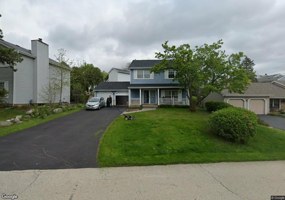
655 Dunham Rd Gurnee, IL 60031
Estimated Value: $281,000 - $349,000
3
Beds
3
Baths
1,456
Sq Ft
$219/Sq Ft
Est. Value
About This Home
This home is located at 655 Dunham Rd, Gurnee, IL 60031 and is currently estimated at $319,159, approximately $219 per square foot. 655 Dunham Rd is a home located in Lake County with nearby schools including Woodland Primary School, Woodland Elementary School, and Woodland Intermediate School.
Ownership History
Date
Name
Owned For
Owner Type
Purchase Details
Closed on
Jul 1, 2003
Sold by
Vang Choua and Vang Kan Bao
Bought by
Galindo Diana J
Current Estimated Value
Home Financials for this Owner
Home Financials are based on the most recent Mortgage that was taken out on this home.
Original Mortgage
$151,500
Outstanding Balance
$64,604
Interest Rate
5.3%
Mortgage Type
Purchase Money Mortgage
Estimated Equity
$254,555
Purchase Details
Closed on
May 10, 1999
Sold by
March James E and March Christa M
Bought by
Vang Choua and Vang Kan Bao
Home Financials for this Owner
Home Financials are based on the most recent Mortgage that was taken out on this home.
Original Mortgage
$142,500
Interest Rate
6.99%
Create a Home Valuation Report for This Property
The Home Valuation Report is an in-depth analysis detailing your home's value as well as a comparison with similar homes in the area
Home Values in the Area
Average Home Value in this Area
Purchase History
| Date | Buyer | Sale Price | Title Company |
|---|---|---|---|
| Galindo Diana J | $191,500 | First American Title | |
| Vang Choua | $150,000 | -- |
Source: Public Records
Mortgage History
| Date | Status | Borrower | Loan Amount |
|---|---|---|---|
| Open | Galindo Diana J | $151,500 | |
| Previous Owner | Vang Choua | $142,500 |
Source: Public Records
Tax History
| Year | Tax Paid | Tax Assessment Tax Assessment Total Assessment is a certain percentage of the fair market value that is determined by local assessors to be the total taxable value of land and additions on the property. | Land | Improvement |
|---|---|---|---|---|
| 2024 | $6,829 | $87,685 | $10,547 | $77,138 |
| 2023 | $6,341 | $77,487 | $9,320 | $68,167 |
| 2022 | $6,341 | $71,053 | $9,532 | $61,521 |
| 2021 | $5,481 | $65,580 | $8,798 | $56,782 |
| 2020 | $5,298 | $63,968 | $8,582 | $55,386 |
| 2019 | $5,144 | $62,111 | $8,333 | $53,778 |
| 2018 | $4,659 | $57,546 | $3,652 | $53,894 |
| 2017 | $4,606 | $55,897 | $3,547 | $52,350 |
| 2016 | $4,557 | $53,408 | $3,389 | $50,019 |
| 2015 | $4,423 | $50,652 | $3,214 | $47,438 |
| 2014 | $4,195 | $45,853 | $3,171 | $42,682 |
| 2012 | $4,951 | $59,469 | $3,195 | $56,274 |
Source: Public Records
Map
Nearby Homes
- 705 Colby Ct Unit U78
- 727 Colby Ct Unit U57
- 598 Dunham Rd Unit U297
- 650 Whitney Ct Unit 108
- 650 Whitney Ct Unit 211
- 690 Chandler Rd Unit 302
- 748 Chandler Rd
- 758 Chandler Rd Unit U159
- 6150 Oakmont Ln
- 920 Vose Dr Unit 106
- 755 Darnell Ln
- 6296 Doral Dr
- 6091 Washington St
- 6063 Morningside Ct
- 6480 Doral Dr
- 17150 W Washington St
- 33430 N Hunt Club Rd
- 84 Foxboro Ln Unit 3
- 387 Long Hill Rd
- 17404 W Walnut Ln Unit 2C
- 647 Williams Ct
- 657 Dunham Rd
- 643 Williams Ct
- 645 Williams Ct
- 659 Dunham Rd
- 642 Sanders Ct
- 644 Sanders Ct
- 641 Williams Ct
- 639 Williams Ct
- 646 Williams Ct
- 644 Williams Ct
- 638 Sanders Ct
- 637 Williams Ct
- 649 Sanders Ct
- 635 Williams Ct
- 636 Sanders Ct
- 647 Dordan Ct
- 647 Sanders Ct
- 5752 Regency Ct
- 640 Williams Ct
Your Personal Tour Guide
Ask me questions while you tour the home.