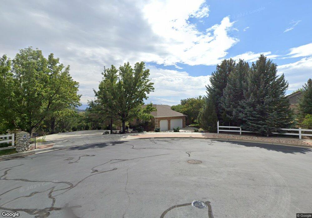
655 Elbert Cir Alpine, UT 84004
Estimated Value: $1,765,000 - $1,899,936
7
Beds
5
Baths
3,313
Sq Ft
$553/Sq Ft
Est. Value
About This Home
This home is located at 655 Elbert Cir, Alpine, UT 84004 and is currently estimated at $1,832,468, approximately $553 per square foot. 655 Elbert Cir is a home located in Utah County with nearby schools including Westfield School, Timberline Middle School, and Lone Peak High School.
Ownership History
Date
Name
Owned For
Owner Type
Purchase Details
Closed on
Jan 27, 2020
Sold by
Callister Debra S and The Debra S Callister Family T
Bought by
Callister Edward F and Callister Debra S
Current Estimated Value
Purchase Details
Closed on
Mar 14, 2002
Sold by
Callister Edward F and Callister Debra
Bought by
Callister Debra S and The Debra S Callister Family T
Purchase Details
Closed on
Sep 28, 1998
Sold by
Mccain Jeffrey C and Mccain Susan E
Bought by
Callister Edward F and Callister Debra
Home Financials for this Owner
Home Financials are based on the most recent Mortgage that was taken out on this home.
Original Mortgage
$227,000
Interest Rate
6.88%
Purchase Details
Closed on
Jan 8, 1998
Sold by
Sunrise Point L L C
Bought by
Mccain Jeffrey C and Mccain Susan E
Create a Home Valuation Report for This Property
The Home Valuation Report is an in-depth analysis detailing your home's value as well as a comparison with similar homes in the area
Home Values in the Area
Average Home Value in this Area
Purchase History
| Date | Buyer | Sale Price | Title Company |
|---|---|---|---|
| Callister Edward F | -- | None Available | |
| Callister Debra S | -- | -- | |
| Callister Edward F | -- | -- | |
| Mccain Jeffrey C | -- | -- |
Source: Public Records
Mortgage History
| Date | Status | Borrower | Loan Amount |
|---|---|---|---|
| Closed | Callister Edward F | $227,000 |
Source: Public Records
Tax History
| Year | Tax Paid | Tax Assessment Tax Assessment Total Assessment is a certain percentage of the fair market value that is determined by local assessors to be the total taxable value of land and additions on the property. | Land | Improvement |
|---|---|---|---|---|
| 2025 | $6,773 | $863,915 | -- | -- |
| 2024 | $6,773 | $789,345 | $0 | $0 |
| 2023 | $5,962 | $746,000 | $0 | $0 |
| 2022 | $6,748 | $1,458,700 | $768,700 | $690,000 |
| 2021 | $5,145 | $952,200 | $452,200 | $500,000 |
| 2020 | $5,016 | $910,200 | $410,200 | $500,000 |
| 2019 | $4,598 | $870,200 | $370,200 | $500,000 |
| 2018 | $4,549 | $850,200 | $350,200 | $500,000 |
| 2017 | $4,502 | $456,535 | $0 | $0 |
| 2016 | $4,484 | $423,890 | $0 | $0 |
| 2015 | $4,344 | $388,470 | $0 | $0 |
| 2014 | $4,189 | $370,650 | $0 | $0 |
Source: Public Records
Map
Nearby Homes
- 522 N Pfeifferhorn Dr
- 591 N Pfeifferhorn Dr
- 151 Glacier Lily Dr
- 820 Eagleview Dr
- 5886 W Timber Ridge Ln
- 259 Twin River Loop
- 30 S Main St
- 250 S Main St Unit 25
- 250 S Main St Unit 20
- 250 S Main St Unit 9
- 250 S Main St Unit 7
- 48 N 100 E
- 475 Grove Dr
- 88 W Cascade Ave
- 11852 Jupiter Cir
- 11987 N Cyprus Dr
- 6174 Apollo Way
- 19 E Elk Ct
- 358 Eastview Dr
- 12184 N Bridgegate Way
- 264 Sunrise Dr
- 650 Elbert Cir
- 640 Blue Spruce Rd
- 658 Elbert Cir
- 220 Sunrise Dr
- 310 Sunrise Dr
- 276 Blue Spruce Rd
- 279 Sunrise Dr
- 675 Hubbard Cir
- 333 Blue Spruce Rd Unit 4
- 180 Sunrise Dr
- 247 Sunrise Dr Unit 1
- 247 Sunrise Dr Unit 1
- 484 Westfield Rd
- 20 Sunrise Dr Unit 30
- 360 Sunrise Dr
- 325 Sunrise Dr
- 328 Blue Spruce Rd
- 645 Hubbard Cir
- 710 W Hubbard Cir Unit 11
Your Personal Tour Guide
Ask me questions while you tour the home.