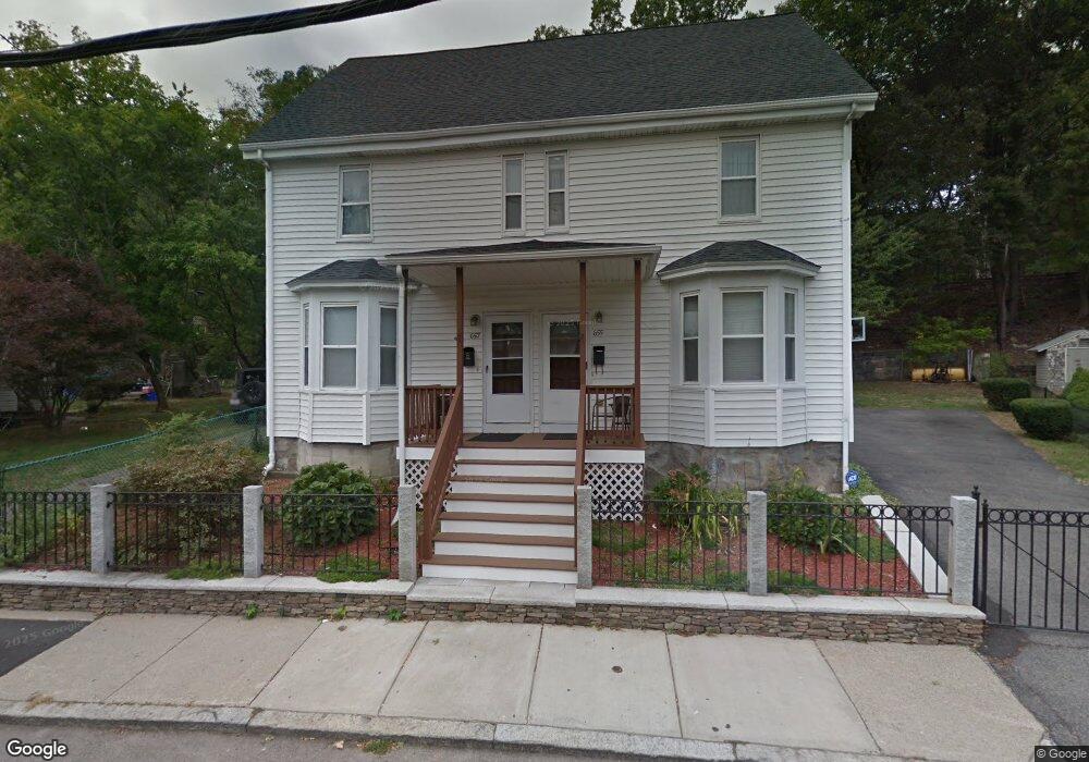
655 South St Unit 657 Roslindale, MA 02131
Roslindale NeighborhoodEstimated Value: $921,000 - $1,439,004
8
Beds
3
Baths
2,788
Sq Ft
$409/Sq Ft
Est. Value
About This Home
This home is located at 655 South St Unit 657, Roslindale, MA 02131 and is currently estimated at $1,140,001, approximately $408 per square foot. 655 South St Unit 657 is a home located in Suffolk County with nearby schools including Brooke Charter School Roslindale, The Croft School - Jamaica Plain, and St. Clare High School.
Ownership History
Date
Name
Owned For
Owner Type
Purchase Details
Closed on
Aug 19, 1994
Sold by
South St Rt 655-657
Bought by
Puran Monica
Current Estimated Value
Home Financials for this Owner
Home Financials are based on the most recent Mortgage that was taken out on this home.
Original Mortgage
$142,400
Interest Rate
8.61%
Mortgage Type
Purchase Money Mortgage
Purchase Details
Closed on
Feb 8, 1994
Sold by
Bodio Theresa Est
Bought by
South St Rt 65
Create a Home Valuation Report for This Property
The Home Valuation Report is an in-depth analysis detailing your home's value as well as a comparison with similar homes in the area
Home Values in the Area
Average Home Value in this Area
Purchase History
| Date | Buyer | Sale Price | Title Company |
|---|---|---|---|
| Puran Monica | $149,900 | -- | |
| South St Rt 65 | $48,500 | -- |
Source: Public Records
Mortgage History
| Date | Status | Borrower | Loan Amount |
|---|---|---|---|
| Open | South St Rt 65 | $20,000 | |
| Closed | South St Rt 65 | $142,400 |
Source: Public Records
Tax History Compared to Growth
Tax History
| Year | Tax Paid | Tax Assessment Tax Assessment Total Assessment is a certain percentage of the fair market value that is determined by local assessors to be the total taxable value of land and additions on the property. | Land | Improvement |
|---|---|---|---|---|
| 2025 | $14,301 | $1,235,000 | $376,600 | $858,400 |
| 2024 | $12,548 | $1,151,200 | $319,000 | $832,200 |
| 2023 | $12,364 | $1,151,200 | $319,000 | $832,200 |
| 2022 | $11,485 | $1,055,600 | $292,500 | $763,100 |
| 2021 | $10,728 | $1,005,400 | $278,600 | $726,800 |
| 2020 | $9,160 | $867,400 | $240,800 | $626,600 |
| 2019 | $8,952 | $849,300 | $214,300 | $635,000 |
| 2018 | $8,318 | $793,700 | $214,300 | $579,400 |
| 2017 | $8,162 | $770,700 | $214,300 | $556,400 |
| 2016 | $8,152 | $741,100 | $214,300 | $526,800 |
| 2015 | $7,901 | $652,400 | $182,800 | $469,600 |
| 2014 | $7,017 | $557,800 | $182,800 | $375,000 |
Source: Public Records
Map
Nearby Homes
- 620 South St
- 4031 Washington St
- 108 Florence St Unit 3
- 108 Florence St Unit 1
- 108 Florence St Unit 4
- 4012 Washington St
- 19 Delford St
- 19 Delford St Unit 1
- 173 Brookway Rd
- 187 Florence St Unit 2L
- 67 Cummins Hwy Unit 101
- 15 S Fairview St Unit 3
- 348-350 Hyde Park Ave Unit 2
- 2 Weld Hill St Unit PH2
- 65 Birch St Unit 3
- 18-20 Northbourne Rd Unit 18
- 79 Robert St Unit 3
- 27 Rowe St
- 50 Southbourne Rd
- 36 Neponset Ave Unit 1
- 653 South St Unit 2
- 653 South St Unit 1
- 661 South St
- 661 South St Unit 661
- 661 South St Unit 1
- 651 South St
- 656 South St
- 654 South St
- 654 South St Unit 1
- 663 South St
- 652 South St
- 652 South St Unit 2
- 652 South St Unit 1
- 649 South St
- 650 South St
- 650 South St Unit 3
- 650 South St Unit 1
- 650 South St Unit 2
- 647 South St
- 648 South St Unit 1