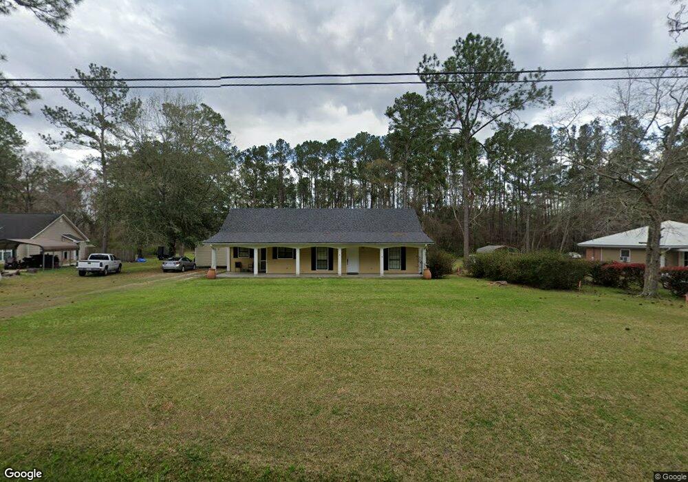
6550 Brookridge Dr Hahira, GA 31632
Estimated Value: $190,000 - $238,000
3
Beds
2
Baths
1,600
Sq Ft
$134/Sq Ft
Est. Value
About This Home
This home is located at 6550 Brookridge Dr, Hahira, GA 31632 and is currently estimated at $214,872, approximately $134 per square foot. 6550 Brookridge Dr is a home located in Lowndes County with nearby schools including Hahira Elementary School, Hahira Middle School, and Lowndes High School.
Ownership History
Date
Name
Owned For
Owner Type
Purchase Details
Closed on
Aug 31, 2022
Sold by
Sabal David A
Bought by
Branham James Mychael Wayne
Current Estimated Value
Purchase Details
Closed on
Mar 20, 2003
Sold by
Mcswain Ernest Paul
Bought by
Sabal David A and Sabal Daniella B
Purchase Details
Closed on
Jan 25, 2001
Sold by
Brotherton Don Properti
Bought by
Mcswain Ernest Paul
Purchase Details
Closed on
Apr 9, 1998
Sold by
Brotherton Carol T
Bought by
Brotherton Don Properti
Purchase Details
Closed on
Jan 7, 1997
Bought by
Brotherton Don
Purchase Details
Closed on
Nov 16, 1989
Bought by
Mullis Jack A
Create a Home Valuation Report for This Property
The Home Valuation Report is an in-depth analysis detailing your home's value as well as a comparison with similar homes in the area
Home Values in the Area
Average Home Value in this Area
Purchase History
| Date | Buyer | Sale Price | Title Company |
|---|---|---|---|
| Branham James Mychael Wayne | -- | -- | |
| Sabal David A | $99,400 | -- | |
| Mcswain Ernest Paul | $84,700 | -- | |
| Brotherton Don Properti | -- | -- | |
| Brotherton Carol T | -- | -- | |
| Brotherton Don | $53,000 | -- | |
| Mullis Jack A | $6,200 | -- |
Source: Public Records
Tax History Compared to Growth
Tax History
| Year | Tax Paid | Tax Assessment Tax Assessment Total Assessment is a certain percentage of the fair market value that is determined by local assessors to be the total taxable value of land and additions on the property. | Land | Improvement |
|---|---|---|---|---|
| 2024 | $1,564 | $65,569 | $20,000 | $45,569 |
| 2023 | $1,564 | $51,969 | $6,400 | $45,569 |
| 2022 | $815 | $35,230 | $6,400 | $28,830 |
| 2021 | $851 | $35,230 | $6,400 | $28,830 |
| 2020 | $790 | $35,230 | $6,400 | $28,830 |
| 2019 | $799 | $35,230 | $6,400 | $28,830 |
| 2018 | $807 | $35,230 | $6,400 | $28,830 |
| 2017 | $820 | $35,230 | $6,400 | $28,830 |
| 2016 | $822 | $35,230 | $6,400 | $28,830 |
| 2015 | -- | $35,230 | $6,400 | $28,830 |
| 2014 | $804 | $35,230 | $6,400 | $28,830 |
Source: Public Records
Map
Nearby Homes
- 6453 Meadow Creek Rd
- 6628 Brookridge Dr
- 6622 Brookridge Dr
- The Belfort Plan at Phillips Place
- The Galen Plan at Phillips Place
- The Cali Plan at Phillips Place
- The Lakeside Plan at Phillips Place
- The Lismore Plan at Phillips Place
- 209 Orvis Ln
- 1601 Beverly Ln
- 1604 Beverly Ln
- 1596 Beverly Ln
- 840 Kristen Ln
- 819 Kristen Ln
- 489 Bryson Cir
- The Ozark Plan at Reynolda Place
- The Walker Plan at Reynolda Place
- The Beau Plan at Reynolda Place
- The Belfort Plan at Reynolda Place
- 1055 Angie Ln
- 6546 Brookridge Dr
- 6558 Brookridge Dr
- 6542 Brookridge Dr
- 6534 Brookridge Dr
- 6551 Brookridge Dr
- 6543 Brookridge Dr
- 6554 Brookridge Dr
- 6410 Hillcrest Dr
- 6414 Hillcrest Dr
- 6566 Brookridge Dr
- 6559 Brookridge Dr
- 6404 Hillcrest Dr
- 6416 Hillcrest Dr
- 6570 Brookridge Dr
- 6400 Hillcrest Dr
- 6420 Hillcrest Dr
- 6563 Brookridge Dr
- 6413 Hillcrest Dr
- 6405 Hillcrest Dr
- 6424 Hillcrest Dr