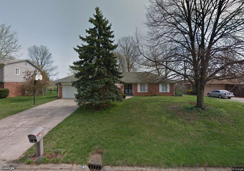
6553 Saint James Dr Indianapolis, IN 46217
Linden Wood NeighborhoodEstimated Value: $262,000 - $352,000
3
Beds
2
Baths
1,620
Sq Ft
$181/Sq Ft
Est. Value
About This Home
This home is located at 6553 Saint James Dr, Indianapolis, IN 46217 and is currently estimated at $293,754, approximately $181 per square foot. 6553 Saint James Dr is a home located in Marion County with nearby schools including William Henry Burkhart Elementary School, Perry Meridian 6th Grade Academy, and Perry Meridian Middle School.
Ownership History
Date
Name
Owned For
Owner Type
Purchase Details
Closed on
Apr 2, 2007
Sold by
Wells Robert L and Wells Esther C
Bought by
Miller Collin M and Miller Elaine T
Current Estimated Value
Home Financials for this Owner
Home Financials are based on the most recent Mortgage that was taken out on this home.
Original Mortgage
$145,000
Outstanding Balance
$87,864
Interest Rate
6.19%
Mortgage Type
New Conventional
Estimated Equity
$205,890
Create a Home Valuation Report for This Property
The Home Valuation Report is an in-depth analysis detailing your home's value as well as a comparison with similar homes in the area
Home Values in the Area
Average Home Value in this Area
Purchase History
| Date | Buyer | Sale Price | Title Company |
|---|---|---|---|
| Miller Collin M | -- | Chicago Title Insurance Co |
Source: Public Records
Mortgage History
| Date | Status | Borrower | Loan Amount |
|---|---|---|---|
| Open | Miller Collin M | $145,000 |
Source: Public Records
Tax History Compared to Growth
Tax History
| Year | Tax Paid | Tax Assessment Tax Assessment Total Assessment is a certain percentage of the fair market value that is determined by local assessors to be the total taxable value of land and additions on the property. | Land | Improvement |
|---|---|---|---|---|
| 2024 | $3,095 | $243,900 | $34,800 | $209,100 |
| 2023 | $3,095 | $240,700 | $34,800 | $205,900 |
| 2022 | $2,854 | $213,500 | $34,800 | $178,700 |
| 2021 | $2,449 | $181,600 | $34,800 | $146,800 |
| 2020 | $2,350 | $173,800 | $34,800 | $139,000 |
| 2019 | $2,199 | $162,300 | $29,600 | $132,700 |
| 2018 | $2,074 | $155,000 | $29,600 | $125,400 |
| 2017 | $1,981 | $148,300 | $29,600 | $118,700 |
| 2016 | $1,894 | $142,100 | $29,600 | $112,500 |
| 2014 | $1,634 | $139,500 | $29,600 | $109,900 |
| 2013 | $1,629 | $142,800 | $29,600 | $113,200 |
Source: Public Records
Map
Nearby Homes
- 402 W Banta Rd
- 639 W Banta Rd
- 745 W Banta Rd
- 655 Yosemite Dr
- 136 W Loretta Dr
- 602 W Southport Rd
- 830 Yosemite Dr
- 747 Yosemite Dr
- 115 Jordan Rd
- 128 Dahlia Ln
- 7011 Mclain Dr
- 7017 Chimney Rock Ct
- 116 Dahlia Ln
- 6407 Bluff Rd
- 6017 Creekbend Blvd
- 535 W Edgewood Ave
- 20 Forrests Edge Ct
- 7126 Forest Park Dr
- 212 Tamara Trail
- 27 Forrests Edge Ct
- 6543 St James Dr
- 6609 Saint James Dr
- 6543 Saint James Dr
- 6564 Ventnor Ln
- 6608 Ventnor Ln
- 6558 Ventnor Ln
- 6554 Saint James Dr
- 6533 Saint James Dr
- 6608 Saint James Dr
- 6533 St James Dr
- 6619 Saint James Dr
- 6616 Ventnor Ln
- 6544 Saint James Dr
- 6544 St James Dr
- 6552 Ventnor Ln
- 6534 St James Dr
- 6628 Saint James Dr
- 6534 Saint James Dr
- 6624 Ventnor Ln
- 6523 Saint James Dr