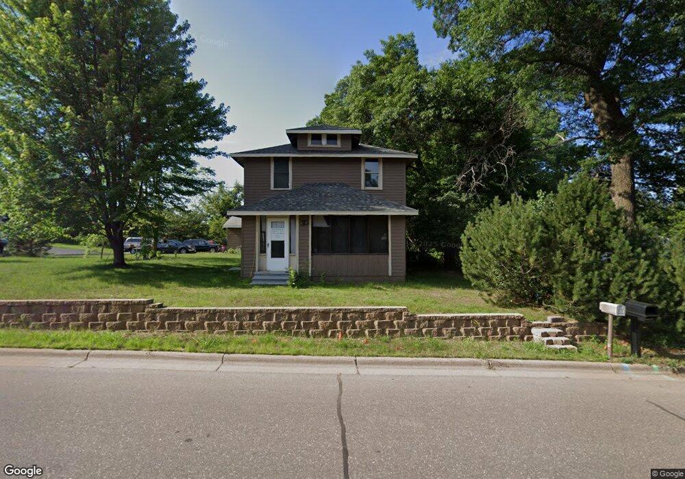
6554 Cedar St North Branch, MN 55056
Estimated Value: $273,000 - $293,000
4
Beds
2
Baths
2,728
Sq Ft
$103/Sq Ft
Est. Value
About This Home
This home is located at 6554 Cedar St, North Branch, MN 55056 and is currently estimated at $281,688, approximately $103 per square foot. 6554 Cedar St is a home located in Chisago County with nearby schools including North Branch Middle School, Sunrise River Elementary School, and North Branch Senior High School.
Ownership History
Date
Name
Owned For
Owner Type
Purchase Details
Closed on
Mar 11, 2021
Sold by
Moulton and Martha
Bought by
Hohneke Sarah
Current Estimated Value
Home Financials for this Owner
Home Financials are based on the most recent Mortgage that was taken out on this home.
Original Mortgage
$206,136
Outstanding Balance
$185,058
Interest Rate
3.05%
Estimated Equity
$96,630
Purchase Details
Closed on
Apr 15, 2008
Sold by
Household Industrial Finance Co
Bought by
Moulton Joseph and Moulton Martha
Home Financials for this Owner
Home Financials are based on the most recent Mortgage that was taken out on this home.
Original Mortgage
$110,467
Interest Rate
6.5%
Mortgage Type
FHA
Create a Home Valuation Report for This Property
The Home Valuation Report is an in-depth analysis detailing your home's value as well as a comparison with similar homes in the area
Home Values in the Area
Average Home Value in this Area
Purchase History
| Date | Buyer | Sale Price | Title Company |
|---|---|---|---|
| Hohneke Sarah | $220,000 | -- | |
| Moulton Joseph | $78,900 | -- | |
| Hohneke Sarah Sarah | $220,000 | -- |
Source: Public Records
Mortgage History
| Date | Status | Borrower | Loan Amount |
|---|---|---|---|
| Open | Hohneke Sarah | $206,136 | |
| Closed | Hohneke Sarah | -- | |
| Previous Owner | Moulton Joseph | $110,467 | |
| Closed | Hohneke Sarah Sarah | $206,136 |
Source: Public Records
Tax History
| Year | Tax Paid | Tax Assessment Tax Assessment Total Assessment is a certain percentage of the fair market value that is determined by local assessors to be the total taxable value of land and additions on the property. | Land | Improvement |
|---|---|---|---|---|
| 2024 | $2,708 | $205,800 | $0 | $0 |
| 2023 | $2,708 | $231,600 | $0 | $0 |
| 2022 | $2,818 | $212,600 | $0 | $0 |
| 2021 | $1,596 | $103,800 | $0 | $0 |
| 2020 | $1,568 | $125,000 | $40,000 | $85,000 |
| 2019 | $1,622 | $0 | $0 | $0 |
| 2018 | $2,100 | $0 | $0 | $0 |
| 2017 | $1,486 | $0 | $0 | $0 |
| 2016 | $1,398 | $0 | $0 | $0 |
| 2015 | $1,344 | $0 | $0 | $0 |
| 2014 | -- | $86,200 | $0 | $0 |
Source: Public Records
Map
Nearby Homes
- 39094 Riverside Ct
- XXXXX Maple St
- 38624 Grand Ave
- TBD Ash St
- 38558 Grand Ave
- 38820 Maple Ct
- 6119 Red Fox Run
- 524X 391st St
- 38xxx Oakview Ave
- TBD Saint Croix Trail
- 38639 Hawthorne Ave
- 7255 Hawthorne Ct
- 7268 Hawthorne Ct
- 7222 Hawthorne Ct
- 7246 385th St
- 38280 Great Oaks Ct
- 5187 391st St
- 5128 391st St
- 5276 391st St
- 5156 391st St
- 39016 Riverside Ct
- 39037 Riverside Ct
- 39032 Riverside Ct
- 6520 Cedar St
- 6584 Cedar St
- 38984 5th Ave
- 6553 Cedar St
- 39059 Riverside Ct
- 6571 Cedar St
- 6596 Cedar St
- 6511 Cedar St
- 6511 Cedar St Unit 1
- 39050 Riverside Ct
- 6581 Cedar St
- 6591 Cedar St
- 39042 4th Ave
- 39081 Riverside Ct
- 39074 Riverside Ct
- 6488 Cedar St
- 38987 6th Ave
Your Personal Tour Guide
Ask me questions while you tour the home.