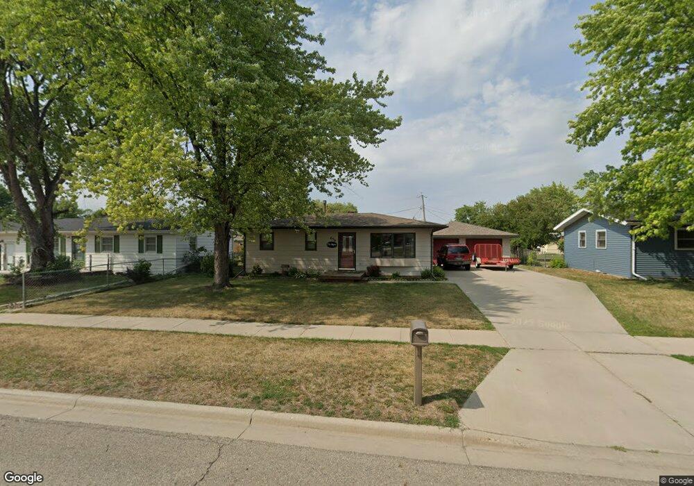
656 4th Ave E West Fargo, ND 58078
Berger NeighborhoodEstimated Value: $226,898 - $241,000
3
Beds
1
Bath
864
Sq Ft
$271/Sq Ft
Est. Value
About This Home
This home is located at 656 4th Ave E, West Fargo, ND 58078 and is currently estimated at $233,949, approximately $270 per square foot. 656 4th Ave E is a home located in Cass County with nearby schools including L.E. Berger Elementary School, Cheney Middle School, and West Fargo High School.
Ownership History
Date
Name
Owned For
Owner Type
Purchase Details
Closed on
Aug 1, 2005
Sold by
Migler Michael L and Migler Susan J
Bought by
Migler Richard S and Migler Bonnie L
Current Estimated Value
Home Financials for this Owner
Home Financials are based on the most recent Mortgage that was taken out on this home.
Original Mortgage
$84,000
Interest Rate
5.71%
Mortgage Type
New Conventional
Create a Home Valuation Report for This Property
The Home Valuation Report is an in-depth analysis detailing your home's value as well as a comparison with similar homes in the area
Home Values in the Area
Average Home Value in this Area
Purchase History
| Date | Buyer | Sale Price | Title Company |
|---|---|---|---|
| Migler Richard S | -- | -- |
Source: Public Records
Mortgage History
| Date | Status | Borrower | Loan Amount |
|---|---|---|---|
| Closed | Migler Richard S | $84,000 |
Source: Public Records
Tax History
| Year | Tax Paid | Tax Assessment Tax Assessment Total Assessment is a certain percentage of the fair market value that is determined by local assessors to be the total taxable value of land and additions on the property. | Land | Improvement |
|---|---|---|---|---|
| 2024 | $1,233 | $110,650 | $19,800 | $90,850 |
| 2023 | $3,063 | $110,950 | $19,800 | $91,150 |
| 2022 | $2,976 | $102,550 | $19,800 | $82,750 |
| 2021 | $2,759 | $91,100 | $14,400 | $76,700 |
| 2020 | $2,748 | $92,100 | $14,400 | $77,700 |
| 2019 | $2,660 | $88,900 | $14,400 | $74,500 |
| 2018 | $2,394 | $82,850 | $14,400 | $68,450 |
| 2017 | $2,274 | $80,300 | $14,400 | $65,900 |
| 2016 | $2,030 | $78,550 | $14,400 | $64,150 |
| 2015 | $1,996 | $70,950 | $14,850 | $56,100 |
| 2014 | $1,955 | $66,300 | $14,850 | $51,450 |
| 2013 | $1,843 | $63,050 | $13,100 | $49,950 |
Source: Public Records
Map
Nearby Homes
- 832 5th Ave E
- 431 5th Ave E Unit 1
- 631 7th Ave E
- 1059 Sommerset Place
- 801 9th St E
- 217 1st Ave E
- 622 12th Ave E
- 1332 Sandstone Dr
- 105 Evergreen Cir
- 1610 Suntree Dr
- 1618 Suntree Dr
- 602 12 1 2 Ave E Unit 5
- 1511 11th Ave E
- 921 Homestead Ct
- 45 Center St
- 620 Sukut St
- 245 12th Ave E
- 1726 2nd Ave E
- 332 13th Ave E
- 306 13th Ave E
Your Personal Tour Guide
Ask me questions while you tour the home.