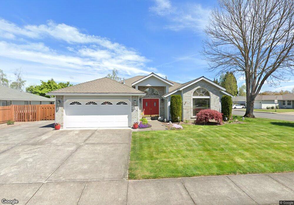
656 Brandon St Central Point, OR 97502
Estimated Value: $508,000 - $551,243
3
Beds
2
Baths
1,892
Sq Ft
$282/Sq Ft
Est. Value
About This Home
This home is located at 656 Brandon St, Central Point, OR 97502 and is currently estimated at $533,811, approximately $282 per square foot. 656 Brandon St is a home located in Jackson County with nearby schools including Richardson Elementary School, Scenic Middle School, and Crater High School.
Ownership History
Date
Name
Owned For
Owner Type
Purchase Details
Closed on
Nov 17, 2022
Sold by
Molano Oscar
Bought by
Bryson E And Nancy K Denis Trust
Current Estimated Value
Purchase Details
Closed on
Jun 11, 1998
Sold by
Cave Jerry E and Cave Mary W
Bought by
Molano Oscar and Heath Evelyn Loretta
Home Financials for this Owner
Home Financials are based on the most recent Mortgage that was taken out on this home.
Original Mortgage
$146,400
Interest Rate
7.17%
Create a Home Valuation Report for This Property
The Home Valuation Report is an in-depth analysis detailing your home's value as well as a comparison with similar homes in the area
Purchase History
| Date | Buyer | Sale Price | Title Company |
|---|---|---|---|
| Bryson E And Nancy K Denis Trust | $540,000 | First American Title | |
| Molano Oscar | $183,000 | Amerititle |
Source: Public Records
Mortgage History
| Date | Status | Borrower | Loan Amount |
|---|---|---|---|
| Previous Owner | Molano Oscar | $146,400 |
Source: Public Records
Tax History
| Year | Tax Paid | Tax Assessment Tax Assessment Total Assessment is a certain percentage of the fair market value that is determined by local assessors to be the total taxable value of land and additions on the property. | Land | Improvement |
|---|---|---|---|---|
| 2026 | $5,592 | $323,560 | $148,000 | $175,560 |
| 2025 | $5,455 | $328,100 | $125,200 | $202,900 |
| 2024 | $5,455 | $318,550 | $121,550 | $197,000 |
| 2023 | $5,279 | $309,280 | $118,010 | $191,270 |
| 2022 | $5,156 | $309,280 | $118,010 | $191,270 |
| 2021 | $5,009 | $300,280 | $114,580 | $185,700 |
| 2020 | $4,863 | $291,540 | $111,240 | $180,300 |
| 2019 | $4,743 | $274,810 | $104,850 | $169,960 |
| 2018 | $4,598 | $266,810 | $101,800 | $165,010 |
| 2017 | $4,483 | $266,810 | $101,800 | $165,010 |
| 2016 | $4,352 | $251,500 | $95,950 | $155,550 |
| 2015 | $4,170 | $251,500 | $95,950 | $155,550 |
| 2014 | $4,064 | $237,070 | $90,430 | $146,640 |
Source: Public Records
Map
Nearby Homes
- 871 Holley Way
- 895 Holley Way
- 556 Glenn Way
- 349 W Pine St
- 166 Nadine Ln
- 436 Cheney Loop
- 884 Mendolia Way
- 420 Mayberry Ln
- 827 Isherwood Dr
- 831 Isherwood Dr
- 114 Cedar St
- 887 Silver Fox Dr
- 407 Silver Creek Dr
- 220 S 3rd St
- 350 Alder St
- 755 S 4th St
- 3220 Freeland Rd
- 626 Griffin Oaks Dr
- 3307 Freeland Rd
- 3371 Freeland Rd
- 610 Brandon St
- 117 Tiffany Ave
- 655 Brandon St
- 155 Tiffany Ave
- 606 Brandon St
- 609 Brandon St
- 162 Tiffany Ave
- 187 Tiffany Ave
- 119 Tiffany Ct
- 605 Brandon St
- 143 Justin Ct
- 155 Justin Ct
- 602 Brandon St
- 710 Brandon St
- 129 Justin Ct
- 128 Tiffany Ct
- 797 Vincent Ave
- 709 Brandon St
- 117 Justin Ct
- 203 Tiffany Ave
Your Personal Tour Guide
Ask me questions while you tour the home.