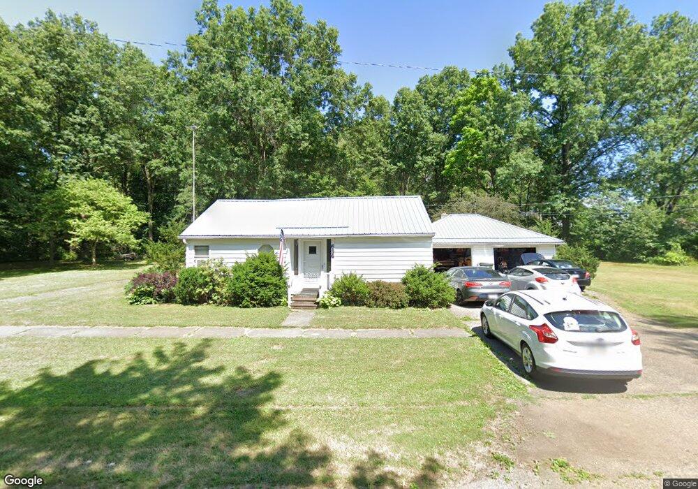
656 N 17th St Sebring, OH 44672
Estimated Value: $113,000 - $208,000
4
Beds
2
Baths
1,392
Sq Ft
$111/Sq Ft
Est. Value
About This Home
This home is located at 656 N 17th St, Sebring, OH 44672 and is currently estimated at $154,255, approximately $110 per square foot. 656 N 17th St is a home located in Mahoning County with nearby schools including B.L. Miller Elementary School and McKinley High School.
Ownership History
Date
Name
Owned For
Owner Type
Purchase Details
Closed on
Oct 29, 2013
Sold by
Eaton Patricia L and Thompson Martha E
Bought by
Minger Richard E
Current Estimated Value
Home Financials for this Owner
Home Financials are based on the most recent Mortgage that was taken out on this home.
Original Mortgage
$49,094
Outstanding Balance
$37,171
Interest Rate
4.62%
Mortgage Type
FHA
Estimated Equity
$117,084
Purchase Details
Closed on
Sep 25, 2012
Sold by
Estate Of Bettie C Thompson
Bought by
Eaton Patricia L and Thompson Martha E
Purchase Details
Closed on
Aug 4, 1983
Bought by
Thompson Bettie C
Create a Home Valuation Report for This Property
The Home Valuation Report is an in-depth analysis detailing your home's value as well as a comparison with similar homes in the area
Home Values in the Area
Average Home Value in this Area
Purchase History
| Date | Buyer | Sale Price | Title Company |
|---|---|---|---|
| Minger Richard E | $50,000 | Heritage Union Title Co Ltd | |
| Eaton Patricia L | -- | None Available | |
| Thompson Bettie C | -- | -- |
Source: Public Records
Mortgage History
| Date | Status | Borrower | Loan Amount |
|---|---|---|---|
| Open | Minger Richard E | $49,094 |
Source: Public Records
Tax History Compared to Growth
Tax History
| Year | Tax Paid | Tax Assessment Tax Assessment Total Assessment is a certain percentage of the fair market value that is determined by local assessors to be the total taxable value of land and additions on the property. | Land | Improvement |
|---|---|---|---|---|
| 2024 | $1,231 | $39,570 | $3,210 | $36,360 |
| 2023 | $1,175 | $39,570 | $3,210 | $36,360 |
| 2022 | $1,093 | $26,710 | $3,210 | $23,500 |
| 2021 | $1,053 | $26,710 | $3,210 | $23,500 |
| 2020 | $1,120 | $26,710 | $3,210 | $23,500 |
| 2019 | $1,060 | $23,120 | $3,210 | $19,910 |
| 2018 | $1,040 | $23,120 | $3,210 | $19,910 |
| 2017 | $1,037 | $23,120 | $3,210 | $19,910 |
| 2016 | $1,041 | $23,320 | $3,210 | $20,110 |
| 2015 | $1,012 | $23,320 | $3,210 | $20,110 |
| 2014 | $1,049 | $23,320 | $3,210 | $20,110 |
| 2013 | $1,031 | $23,320 | $3,210 | $20,110 |
Source: Public Records
Map
Nearby Homes
- 0 16th St Unit 5159092
- 406 W Indiana Ave
- 226 W Maryland Ave
- 325 W Maryland Ave
- 0 W Maryland Ave
- 756 N 15th St
- 154 W Nevada Ave Unit 154
- 0 W Nevada Ave Unit 5159074
- 495 W Ohio Ave
- 145 N 17th St
- 245 E Maryland Ave
- 540 W Oregon Ave Unit 1/2
- 625 W Maryland Ave
- 236 E Ohio Ave
- 670 W Maryland Ave
- 355 E Michigan Ave
- 726 N 12th St
- 240 S 15th St
- 495 W Texas Ave
- 104 W Carolina Ave
- 635 N 17th St
- 286 W Virginia Ave
- 625 N 17th St
- 315 W Michigan Ave
- 266 W Virginia Ave
- 306 W Virginia Ave
- 326 W Virginia Ave
- 256 W Virginia Ave
- 285 W Virginia Ave
- 346 W Virginia Ave
- 226 W Virginia Ave
- 295 W Virginia Ave
- 756 N 17th St
- 745 N 17th St
- 635 N 16th St
- 305 W Virginia Ave
- 265 W Vermont Ave
- 265 W Vermont Ave
- 265 W Virginia Ave
- 315 W Virginia Ave