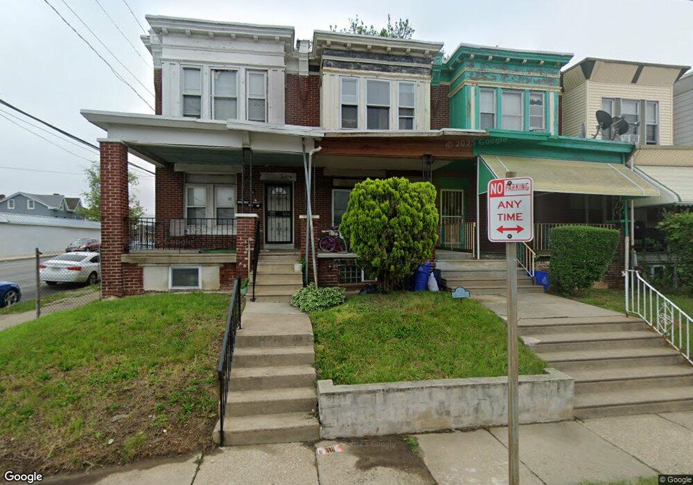
6567 N Lambert St Philadelphia, PA 19138
West Oak Lane NeighborhoodEstimated Value: $172,000 - $199,000
3
Beds
1
Bath
1,134
Sq Ft
$161/Sq Ft
Est. Value
About This Home
This home is located at 6567 N Lambert St, Philadelphia, PA 19138 and is currently estimated at $182,718, approximately $161 per square foot. 6567 N Lambert St is a home located in Philadelphia County with nearby schools including Prince Hall School, Gen. Louis Wagner Middle School, and Martin Luther King High School.
Ownership History
Date
Name
Owned For
Owner Type
Purchase Details
Closed on
Mar 2, 2009
Sold by
Morgan Emilee M
Bought by
Morgan Emilee M
Current Estimated Value
Purchase Details
Closed on
Jul 8, 2008
Sold by
Moore Marcia C and Morgan Emilee M
Bought by
Strother Marva and Strother Melvin
Purchase Details
Closed on
Nov 15, 2002
Sold by
Strother Marva C and Strother Melvin O
Bought by
Moore Marcia C and Morgan Emilee
Purchase Details
Closed on
Mar 27, 1998
Sold by
Strother Marva
Bought by
Strother Marva and Strother Melvin O
Purchase Details
Closed on
Feb 16, 1996
Sold by
Strother Marva and Gibson Mamie
Bought by
Strother Marva
Create a Home Valuation Report for This Property
The Home Valuation Report is an in-depth analysis detailing your home's value as well as a comparison with similar homes in the area
Home Values in the Area
Average Home Value in this Area
Purchase History
| Date | Buyer | Sale Price | Title Company |
|---|---|---|---|
| Morgan Emilee M | -- | None Available | |
| Strother Marva | -- | None Available | |
| Moore Marcia C | -- | -- | |
| Strother Marva | -- | -- | |
| Strother Marva | -- | -- |
Source: Public Records
Tax History Compared to Growth
Tax History
| Year | Tax Paid | Tax Assessment Tax Assessment Total Assessment is a certain percentage of the fair market value that is determined by local assessors to be the total taxable value of land and additions on the property. | Land | Improvement |
|---|---|---|---|---|
| 2025 | $1,841 | $161,900 | $32,380 | $129,520 |
| 2024 | $1,841 | $161,900 | $32,380 | $129,520 |
| 2023 | $1,841 | $131,500 | $26,300 | $105,200 |
| 2022 | $799 | $86,500 | $26,300 | $60,200 |
| 2021 | $1,429 | $0 | $0 | $0 |
| 2020 | $1,429 | $0 | $0 | $0 |
| 2019 | $1,492 | $0 | $0 | $0 |
| 2018 | $1,296 | $0 | $0 | $0 |
| 2017 | $1,296 | $0 | $0 | $0 |
| 2016 | $876 | $0 | $0 | $0 |
| 2015 | $764 | $0 | $0 | $0 |
| 2014 | -- | $87,000 | $7,738 | $79,262 |
| 2012 | -- | $11,520 | $2,460 | $9,060 |
Source: Public Records
Map
Nearby Homes
- 6534 N Lambert St
- 6603 N 21st St
- 6558 Limekiln Pike
- 2105 Stenton Ave
- 2120 66th Ave
- 2115 Stenton Ave
- 6600 N Opal St
- 2022 66th Ave
- 2061 Independence St
- 2125 Stenton Ave
- 1914 W 65th Ave
- 6531 N Beechwood St
- 6731 N Woodstock St
- 6733 N Woodstock St
- 2152 Stenton Ave
- 6420 N Woodstock St
- 6421 N 21st St
- 6824 Rodney St
- 6436 N 20th St
- 2056 Eastburn Ave
- 6565 N Lambert St
- 6569 N Lambert St
- 6563 N Lambert St
- 6561 N Lambert St
- 6559 N Lambert St
- 6557 N Lambert St
- 6570 N Woodstock St
- 6574 N Woodstock St
- 6572 N Woodstock St
- 6576 N Woodstock St
- 6555 N Lambert St
- 6568 N Woodstock St
- 6566 N Woodstock St
- 6553 N Lambert St
- 6564 N Woodstock St
- 6562 N Woodstock St
- 6551 N Lambert St
- 6554 N Lambert St
- 6560 N Woodstock St
- 6549 N Lambert St