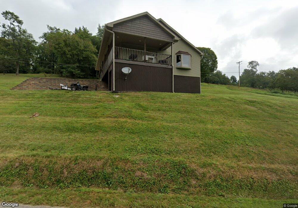
657 Mill Branch Rd Belpre, OH 45714
Estimated Value: $229,000 - $268,000
3
Beds
2
Baths
1,353
Sq Ft
$186/Sq Ft
Est. Value
About This Home
This home is located at 657 Mill Branch Rd, Belpre, OH 45714 and is currently estimated at $252,321, approximately $186 per square foot. 657 Mill Branch Rd is a home located in Washington County with nearby schools including Belpre Elementary School and Belpre High School.
Ownership History
Date
Name
Owned For
Owner Type
Purchase Details
Closed on
Dec 20, 2011
Sold by
Boyce Kellis C
Bought by
Williams George Henry
Current Estimated Value
Purchase Details
Closed on
Dec 6, 2006
Sold by
Williams Dave
Bought by
Poyce Kellis C
Purchase Details
Closed on
Aug 30, 2006
Sold by
Grim Raymond R and Lorain Grim C
Bought by
Williams Dave
Purchase Details
Closed on
Jul 20, 1998
Bought by
Grim Raymond R and Grim Lorain
Create a Home Valuation Report for This Property
The Home Valuation Report is an in-depth analysis detailing your home's value as well as a comparison with similar homes in the area
Home Values in the Area
Average Home Value in this Area
Purchase History
| Date | Buyer | Sale Price | Title Company |
|---|---|---|---|
| Williams George Henry | $14,600 | Attorney | |
| Poyce Kellis C | -- | Attorney | |
| Williams Dave | $30,000 | None Available | |
| Grim Raymond R | -- | -- | |
| Grim Raymond R | -- | -- |
Source: Public Records
Tax History
| Year | Tax Paid | Tax Assessment Tax Assessment Total Assessment is a certain percentage of the fair market value that is determined by local assessors to be the total taxable value of land and additions on the property. | Land | Improvement |
|---|---|---|---|---|
| 2024 | $4,028 | $66,130 | $9,630 | $56,500 |
| 2023 | $2,629 | $66,130 | $9,630 | $56,500 |
| 2022 | $2,615 | $66,130 | $9,630 | $56,500 |
| 2021 | $2,045 | $48,480 | $6,920 | $41,560 |
| 2020 | $1,926 | $48,480 | $6,920 | $41,560 |
| 2019 | $1,918 | $48,480 | $6,920 | $41,560 |
| 2018 | $1,881 | $45,950 | $6,290 | $39,660 |
| 2017 | $1,512 | $45,950 | $6,290 | $39,660 |
| 2016 | $2,305 | $45,950 | $6,290 | $39,660 |
| 2015 | $1,326 | $39,000 | $6,010 | $32,990 |
| 2014 | $383 | $7,620 | $6,010 | $1,610 |
| 2013 | $260 | $7,620 | $6,010 | $1,610 |
Source: Public Records
Map
Nearby Homes
- 1948 State Route 339
- 155 Ridgewood Blvd
- 240 Hollywood Dr
- 1310 Oxbow Rd
- 56 Carson Ln
- 120 Carson Ln
- 631 Short Brook Rd
- 195 N Bruce St
- 2053 Mcgill Rd
- 111 T322
- 2526 Valley View Dr
- 2811 Washington Blvd
- 1103 Farson St
- 8045 Veto Rd
- 1556 Mcgill Rd
- 2313 Washington Blvd
- 82 Highland Lake Cir
- 350 Blennerhassett Heights
- 2853 Lake Washington Rd
- 1806 Pennsylvania Ave
- 126 Emmaus Rd
- 36 Adorian Place Rd
- 33 Adorian Place Rd
- 176 Emmaus Rd
- 657 T289
- 606 Mill Branch Rd
- 195 Emmaus Rd
- 173 Emmaus Rd
- 238 Emmaus Rd
- 630 Mill Branch Rd
- 550 Mill Branch Rd
- 159 Emmaus Rd
- 217 Emmaus Rd
- 276 Emmaus Rd
- 695 Mill Branch Rd
- 695 Mill Branch Rd
- 320 Emmaus Rd
- 296 Emmaus Rd
- 247 Emmaus Rd
- 259 Emmaus Rd
Your Personal Tour Guide
Ask me questions while you tour the home.