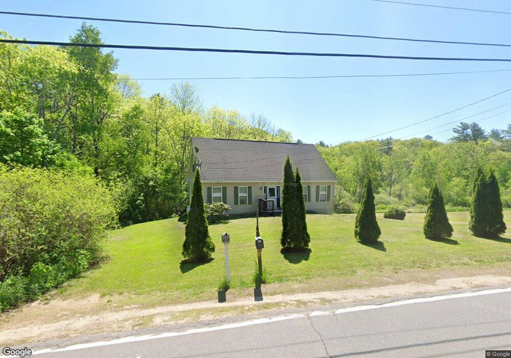
657 Plains Rd Litchfield, ME 04350
Estimated Value: $411,557 - $549,000
4
Beds
2
Baths
1,716
Sq Ft
$277/Sq Ft
Est. Value
About This Home
This home is located at 657 Plains Rd, Litchfield, ME 04350 and is currently estimated at $474,639, approximately $276 per square foot. 657 Plains Rd is a home located in Kennebec County with nearby schools including Libby-Tozier School, Sabattus Primary School, and Carrie Ricker School.
Ownership History
Date
Name
Owned For
Owner Type
Purchase Details
Closed on
Jul 9, 2007
Sold by
Barnett Carrie A and Barnett Jeffrey R
Bought by
White William A
Current Estimated Value
Home Financials for this Owner
Home Financials are based on the most recent Mortgage that was taken out on this home.
Original Mortgage
$142,000
Outstanding Balance
$88,243
Interest Rate
6.39%
Mortgage Type
Purchase Money Mortgage
Estimated Equity
$386,396
Create a Home Valuation Report for This Property
The Home Valuation Report is an in-depth analysis detailing your home's value as well as a comparison with similar homes in the area
Home Values in the Area
Average Home Value in this Area
Purchase History
| Date | Buyer | Sale Price | Title Company |
|---|---|---|---|
| White William A | -- | -- |
Source: Public Records
Mortgage History
| Date | Status | Borrower | Loan Amount |
|---|---|---|---|
| Open | White William A | $142,000 |
Source: Public Records
Tax History Compared to Growth
Tax History
| Year | Tax Paid | Tax Assessment Tax Assessment Total Assessment is a certain percentage of the fair market value that is determined by local assessors to be the total taxable value of land and additions on the property. | Land | Improvement |
|---|---|---|---|---|
| 2024 | $3,768 | $264,400 | $58,000 | $206,400 |
| 2023 | $3,569 | $264,400 | $58,000 | $206,400 |
| 2022 | $3,463 | $220,300 | $48,300 | $172,000 |
| 2021 | $3,113 | $220,300 | $48,300 | $172,000 |
| 2020 | $3,128 | $220,300 | $48,300 | $172,000 |
| 2019 | $3,084 | $220,300 | $48,300 | $172,000 |
| 2018 | $2,506 | $155,151 | $42,775 | $112,376 |
| 2017 | $2,506 | $155,151 | $42,775 | $112,376 |
| 2016 | $2,526 | $156,413 | $42,775 | $113,638 |
| 2015 | $2,432 | $156,413 | $42,775 | $113,638 |
| 2014 | $2,247 | $157,676 | $42,775 | $114,901 |
| 2013 | $1,939 | $157,676 | $42,775 | $114,901 |
Source: Public Records
Map
Nearby Homes
- 525 Plains Rd
- 766 Brunswick Rd
- 90 Mallard Dr
- 857 Brunswick Rd
- 22 Spencer Ln
- 58 Military Ln
- 1145 Brunswick Rd
- 603 Langdon Rd
- 5 Hideaway Ln
- 476 Pine Tree Rd
- 1468 Richmond Rd
- 1507 Richmond Rd
- 3 Balsam Ln
- 0 Hallowell Rd Unit 1627507
- Lot 12 Hallowell Rd
- 1178 Brunswick Ave
- Lot 8A Weeks Rd
- M7L21 Beedle Rd
- 65 Weeks Rd
- 1-70 Maine 197
- 624 Plains Rd
- 161 Thorofare Rd
- 153 Thorofare Rd
- 644 Plains Rd
- 629 Plains Rd
- 669 Plains Rd
- 658 Plains Rd
- 32 Pleasant Pond Ln
- 23 Pleasant Pond Ln
- Lot A Pleasant Pond Ln
- 18 Pleasant Pond Ln
- 127 Thorofare Rd
- 35 Pleasant Pond Ln
- 13 Potters Brook Ln
- 586 Plains Rd
- 60 Pleasant Pond Ln
- 49 Pleasant Pond Ln
- 41 Pleasant Pond Ln
- 31 Potters Brook Ln
- 34 Potters Brook Ln