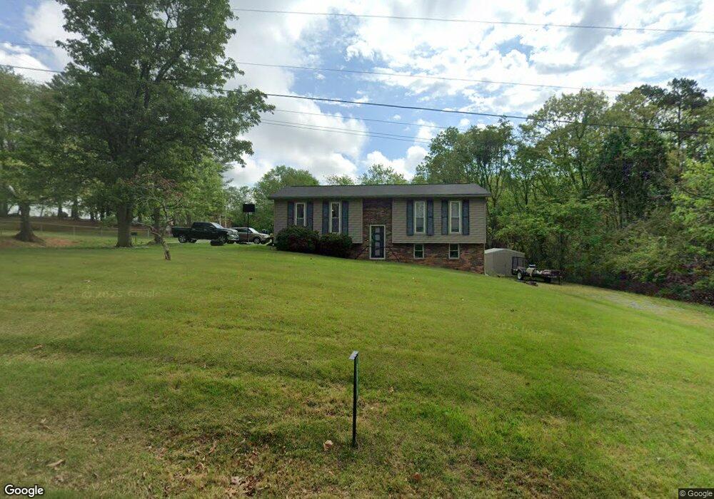
6576 Damascus Cir Talbott, TN 37877
Estimated Value: $229,705 - $254,000
3
Beds
2
Baths
944
Sq Ft
$255/Sq Ft
Est. Value
About This Home
This home is located at 6576 Damascus Cir, Talbott, TN 37877 and is currently estimated at $241,176, approximately $255 per square foot. 6576 Damascus Cir is a home located in Hamblen County with nearby schools including Alpha Elementary School, West View Middle School, and Morristown West High School.
Ownership History
Date
Name
Owned For
Owner Type
Purchase Details
Closed on
Jun 22, 2017
Sold by
Adams William D
Bought by
Brooks Ustin A
Current Estimated Value
Home Financials for this Owner
Home Financials are based on the most recent Mortgage that was taken out on this home.
Original Mortgage
$125,858
Outstanding Balance
$103,468
Interest Rate
3.95%
Mortgage Type
New Conventional
Estimated Equity
$137,708
Purchase Details
Closed on
May 27, 1994
Sold by
Hill Brian
Bought by
William Adams
Purchase Details
Closed on
May 26, 1994
Bought by
Adams William D and Adams Stephanie D
Purchase Details
Closed on
Feb 5, 1990
Bought by
Hill Brian M and Hill Kathy D
Purchase Details
Closed on
Jul 24, 1987
Bought by
Peoples Paul E & Marie E
Purchase Details
Closed on
Feb 12, 1983
Bought by
Diehl James C and Diehl Karen K
Purchase Details
Closed on
Feb 11, 1983
Purchase Details
Closed on
Sep 20, 1978
Bought by
Salyer Jeffrey W
Create a Home Valuation Report for This Property
The Home Valuation Report is an in-depth analysis detailing your home's value as well as a comparison with similar homes in the area
Purchase History
| Date | Buyer | Sale Price | Title Company |
|---|---|---|---|
| Brooks Ustin A | $124,600 | Lakeway Title Services | |
| William Adams | -- | -- | |
| Adams William D | $59,900 | -- | |
| Hill Brian M | $50,500 | -- | |
| Peoples Paul E & Marie E | $43,800 | -- | |
| Diehl James C | $41,900 | -- | |
| -- | -- | -- | |
| Salyer Jeffrey W | -- | -- |
Source: Public Records
Mortgage History
| Date | Status | Borrower | Loan Amount |
|---|---|---|---|
| Open | Brooks Ustin A | $125,858 |
Source: Public Records
Tax History
| Year | Tax Paid | Tax Assessment Tax Assessment Total Assessment is a certain percentage of the fair market value that is determined by local assessors to be the total taxable value of land and additions on the property. | Land | Improvement |
|---|---|---|---|---|
| 2025 | $724 | $49,275 | $7,575 | $41,700 |
| 2024 | $540 | $27,400 | $3,600 | $23,800 |
| 2023 | $540 | $27,400 | $0 | $0 |
| 2022 | $540 | $27,400 | $3,600 | $23,800 |
| 2021 | $540 | $27,400 | $3,600 | $23,800 |
| 2020 | $540 | $27,400 | $3,600 | $23,800 |
| 2019 | $472 | $22,150 | $4,325 | $17,825 |
| 2018 | $472 | $22,150 | $4,325 | $17,825 |
| 2017 | $472 | $22,150 | $4,325 | $17,825 |
| 2016 | $441 | $22,150 | $4,325 | $17,825 |
| 2015 | $410 | $22,150 | $4,325 | $17,825 |
| 2014 | -- | $22,150 | $4,325 | $17,825 |
| 2013 | -- | $23,775 | $0 | $0 |
Source: Public Records
Map
Nearby Homes
- 1154 Lakeshore Rd
- 2301 Boat Dock Rd
- 2327 Boat Dock Rd
- 6161 Hiawatha Rd
- 1533 Allen Rd
- 0 Collinson Ford Rd
- 6282 Golden Dr
- Lot 3 Lowe Dr
- Lot 1R1 Lowe Dr
- 6130 James Cline Rd
- 812 Hemlock Cir
- 1580 Pin Oak Dr
- 6152 Silver Fox Trail
- 6262 Wintergreen Rd
- 6153 Silver Fox Trail
- 2085 Seven Oaks Dr
- 1167 Cherry Blossom Ln
- Lot 1 & 2 Old Poplar Ridge Rd
- 1256 Pratt Rd
- 7474 Evolene Cir
- 6576 Damascus Cir
- 6613 Rocky Top Dr
- 6562 Damascus Cir
- 6581 Damascus Cir
- 6577 Damascus Cir
- 6588 Damascus Cir
- 6572 Rocky Top Dr
- 1840 Poplar Springs Rd
- 6614 Rocky Top Dr
- 1798 Poplar Springs Rd
- 6624 Rocky Top Dr
- 6609 Damascus Cir
- 1860 Poplar Springs Rd
- 6600 Damascus Cir
- 6618 Damascus Cir
- 6627 Damascus Cir
- 1692 Vale Dr
- 1841 Poplar Springs Rd
- 6605 Cedar Hill Rd
- 6611 Cedar Hill Rd
Your Personal Tour Guide
Ask me questions while you tour the home.