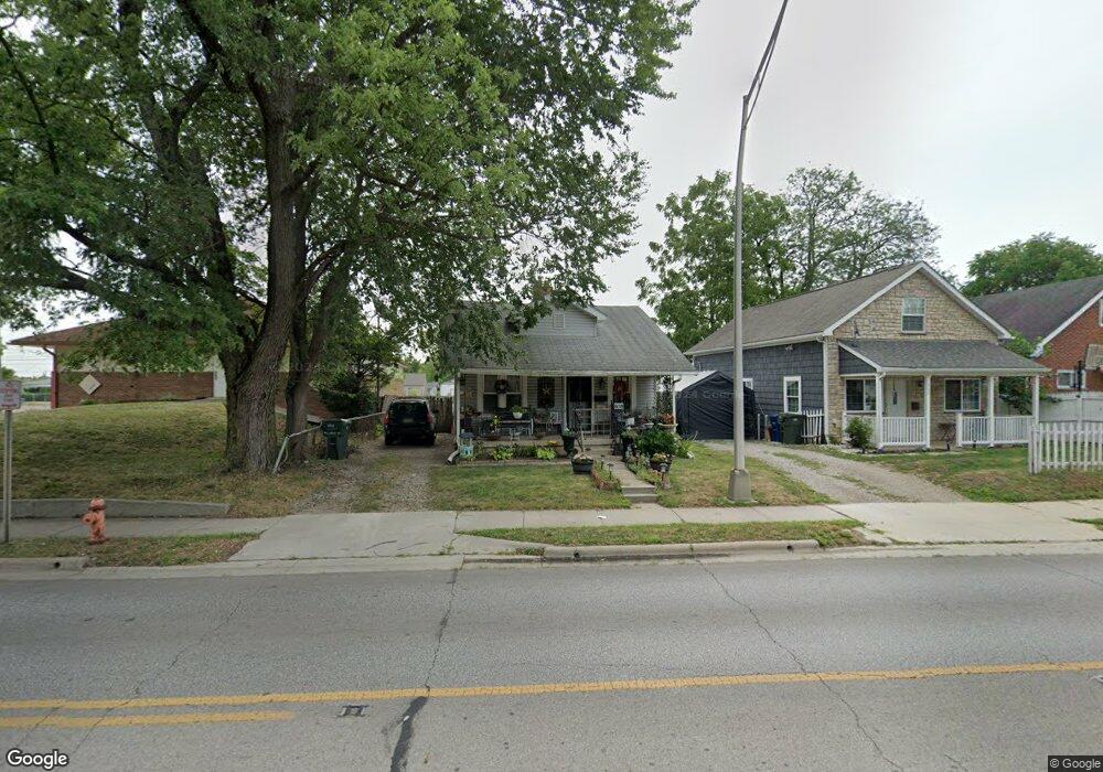
658 Demorest Rd Columbus, OH 43204
Southwest Hilltop NeighborhoodEstimated Value: $126,589 - $152,000
2
Beds
1
Bath
828
Sq Ft
$165/Sq Ft
Est. Value
About This Home
This home is located at 658 Demorest Rd, Columbus, OH 43204 and is currently estimated at $136,897, approximately $165 per square foot. 658 Demorest Rd is a home located in Franklin County with nearby schools including West Franklin Elementary School, Franklin Woods Intermediate School, and Finland Middle School.
Ownership History
Date
Name
Owned For
Owner Type
Purchase Details
Closed on
Aug 1, 2014
Sold by
Stevens James W and Stevens Mary Ann
Bought by
Stevens Jeffrey W
Current Estimated Value
Purchase Details
Closed on
Jul 28, 2014
Sold by
Stevens Dale R
Bought by
Stevens Jeffrey W
Purchase Details
Closed on
Jan 16, 1985
Bought by
Stevens James William
Purchase Details
Closed on
May 1, 1984
Create a Home Valuation Report for This Property
The Home Valuation Report is an in-depth analysis detailing your home's value as well as a comparison with similar homes in the area
Home Values in the Area
Average Home Value in this Area
Purchase History
| Date | Buyer | Sale Price | Title Company |
|---|---|---|---|
| Stevens Jeffrey W | $12,600 | None Available | |
| Stevens Jeffrey W | $12,600 | None Available | |
| Stevens James William | $22,000 | -- | |
| -- | -- | -- |
Source: Public Records
Tax History Compared to Growth
Tax History
| Year | Tax Paid | Tax Assessment Tax Assessment Total Assessment is a certain percentage of the fair market value that is determined by local assessors to be the total taxable value of land and additions on the property. | Land | Improvement |
|---|---|---|---|---|
| 2024 | $1,363 | $37,380 | $12,110 | $25,270 |
| 2023 | $1,339 | $37,380 | $12,110 | $25,270 |
| 2022 | $963 | $19,740 | $4,480 | $15,260 |
| 2021 | $983 | $19,740 | $4,480 | $15,260 |
| 2020 | $977 | $19,740 | $4,480 | $15,260 |
| 2019 | $908 | $16,180 | $3,750 | $12,430 |
| 2018 | $792 | $16,180 | $3,750 | $12,430 |
| 2017 | $790 | $16,180 | $3,750 | $12,430 |
| 2016 | $680 | $11,240 | $2,630 | $8,610 |
| 2015 | $680 | $11,240 | $2,630 | $8,610 |
| 2014 | $700 | $11,240 | $2,630 | $8,610 |
| 2013 | $134 | $13,195 | $3,080 | $10,115 |
Source: Public Records
Map
Nearby Homes
- 617 Athens St
- 585 Athens Ave
- 695 Demorest Rd
- 3300-3302 Sullivant Ave
- 3276-3278 Sullivant Ave
- 781 Stephen Dr W
- 737 S Brinker Ave
- 756 Brixham Rd
- 840 Mark Place
- 328 S Southampton Ave
- 3318 Miriam Dr S
- 3551 Glorious Rd
- 610 Salisbury Rd
- 725 Binns Blvd
- 0 S Brinker Ave
- 793 Binns Blvd
- 3360 Briggs Rd
- 638 Binns Blvd
- 828 Binns Blvd
- 1027 S Brinker Ave
- 662 Demorest Rd
- 640 Demorest Rd
- 668 Demorest Rd
- 680 Demorest Rd
- 659 Dexter Ave
- 669 Dexter Ave
- 651 Dexter Ave
- 673 Dexter Ave
- 655 Demorest Rd
- 686 Demorest Rd
- 661 Demorest Rd
- 649 Demorest Rd
- 679 Dexter Ave
- 669 Demorest Rd
- 643 Demorest Rd
- 683 Dexter Ave
- 690 Demorest Rd
- 675 Demorest Rd
- 635 Demorest Rd
- 689 Dexter Ave