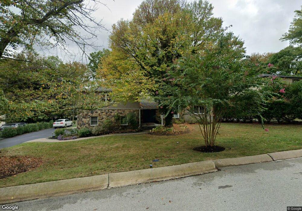
658 Glenwyd Rd Bryn Mawr, PA 19010
Estimated Value: $958,649 - $1,171,000
4
Beds
3
Baths
3,238
Sq Ft
$318/Sq Ft
Est. Value
About This Home
This home is located at 658 Glenwyd Rd, Bryn Mawr, PA 19010 and is currently estimated at $1,030,162, approximately $318 per square foot. 658 Glenwyd Rd is a home located in Delaware County with nearby schools including Ithan Elementary School, Radnor Middle School, and Radnor Senior High School.
Ownership History
Date
Name
Owned For
Owner Type
Purchase Details
Closed on
Oct 31, 2007
Sold by
Elkins Scott R and Elkins Donna
Bought by
Khan Muhammad Aslam and Zuberi Lubna M
Current Estimated Value
Home Financials for this Owner
Home Financials are based on the most recent Mortgage that was taken out on this home.
Original Mortgage
$417,000
Outstanding Balance
$265,063
Interest Rate
6.47%
Mortgage Type
Purchase Money Mortgage
Estimated Equity
$765,099
Purchase Details
Closed on
Nov 13, 2001
Sold by
Bailey Barry and Bailey Jacqueline
Bought by
Elkins Scott R and Elkins Donna
Home Financials for this Owner
Home Financials are based on the most recent Mortgage that was taken out on this home.
Original Mortgage
$245,000
Interest Rate
6.72%
Mortgage Type
Purchase Money Mortgage
Create a Home Valuation Report for This Property
The Home Valuation Report is an in-depth analysis detailing your home's value as well as a comparison with similar homes in the area
Home Values in the Area
Average Home Value in this Area
Purchase History
| Date | Buyer | Sale Price | Title Company |
|---|---|---|---|
| Khan Muhammad Aslam | $610,000 | None Available | |
| Elkins Scott R | $320,000 | Chicago Title Insurance Co |
Source: Public Records
Mortgage History
| Date | Status | Borrower | Loan Amount |
|---|---|---|---|
| Open | Khan Muhammad Aslam | $417,000 | |
| Previous Owner | Elkins Scott R | $245,000 | |
| Closed | Elkins Scott R | $48,000 |
Source: Public Records
Tax History Compared to Growth
Tax History
| Year | Tax Paid | Tax Assessment Tax Assessment Total Assessment is a certain percentage of the fair market value that is determined by local assessors to be the total taxable value of land and additions on the property. | Land | Improvement |
|---|---|---|---|---|
| 2025 | $10,930 | $540,590 | $213,770 | $326,820 |
| 2024 | $10,930 | $540,590 | $213,770 | $326,820 |
| 2023 | $10,497 | $540,590 | $213,770 | $326,820 |
| 2022 | $10,382 | $540,590 | $213,770 | $326,820 |
| 2021 | $15,109 | $489,770 | $213,770 | $276,000 |
| 2020 | $9,485 | $272,660 | $122,500 | $150,160 |
| 2019 | $9,218 | $272,660 | $122,500 | $150,160 |
| 2018 | $9,037 | $272,660 | $0 | $0 |
| 2017 | $8,848 | $272,660 | $0 | $0 |
| 2016 | $1,496 | $272,660 | $0 | $0 |
| 2015 | $1,496 | $272,660 | $0 | $0 |
| 2014 | $1,496 | $272,660 | $0 | $0 |
Source: Public Records
Map
Nearby Homes
- 560 S Bryn Mawr Ave
- 820 Darby Paoli Rd
- 3920 Darby Rd
- 124 Carli Dr
- 633 Foxfields Rd
- 202 Summit Dr Unit B
- 103 Summit Dr Unit B
- 307 B B000 Summit Dr Unit B
- 726 Darby Paoli Rd
- 119 Bella Dr Unit 2MD
- 117 Bella Dr Unit 3AD
- 67 Parkridge Dr
- 127 Deerfield Rd
- 62 Parkridge Dr Unit 62
- 215 Cornell Dr
- 6205 Parkview Dr
- 14 Westview Rd
- 12 Lincoln Ln
- 390 S Bryn Mawr Ave
- 406 Barclay Rd
- 660 Glenwyd Rd
- 656 Glenwyd Rd
- 654 Glenwyd Rd
- 657 Glenwyd Rd
- 659 Glenwyd Rd
- 655 Glenwyd Rd
- 662 Glenwyd Rd
- 652 Glenwyd Rd
- 664 Glenwyd Rd
- 653 Glenwyd Rd
- 2 Stone Creek Ln
- 612 Heather Ln
- 666 Glenwyd Rd
- 614 Heather Ln
- 607 Cornerstone Ln
- 610 Heather Ln
- 603 Cornerstone Ln
- 601 Cornerstone Ln
- 605 Cornerstone Ln
- 608 Heather Ln