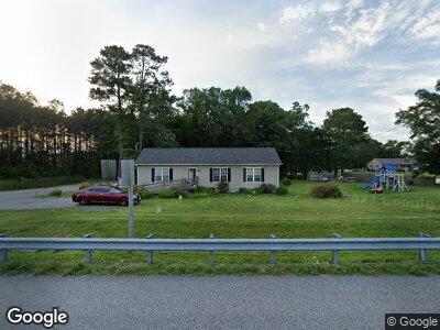
6583 Worcester Hwy Newark, MD 21841
Estimated Value: $171,000 - $316,000
--
Bed
1
Bath
1,100
Sq Ft
$242/Sq Ft
Est. Value
About This Home
This home is located at 6583 Worcester Hwy, Newark, MD 21841 and is currently estimated at $265,995, approximately $241 per square foot. 6583 Worcester Hwy is a home located in Worcester County with nearby schools including Snow Hill Elementary School, Snow Hill Middle School, and Snow Hill High School.
Ownership History
Date
Name
Owned For
Owner Type
Purchase Details
Closed on
Sep 26, 2024
Sold by
Purnell-Hayman Makeita and Hayman Wayne
Bought by
Purnell-Riley Terri
Current Estimated Value
Purchase Details
Closed on
Aug 27, 2019
Sold by
Purnell Riley Terri
Bought by
Purnell Hayman Makeita and Hayman Wayne
Home Financials for this Owner
Home Financials are based on the most recent Mortgage that was taken out on this home.
Original Mortgage
$85,000
Interest Rate
3.4%
Mortgage Type
Land Contract Argmt. Of Sale
Create a Home Valuation Report for This Property
The Home Valuation Report is an in-depth analysis detailing your home's value as well as a comparison with similar homes in the area
Home Values in the Area
Average Home Value in this Area
Purchase History
| Date | Buyer | Sale Price | Title Company |
|---|---|---|---|
| Purnell-Riley Terri | $85,000 | None Listed On Document | |
| Purnell-Riley Terri | $85,000 | None Listed On Document | |
| Purnell Hayman Makeita | $85,000 | None Available |
Source: Public Records
Mortgage History
| Date | Status | Borrower | Loan Amount |
|---|---|---|---|
| Previous Owner | Purnell Hayman Makeita | $85,000 |
Source: Public Records
Tax History Compared to Growth
Tax History
| Year | Tax Paid | Tax Assessment Tax Assessment Total Assessment is a certain percentage of the fair market value that is determined by local assessors to be the total taxable value of land and additions on the property. | Land | Improvement |
|---|---|---|---|---|
| 2024 | $1,903 | $193,467 | $0 | $0 |
| 2023 | $1,722 | $174,433 | $0 | $0 |
| 2022 | $1,541 | $155,400 | $51,500 | $103,900 |
| 2021 | $1,542 | $154,867 | $0 | $0 |
| 2020 | $1,537 | $154,333 | $0 | $0 |
| 2019 | $1,532 | $153,800 | $51,500 | $102,300 |
| 2018 | $1,510 | $153,800 | $51,500 | $102,300 |
| 2017 | $1,516 | $153,800 | $0 | $0 |
| 2016 | -- | $157,000 | $0 | $0 |
| 2015 | $1,023 | $153,467 | $0 | $0 |
| 2014 | $1,023 | $148,933 | $0 | $0 |
Source: Public Records
Map
Nearby Homes
- 7109 Daffodil Ln Rd
- 7126 Arcadia Cir
- 7146 Arcadia Cir
- 8422 Newark Rd
- 7204 Mill St
- 0 Cedartown Rd
- 6060 Worcester Hwy
- Lot 5 Newark Rd
- Lot 4 Newark Rd
- Lot 3 Newark Rd
- 0 Newark Rd Unit MDWO2014316
- 6629 Bowden Rd
- 0 Patey Woods Rd Unit MDWO2014080
- 7044 Whiton Crossing Rd
- 9331 Cropper Island Rd
- 306 Park Row
- 220 E Federal St
- 207 Purnell St
- 217 E Federal St
- 210 Walnut St
- 6583 Worcester Hwy
- 6597 Worcester Hwy
- 6570 Worcester Hwy
- 6601 Worcester Hwy
- 6621 Worcester Hwy
- 6641 Worcester Hwy
- 6656 Worcester Hwy
- 6679 Worcester Hwy
- 6704 Worcester Hwy
- 6706 Worcester Hwy
- 6855 Basket Switch Rd
- 6424 Worcester Hwy
- 6847 Basket Switch Rd
- 6830 Five Mile Branch Rd
- 8022 Queponco Rd
- 6846 Basket Switch Rd
- 6922 Five Mile Branch Rd
- 6830 Basket Switch Rd
- 6715 Five Mile Branch Rd
- 5 Mile Branch Rd