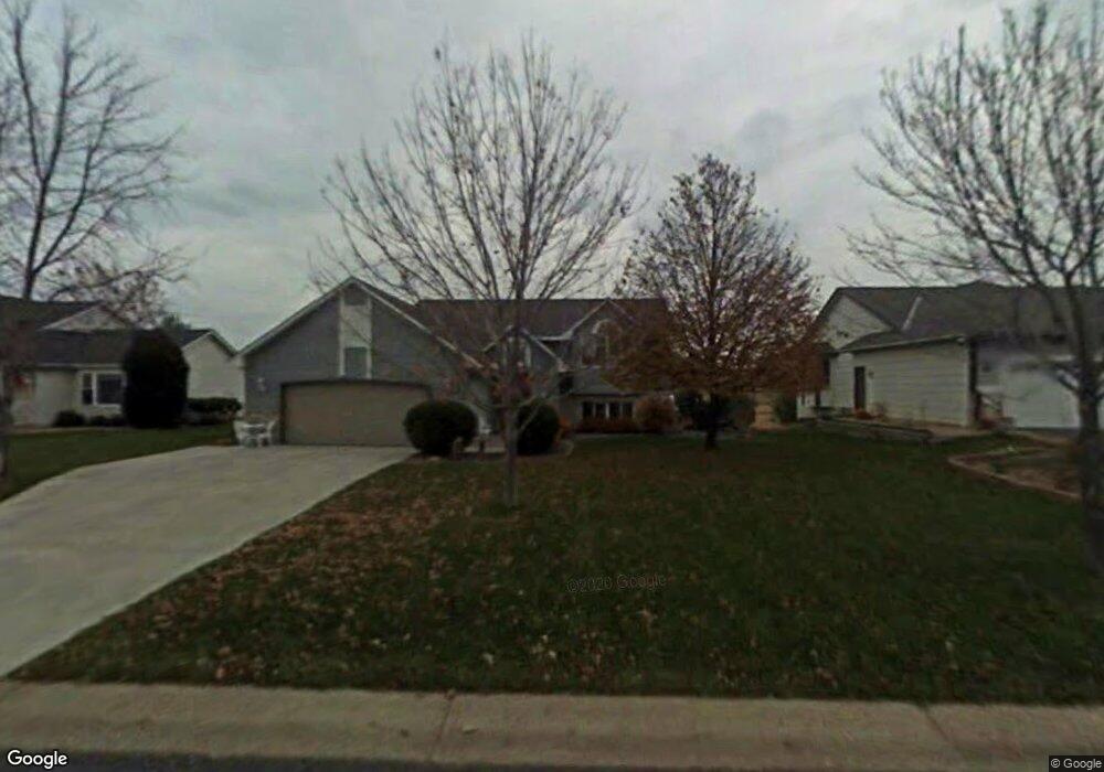
6586 Pheasant Run S Circle Pines, MN 55014
Estimated Value: $417,564 - $430,000
4
Beds
2
Baths
2,326
Sq Ft
$182/Sq Ft
Est. Value
About This Home
This home is located at 6586 Pheasant Run S, Circle Pines, MN 55014 and is currently estimated at $423,641, approximately $182 per square foot. 6586 Pheasant Run S is a home located in Anoka County with nearby schools including Rice Lake Elementary School, Centennial Middle School, and Centennial High School.
Ownership History
Date
Name
Owned For
Owner Type
Purchase Details
Closed on
Apr 8, 2020
Sold by
Renslow Timothy K and Renslow Sussa Kay
Bought by
Brodeen Brianne and Gottfried Joshua
Current Estimated Value
Home Financials for this Owner
Home Financials are based on the most recent Mortgage that was taken out on this home.
Original Mortgage
$333,340
Outstanding Balance
$294,738
Interest Rate
3.3%
Mortgage Type
New Conventional
Estimated Equity
$128,903
Create a Home Valuation Report for This Property
The Home Valuation Report is an in-depth analysis detailing your home's value as well as a comparison with similar homes in the area
Home Values in the Area
Average Home Value in this Area
Purchase History
| Date | Buyer | Sale Price | Title Company |
|---|---|---|---|
| Brodeen Brianne | $336,000 | Partners Title Llc |
Source: Public Records
Mortgage History
| Date | Status | Borrower | Loan Amount |
|---|---|---|---|
| Open | Brodeen Brianne | $333,340 |
Source: Public Records
Tax History Compared to Growth
Tax History
| Year | Tax Paid | Tax Assessment Tax Assessment Total Assessment is a certain percentage of the fair market value that is determined by local assessors to be the total taxable value of land and additions on the property. | Land | Improvement |
|---|---|---|---|---|
| 2025 | $4,318 | $388,300 | $120,000 | $268,300 |
| 2024 | $4,318 | $370,500 | $113,800 | $256,700 |
| 2023 | $4,083 | $372,900 | $113,800 | $259,100 |
| 2022 | $3,766 | $371,200 | $102,500 | $268,700 |
| 2021 | $3,669 | $298,900 | $78,000 | $220,900 |
| 2020 | $3,603 | $284,600 | $78,000 | $206,600 |
| 2019 | $3,437 | $270,300 | $72,500 | $197,800 |
| 2018 | $2,985 | $246,100 | $0 | $0 |
| 2017 | $2,894 | $235,400 | $0 | $0 |
| 2016 | $2,978 | $216,700 | $0 | $0 |
| 2015 | -- | $216,700 | $78,400 | $138,300 |
| 2014 | -- | $194,800 | $72,600 | $122,200 |
Source: Public Records
Map
Nearby Homes
- 6484 Killdeer Dr
- 6478 Fox Rd
- 1159 Durango Point
- 6457 Fox Rd
- 907 Fox Rd
- 6733 Timberwolf Trail
- 1351 Hunters Ridge
- 1428 Sherman Lake Rd
- 1469 Sherman Lake Rd
- 6445 Pheasant Hills Dr
- 6275 W Shadow Lake Dr
- 1610 Widgeon Cir
- 6391 Centerville Rd
- 8 Leaf Wing Dr
- 78 Rapp Farm Ln
- 1707 Dupre Rd
- 22 Leaf Wing Dr
- 6558 Hokah Dr
- 66 Monarch Way
- 376 Arrowhead Dr
- 6582 Pheasant Run S
- 6590 Pheasant Run S
- 6578 6578 S Pheasant Run
- 6578 Pheasant Run S
- 6598 Pheasant Run S
- 6587 Pheasant Run S
- 6583 Pheasant Run S
- 6583 6583 Pheasant-Run-s
- 6574 Pheasant Run S
- 6591 Pheasant Run S
- 6579 Pheasant Run S
- 6599 Pheasant Run S
- 6566 Pheasant Run S
- 6575 Pheasant Run S
- 6567 Pheasant Run S
- 6586 Black Duck Dr S
- 6582 Black Duck Dr S
- 6558 Pheasant Run S
- 6590 Black Duck Dr S
- 6602 Pheasant Run