Estimated Value: $421,170 - $458,000
4
Beds
3
Baths
2,238
Sq Ft
$198/Sq Ft
Est. Value
About This Home
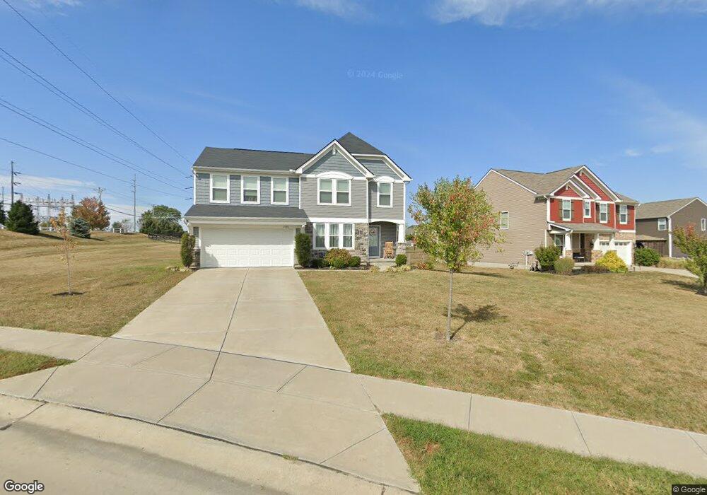
This home is located at 6588 Gordon Blvd, Union, KY 41091 and is currently estimated at $442,543, approximately $197 per square foot. 6588 Gordon Blvd is a home located in Boone County with nearby schools including Longbranch Elementary School, Ockerman Middle School, and Randall K. Cooper High School.
Ownership History
Date
Name
Owned For
Owner Type
Purchase Details
Closed on
Jul 20, 2023
Sold by
Mccray Timothy Logan and Osborne Melissa A
Bought by
Osborne Melissa A
Current Estimated Value
Home Financials for this Owner
Home Financials are based on the most recent Mortgage that was taken out on this home.
Original Mortgage
$40,000
Outstanding Balance
$39,165
Interest Rate
7.5%
Mortgage Type
New Conventional
Estimated Equity
$403,378
Purchase Details
Closed on
Jan 20, 2020
Sold by
Drees Company
Bought by
Mccray Timothy Logan and Osborne Melissa A
Home Financials for this Owner
Home Financials are based on the most recent Mortgage that was taken out on this home.
Original Mortgage
$250,727
Interest Rate
3.6%
Mortgage Type
New Conventional
Purchase Details
Closed on
Oct 1, 2019
Sold by
Camp Ernst Road Llc
Bought by
The Drees Company Inc
Create a Home Valuation Report for This Property
The Home Valuation Report is an in-depth analysis detailing your home's value as well as a comparison with similar homes in the area
Home Values in the Area
Average Home Value in this Area
Purchase History
| Date | Buyer | Sale Price | Title Company |
|---|---|---|---|
| Osborne Melissa A | -- | None Listed On Document | |
| Mccray Timothy Logan | $275,965 | Terry Monnie Title | |
| The Drees Company Inc | $40,241 | None Available |
Source: Public Records
Mortgage History
| Date | Status | Borrower | Loan Amount |
|---|---|---|---|
| Open | Osborne Melissa A | $40,000 | |
| Previous Owner | Mccray Timothy Logan | $250,727 |
Source: Public Records
Tax History Compared to Growth
Tax History
| Year | Tax Paid | Tax Assessment Tax Assessment Total Assessment is a certain percentage of the fair market value that is determined by local assessors to be the total taxable value of land and additions on the property. | Land | Improvement |
|---|---|---|---|---|
| 2024 | $3,107 | $276,000 | $40,200 | $235,800 |
| 2023 | $3,141 | $276,000 | $40,200 | $235,800 |
| 2022 | $3,099 | $276,000 | $40,200 | $235,800 |
| 2021 | $3,180 | $276,000 | $40,200 | $235,800 |
| 2020 | $460 | $40,200 | $40,200 | $0 |
| 2019 | $423 | $36,500 | $36,500 | $0 |
| 2018 | $416 | $36,500 | $36,500 | $0 |
| 2017 | $416 | $36,500 | $36,500 | $0 |
Source: Public Records
Map
Nearby Homes
- WEMBLEY Plan at Hawk's Landing
- ASHTON Plan at Hawk's Landing
- BEACHWOOD Plan at Hawk's Landing
- SAXON Plan at Hawk's Landing
- ALEXANDER Plan at Hawk's Landing
- 273 Mallory Ln
- 6685 Gordon Blvd
- 6637 Gordon Blvd
- 8212 B Camp Ernst Rd
- 3016 Kel Ct
- 2709 Longbranch Rd
- 290 Kassady Ct
- 8720 Eden Ct
- 8629 Treeline Dr
- 9412 Dauphine Dr
- 5112 Loch Dr
- 5125 Loch Dr
- 5129 Loch Dr
- 7704 Falls Creek Way
- 8636 Eden Ct