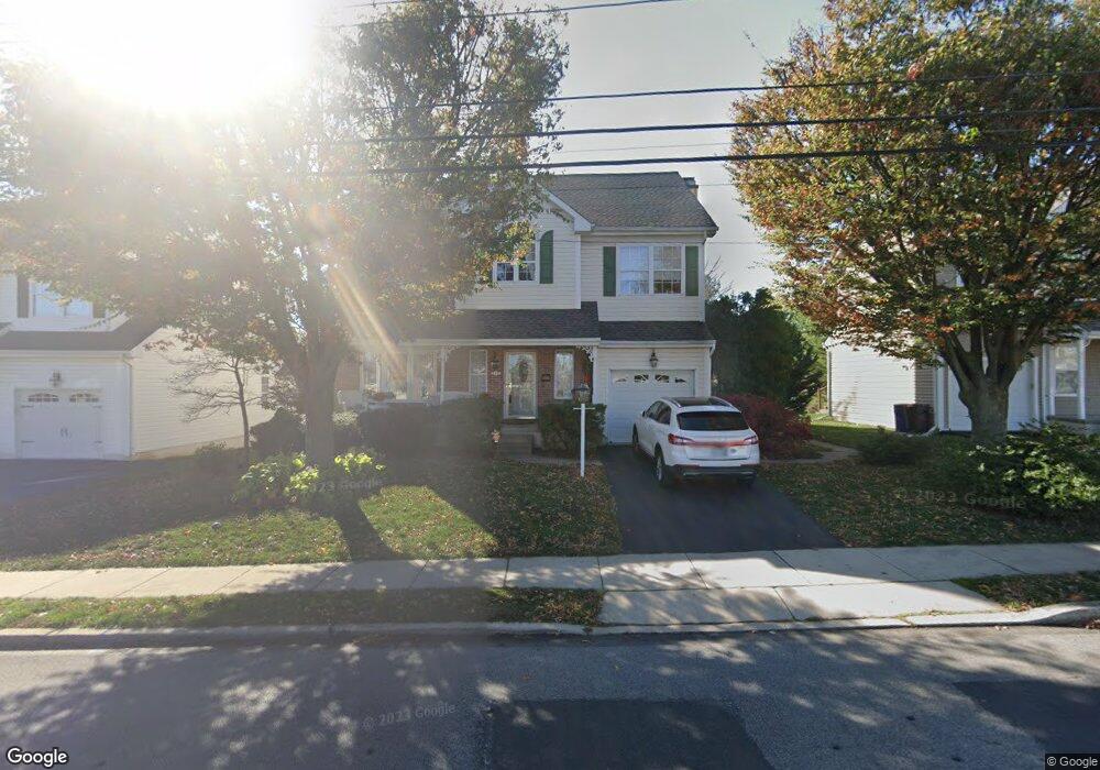
659 Amosland Rd Morton, PA 19070
Estimated Value: $436,000 - $489,000
4
Beds
3
Baths
2,371
Sq Ft
$197/Sq Ft
Est. Value
About This Home
This home is located at 659 Amosland Rd, Morton, PA 19070 and is currently estimated at $466,302, approximately $196 per square foot. 659 Amosland Rd is a home located in Delaware County with nearby schools including Amosland El School, Ridley Middle School, and Ridley High School.
Ownership History
Date
Name
Owned For
Owner Type
Purchase Details
Closed on
May 26, 1994
Sold by
Hellings Properties Of Ridley Ltd
Bought by
Henry James C and Henry Rita J
Current Estimated Value
Home Financials for this Owner
Home Financials are based on the most recent Mortgage that was taken out on this home.
Original Mortgage
$75,000
Interest Rate
8.49%
Mortgage Type
Purchase Money Mortgage
Create a Home Valuation Report for This Property
The Home Valuation Report is an in-depth analysis detailing your home's value as well as a comparison with similar homes in the area
Home Values in the Area
Average Home Value in this Area
Purchase History
| Date | Buyer | Sale Price | Title Company |
|---|---|---|---|
| Henry James C | $179,900 | -- |
Source: Public Records
Mortgage History
| Date | Status | Borrower | Loan Amount |
|---|---|---|---|
| Closed | Henry James C | $75,000 |
Source: Public Records
Tax History Compared to Growth
Tax History
| Year | Tax Paid | Tax Assessment Tax Assessment Total Assessment is a certain percentage of the fair market value that is determined by local assessors to be the total taxable value of land and additions on the property. | Land | Improvement |
|---|---|---|---|---|
| 2025 | $7,905 | $227,660 | $62,830 | $164,830 |
| 2024 | $7,905 | $227,660 | $62,830 | $164,830 |
| 2023 | $7,561 | $227,660 | $62,830 | $164,830 |
| 2022 | $7,318 | $227,660 | $62,830 | $164,830 |
| 2021 | $11,329 | $227,660 | $62,830 | $164,830 |
| 2020 | $7,939 | $140,530 | $48,320 | $92,210 |
| 2019 | $7,793 | $140,530 | $48,320 | $92,210 |
| 2018 | $7,696 | $140,530 | $0 | $0 |
| 2017 | $9,432 | $172,220 | $0 | $0 |
| 2016 | $945 | $172,220 | $0 | $0 |
| 2015 | $945 | $172,220 | $0 | $0 |
| 2014 | $945 | $172,220 | $0 | $0 |
Source: Public Records
Map
Nearby Homes
- 1919 Pershing Ave
- 706 Brooke Ave
- 734 Brooke Cir
- 2202 Clayton Rd
- 510 Amosland Rd
- 31 Faraday Ct
- 810 Quince Ln
- 668 Hutchinson Terrace
- 370 Amosland Rd
- 361 Amosland Rd
- 1908 Franklin Ave
- 425 Hutchinson Terrace
- 2329 Armstrong Ave
- 115 President Ave
- 339 Sutton Ave
- 357 Cedar Ave
- 31 Silver Lake Terrace Unit 32
- 363 Holmes Rd
- 537 Folsom Ave
- 2335 Poe Rd
- 665 Amosland Rd
- 653 Amosland Rd
- 647 Amosland Rd
- 650 Amosland Rd
- 1924 Armstrong Ave
- 700 Amosland Rd
- 662 Acer Ave
- 666 Acer Ave
- 658 Acer Ave
- 646 Amosland Rd
- 670 Acer Ave
- 641 Amosland Rd
- 704 Amosland Rd
- 654 Acer Ave
- 674 Acer Ave
- 642 Amosland Rd
- 650 Acer Ave
- 646 Acer Ave
- 2106 Armstrong Ave
- 1916 Armstrong Ave