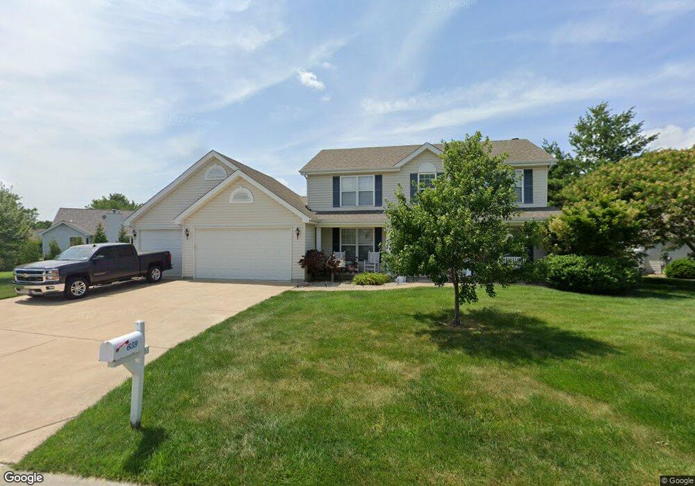
659 Castlebrook Dr Saint Peters, MO 63376
Estimated Value: $495,729 - $582,000
4
Beds
3
Baths
2,446
Sq Ft
$219/Sq Ft
Est. Value
About This Home
This home is located at 659 Castlebrook Dr, Saint Peters, MO 63376 and is currently estimated at $535,182, approximately $218 per square foot. 659 Castlebrook Dr is a home located in St. Charles County with nearby schools including Progress South Elementary School, Fort Zumwalt South Middle School, and Fort Zumwalt South High School.
Ownership History
Date
Name
Owned For
Owner Type
Purchase Details
Closed on
Feb 11, 1999
Sold by
Tom Johnson Construction Company Inc
Bought by
Jackson Thomas M and Jackson Tina M
Current Estimated Value
Home Financials for this Owner
Home Financials are based on the most recent Mortgage that was taken out on this home.
Original Mortgage
$105,000
Outstanding Balance
$24,396
Interest Rate
6.78%
Estimated Equity
$510,786
Create a Home Valuation Report for This Property
The Home Valuation Report is an in-depth analysis detailing your home's value as well as a comparison with similar homes in the area
Home Values in the Area
Average Home Value in this Area
Purchase History
| Date | Buyer | Sale Price | Title Company |
|---|---|---|---|
| Jackson Thomas M | $166,350 | -- |
Source: Public Records
Mortgage History
| Date | Status | Borrower | Loan Amount |
|---|---|---|---|
| Open | Jackson Thomas M | $105,000 |
Source: Public Records
Tax History Compared to Growth
Tax History
| Year | Tax Paid | Tax Assessment Tax Assessment Total Assessment is a certain percentage of the fair market value that is determined by local assessors to be the total taxable value of land and additions on the property. | Land | Improvement |
|---|---|---|---|---|
| 2025 | $5,126 | $84,087 | -- | -- |
| 2024 | $5,126 | $77,689 | -- | -- |
| 2023 | $5,128 | $77,689 | $0 | $0 |
| 2022 | $4,610 | $64,955 | $0 | $0 |
| 2021 | $4,613 | $64,955 | $0 | $0 |
| 2020 | $4,191 | $57,099 | $0 | $0 |
| 2019 | $4,201 | $57,099 | $0 | $0 |
| 2018 | $3,737 | $48,465 | $0 | $0 |
| 2017 | $3,694 | $48,465 | $0 | $0 |
| 2016 | $3,572 | $46,687 | $0 | $0 |
| 2015 | $3,321 | $46,687 | $0 | $0 |
| 2014 | $3,093 | $42,747 | $0 | $0 |
Source: Public Records
Map
Nearby Homes
- 661 Clifton Hill Dr
- 421 Jacobs Place Dr
- 201 Dardenne Farms Dr
- 212 Jacobs Way
- 225 Jacobs Way
- 213 Black Oak Dr
- 120 Glenallen Dr
- 6355 Sprucefield Dr
- 60 Loganberry Ct
- 1 Pauley Cir
- 1228 Cold Spring Dr
- 1218 Cold Spring Dr
- 1017 Windsor Crest Ct
- 1700 Birdie Hills Rd
- 1313 Commons Cir
- 0 the Rainier@weiss Rd
- New Build Forest J at Weiss Rd
- 7 Park City Ct
- New Build Forest H at Weiss Rd
- 0 the Indigo@weiss Rd
- 649 Castlebrook Dr
- 652 Clifton Hill Dr
- 656 Clifton Hill Dr
- 648 Clifton Hill Dr
- 654 Castlebrook Dr
- 645 Castlebrook Dr
- 658 Castlebrook Dr
- 664 Castlebrook Dr
- 650 Castlebrook Dr
- 644 Clifton Hill Dr
- 662 Castlebrook Dr
- 668 Castlebrook Dr
- 641 Castlebrook Dr
- 646 Castlebrook Dr
- 653 Clifton Hill Dr
- 657 Clifton Hill Dr
- 2bblt Wyndgate Commons
- 02BBLT Wyndgate Oaks Arlington II Her
- 02BBLT Wyndgate Oaks Hadleigh Heritag
- 02BBLT Wyndgate Oaks Durham Heritage