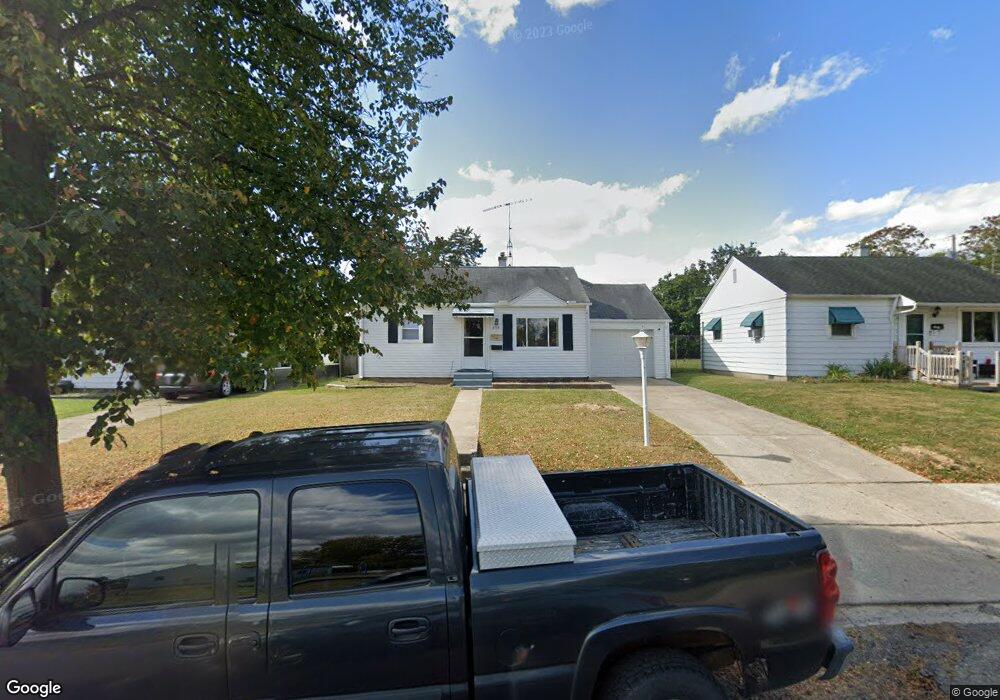
659 Cortland Dr Springfield, OH 45505
Estimated Value: $112,000 - $140,000
2
Beds
1
Bath
1,008
Sq Ft
$125/Sq Ft
Est. Value
About This Home
This home is located at 659 Cortland Dr, Springfield, OH 45505 and is currently estimated at $126,207, approximately $125 per square foot. 659 Cortland Dr is a home located in Clark County with nearby schools including Mann Elementary School, Schaefer Middle School, and Springfield High School.
Ownership History
Date
Name
Owned For
Owner Type
Purchase Details
Closed on
Nov 25, 2022
Sold by
Endicott Justin M and Endicott Evan
Bought by
Endicott Properties Llc
Current Estimated Value
Purchase Details
Closed on
Oct 6, 2022
Sold by
Endicott Kenneth E and Endicott Beverly D
Bought by
Endicott Justin M
Purchase Details
Closed on
Mar 11, 2010
Sold by
Peyton Miles D and Peyton Norma A
Bought by
Endicott Beverly D
Create a Home Valuation Report for This Property
The Home Valuation Report is an in-depth analysis detailing your home's value as well as a comparison with similar homes in the area
Home Values in the Area
Average Home Value in this Area
Purchase History
| Date | Buyer | Sale Price | Title Company |
|---|---|---|---|
| Endicott Properties Llc | -- | -- | |
| Endicott Properties Llc | -- | None Listed On Document | |
| Endicott Justin M | -- | -- | |
| Endicott Justin M | -- | None Listed On Document | |
| Endicott Beverly D | -- | Attorney |
Source: Public Records
Tax History Compared to Growth
Tax History
| Year | Tax Paid | Tax Assessment Tax Assessment Total Assessment is a certain percentage of the fair market value that is determined by local assessors to be the total taxable value of land and additions on the property. | Land | Improvement |
|---|---|---|---|---|
| 2024 | $1,403 | $27,710 | $4,460 | $23,250 |
| 2023 | $1,369 | $27,710 | $4,460 | $23,250 |
| 2022 | $940 | $27,710 | $4,460 | $23,250 |
| 2021 | $1,172 | $21,920 | $3,540 | $18,380 |
| 2020 | $1,175 | $21,920 | $3,540 | $18,380 |
| 2019 | $1,178 | $21,920 | $3,540 | $18,380 |
| 2018 | $986 | $17,620 | $2,650 | $14,970 |
| 2017 | $985 | $19,317 | $2,653 | $16,664 |
| 2016 | $986 | $19,317 | $2,653 | $16,664 |
| 2015 | $958 | $19,317 | $2,653 | $16,664 |
| 2014 | $954 | $19,317 | $2,653 | $16,664 |
| 2013 | $878 | $19,317 | $2,653 | $16,664 |
Source: Public Records
Map
Nearby Homes
- 637 S Arlington Ave
- 2345 Irwin Ave
- 2434 Irwin Ave
- 2422 Lexington Ave
- 500 S Belmont Ave Unit 502
- 351 S Clairmont Ave
- 360 Buxton Ave
- 327 Buxton Ave
- 1979 Kenton St
- 535 S Hubert Ave
- 2201 Elmwood Ave
- 2733 Elmore Dr
- 1714 Kenton St
- 603 Linwood Ave Unit 605
- 2027 Elmwood Ave
- 2751 Share St
- 523 Linwood Ave
- 2753 Van Buren Ave
- 1915 Kenwood Ave
- 1810 Kenwood Ave
- 653 Cortland Dr
- 663 Cortland Dr
- 705 Cortland Dr
- 662 Reading Dr
- 652 Reading Dr
- 711 Cortland Dr
- 702 Reading Dr
- 643 Cortland Dr
- 646 Reading Dr
- 708 Reading Dr
- 648 Cortland Dr
- 642 Reading Dr
- 717 Cortland Dr
- 644 Cortland Dr
- 2347 Dellwood Dr
- 2341 Dellwood Dr
- 708 Cortland Dr
- 2408 Leland Dr
- 714 Reading Dr
- 706 Cortland Dr