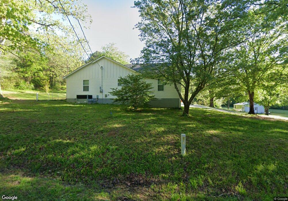
659 Dixon Branch Rd Loretto, TN 38469
Estimated Value: $243,753 - $322,000
Studio
1
Bath
2,001
Sq Ft
$142/Sq Ft
Est. Value
About This Home
This home is located at 659 Dixon Branch Rd, Loretto, TN 38469 and is currently estimated at $284,188, approximately $142 per square foot. 659 Dixon Branch Rd is a home located in Lawrence County with nearby schools including South Lawrence Elementary School, Lawrenceburg Public Elementary School, and Ingram Sowell Elementary School.
Ownership History
Date
Name
Owned For
Owner Type
Purchase Details
Closed on
Aug 5, 2019
Sold by
Harding Nannette Susan and Hollinsworth Annette Frances
Bought by
Simbeck Michael and Simbeck Charity
Current Estimated Value
Purchase Details
Closed on
Mar 30, 2006
Sold by
Yocom Echols Pamela
Bought by
Carl Rose Ann B
Purchase Details
Closed on
Nov 6, 1992
Bought by
Yocom Pam
Purchase Details
Closed on
May 19, 1989
Bought by
Carl Rose Ann
Create a Home Valuation Report for This Property
The Home Valuation Report is an in-depth analysis detailing your home's value as well as a comparison with similar homes in the area
Purchase History
We collect this data history from publicly available records. To have your information removed, we recommend requesting removal directly through your county’s website.
| Date | Buyer | Sale Price | Title Company |
|---|---|---|---|
| Simbeck Michael | $45,000 | None Available | |
| Carl Rose Ann B | $2,000 | -- | |
| Yocom Pam | $4,500 | -- | |
| Carl Rose Ann | $9,000 | -- |
Source: Public Records
Tax History
| Year | Tax Paid | Tax Assessment Tax Assessment Total Assessment is a certain percentage of the fair market value that is determined by local assessors to be the total taxable value of land and additions on the property. | Land | Improvement |
|---|---|---|---|---|
| 2025 | -- | $54,850 | $4,700 | $50,150 |
| 2024 | $1,284 | $54,850 | $4,700 | $50,150 |
| 2023 | $1,284 | $54,850 | $4,700 | $50,150 |
| 2022 | $1,284 | $54,850 | $4,700 | $50,150 |
| 2021 | $1,318 | $39,250 | $3,025 | $36,225 |
| 2020 | $102 | $39,250 | $3,025 | $36,225 |
| 2019 | $452 | $13,450 | $3,025 | $10,425 |
| 2018 | $445 | $13,450 | $3,025 | $10,425 |
| 2017 | $432 | $13,450 | $3,025 | $10,425 |
| 2016 | $432 | $13,450 | $3,025 | $10,425 |
| 2015 | $394 | $13,450 | $3,025 | $10,425 |
| 2014 | $260 | $8,875 | $3,025 | $5,850 |
Source: Public Records
Map
Nearby Homes
- 412 Eells St
- 205 Dixon Branch Rd
- 118 Park St
- 205 Dixon Rd E
- 119 Horn Ave
- 801 Cherokee Hills Dr
- 502 N Main St
- 0 Littrell Rd
- 497 Rascal Town Rd
- 530 N Main St
- 219 Vine Cir
- 202 Vine St
- 211 Church St
- 705 N Military St
- 130 Beartown Rd
- 109 2nd Ave N
- 716 Brenda Ave
- 717 Brenda Ave
- 402 W Commerce St
- 132 Beartown Rd
- 655 Dixon Branch Rd
- 0 Dixon Branch Rd
- 122 Browns Ln
- 8 Methvin Rd
- 121 Browns Ln
- 631 Dixon Branch Rd
- 116 Browns Ln
- 117 Browns Ln
- 117 Browns Ln
- 113 Browns Ln
- 534 Highway 43 S
- 430 Eells St
- 423 Eells St
- 627 Dixon Branch Rd
- 8 Rigling
- 15 Methvin Rd
- 621 Dixon Branch Rd
- 414 Eells St
- 619 Dixon Branch Rd
- 415 Eells St
Your Personal Tour Guide
Ask me questions while you tour the home.