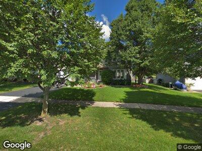
659 Matthew Ln Carol Stream, IL 60188
Estimated Value: $453,330 - $495,000
3
Beds
3
Baths
2,207
Sq Ft
$215/Sq Ft
Est. Value
About This Home
This home is located at 659 Matthew Ln, Carol Stream, IL 60188 and is currently estimated at $474,833, approximately $215 per square foot. 659 Matthew Ln is a home located in DuPage County with nearby schools including Heritage Lakes Elementary School, Jay Stream Middle School, and Glenbard North High School.
Ownership History
Date
Name
Owned For
Owner Type
Purchase Details
Closed on
Jun 19, 2017
Sold by
Pauling Kenneth K and Pauling Jody L
Bought by
Pauling Kenneth K and Pauling Jody L
Current Estimated Value
Purchase Details
Closed on
Mar 10, 2012
Sold by
Pauling Kenneth K and Pauling Susan M
Bought by
Pauling Kenneth K and Gresko Jody L
Home Financials for this Owner
Home Financials are based on the most recent Mortgage that was taken out on this home.
Original Mortgage
$143,000
Interest Rate
3.6%
Mortgage Type
New Conventional
Create a Home Valuation Report for This Property
The Home Valuation Report is an in-depth analysis detailing your home's value as well as a comparison with similar homes in the area
Home Values in the Area
Average Home Value in this Area
Purchase History
| Date | Buyer | Sale Price | Title Company |
|---|---|---|---|
| Pauling Kenneth K | -- | Attorney | |
| Pauling Kenneth K | $119,000 | Title Resource Group |
Source: Public Records
Mortgage History
| Date | Status | Borrower | Loan Amount |
|---|---|---|---|
| Open | Pauling Kenneth K | $126,780 | |
| Previous Owner | Pauling Kenneth K | $143,000 | |
| Previous Owner | Pauling Kenneth K | $48,000 |
Source: Public Records
Tax History Compared to Growth
Tax History
| Year | Tax Paid | Tax Assessment Tax Assessment Total Assessment is a certain percentage of the fair market value that is determined by local assessors to be the total taxable value of land and additions on the property. | Land | Improvement |
|---|---|---|---|---|
| 2023 | $8,877 | $115,350 | $30,110 | $85,240 |
| 2022 | $10,341 | $123,100 | $29,910 | $93,190 |
| 2021 | $9,843 | $116,960 | $28,420 | $88,540 |
| 2020 | $10,250 | $115,270 | $27,730 | $87,540 |
| 2019 | $9,865 | $110,770 | $26,650 | $84,120 |
| 2018 | $10,021 | $113,870 | $25,950 | $87,920 |
| 2017 | $9,486 | $105,540 | $24,050 | $81,490 |
| 2016 | $8,995 | $97,680 | $22,260 | $75,420 |
| 2015 | $8,800 | $91,150 | $20,770 | $70,380 |
| 2014 | $7,793 | $80,040 | $18,240 | $61,800 |
| 2013 | $7,834 | $82,780 | $18,860 | $63,920 |
Source: Public Records
Map
Nearby Homes
- 620 Teton Cir
- 534 Alton Ct
- 601 Oswego Dr
- 706 Shining Water Dr
- 491 Dakota Ct Unit 2
- 440 Shelburne Dr
- 26W241 Lies Rd
- 806 Idaho St
- 1054 Evergreen Dr
- 942 Hill Crest Dr
- 828 Huron Ct
- 443 Indianwood Dr
- 525 Burke Dr
- 1089 Baybrook Ln
- 1096 Gunsmoke Ct
- 474 Hunter Dr
- 27W270 Jefferson St
- 375 Hunter Dr
- 315 Canyon Trail
- 398 Stonewood Cir
- 659 Matthew Ln
- 655 Matthew Ln
- 663 Matthew Ln
- 682 Chestnut Dr
- 688 Chestnut Dr
- 676 Chestnut Dr
- 651 Matthew Ln
- 665 Matthew Ln
- 694 Chestnut Dr
- 660 Matthew Ln
- 654 Matthew Ln
- 664 Matthew Ln
- 670 Chestnut Dr
- 647 Matthew Ln
- 650 Matthew Ln
- 667 Matthew Ln
- 800 Tamarac Dr
- 664 Chestnut Dr
- 669 Matthew Ln
- 648 Matthew Ln