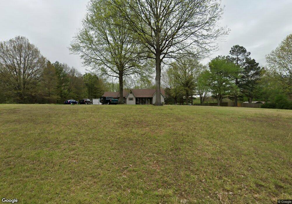
6590 Walsh Rd Millington, TN 38053
Estimated Value: $270,000 - $332,000
3
Beds
2
Baths
1,833
Sq Ft
$166/Sq Ft
Est. Value
About This Home
This home is located at 6590 Walsh Rd, Millington, TN 38053 and is currently estimated at $303,390, approximately $165 per square foot. 6590 Walsh Rd is a home located in Shelby County with nearby schools including E.E. Jeter Elementary School and Trezevant High School.
Ownership History
Date
Name
Owned For
Owner Type
Purchase Details
Closed on
Apr 11, 2017
Sold by
Winchester Walter N
Bought by
H & H Racing Llc
Current Estimated Value
Purchase Details
Closed on
Apr 10, 2017
Sold by
Ho Jiunn H and Yo Jene Y
Bought by
Hubbard Cliff
Purchase Details
Closed on
Dec 21, 1998
Sold by
Hubbard Roy Clifton
Bought by
Hubbard Cliff and Hubbard Leigh M
Home Financials for this Owner
Home Financials are based on the most recent Mortgage that was taken out on this home.
Original Mortgage
$100,000
Interest Rate
6.94%
Purchase Details
Closed on
Aug 11, 1998
Sold by
Hubbard Nancy
Bought by
Hubbard Roy Clifton
Create a Home Valuation Report for This Property
The Home Valuation Report is an in-depth analysis detailing your home's value as well as a comparison with similar homes in the area
Home Values in the Area
Average Home Value in this Area
Purchase History
| Date | Buyer | Sale Price | Title Company |
|---|---|---|---|
| H & H Racing Llc | $23,100 | None Available | |
| Hubbard Cliff | $44,000 | Fntg | |
| Hubbard Cliff | -- | Lawyers Title Insurance Corp | |
| Hubbard Roy Clifton | -- | -- |
Source: Public Records
Mortgage History
| Date | Status | Borrower | Loan Amount |
|---|---|---|---|
| Previous Owner | Hubbard Cliff | $100,000 |
Source: Public Records
Tax History Compared to Growth
Tax History
| Year | Tax Paid | Tax Assessment Tax Assessment Total Assessment is a certain percentage of the fair market value that is determined by local assessors to be the total taxable value of land and additions on the property. | Land | Improvement |
|---|---|---|---|---|
| 2025 | $1,568 | $57,350 | $13,500 | $43,850 |
| 2024 | $1,568 | $46,250 | $11,850 | $34,400 |
| 2023 | $1,568 | $46,250 | $11,850 | $34,400 |
| 2022 | $1,568 | $46,250 | $11,850 | $34,400 |
| 2021 | $1,822 | $52,800 | $11,850 | $40,950 |
| 2020 | $781 | $38,150 | $10,775 | $27,375 |
| 2019 | $1,545 | $38,150 | $10,775 | $27,375 |
| 2018 | $1,545 | $38,150 | $10,775 | $27,375 |
| 2017 | $1,568 | $38,150 | $10,775 | $27,375 |
| 2016 | $1,566 | $35,825 | $0 | $0 |
| 2014 | $1,566 | $35,825 | $0 | $0 |
Source: Public Records
Map
Nearby Homes
- 1 Walsh Rd
- 6770 Camp John Rd
- 0 N Watkins Unit 10203950
- 0 N Watkins Unit 10193620
- 6525 N Watkins Rd
- 1435 Walsh Cove
- 1907 Campbell Rd
- 6234 Woodstock Cuba Rd
- 7441 Walsh Rd
- 2714 Moonview Rd
- 7550 Woodstock Cuba Rd
- 6007 Island Forty Rd
- 7265 Ward Rd
- 6224 Benjestown Rd
- 6621 Benjestown Rd
- 5921 Benjestown Rd
- 7790 Deer Lake Dr
- 5907 Old Millington Rd
- 3073 Jericho Rd
- 5387 Cornstalk Cove