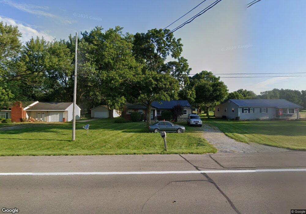
6591 W Us Route 36 Covington, OH 45318
Estimated Value: $195,728 - $221,000
3
Beds
1
Bath
1,250
Sq Ft
$167/Sq Ft
Est. Value
About This Home
This home is located at 6591 W Us Route 36, Covington, OH 45318 and is currently estimated at $209,182, approximately $167 per square foot. 6591 W Us Route 36 is a home located in Miami County with nearby schools including Covington Elementary/Junior High School, Covington Junior High School, and Covington High School.
Ownership History
Date
Name
Owned For
Owner Type
Purchase Details
Closed on
Jun 14, 2023
Sold by
Malone Bruce R and Malone Marilyn L
Bought by
Malone Eric J
Current Estimated Value
Home Financials for this Owner
Home Financials are based on the most recent Mortgage that was taken out on this home.
Original Mortgage
$136,000
Outstanding Balance
$131,599
Interest Rate
6.35%
Mortgage Type
New Conventional
Estimated Equity
$77,583
Purchase Details
Closed on
Oct 5, 2017
Sold by
Malone Bruce R and Malone Marilyn L
Bought by
Malone Brain and Malone Eric
Purchase Details
Closed on
Oct 17, 2008
Sold by
Morequity Inc
Bought by
Malone Bruce R and Malone Marilyn L
Purchase Details
Closed on
Jan 31, 2008
Sold by
Kittle Thomas L
Bought by
Morequity Inc
Purchase Details
Closed on
Oct 29, 1999
Sold by
Crabtree Orie M and Crabtree Beverly
Bought by
Kittle Thomas L and Kittle Gloria A
Purchase Details
Closed on
Jun 4, 1991
Bought by
Crabtree Orie M
Create a Home Valuation Report for This Property
The Home Valuation Report is an in-depth analysis detailing your home's value as well as a comparison with similar homes in the area
Purchase History
| Date | Buyer | Sale Price | Title Company |
|---|---|---|---|
| Malone Eric J | $170,000 | Box Buckeye Title | |
| Malone Brain | -- | -- | |
| Malone Bruce R | $59,500 | -- | |
| Morequity Inc | $65,000 | -- | |
| Kittle Thomas L | $83,500 | -- | |
| Crabtree Orie M | $55,000 | -- |
Source: Public Records
Mortgage History
| Date | Status | Borrower | Loan Amount |
|---|---|---|---|
| Open | Malone Eric J | $136,000 |
Source: Public Records
Tax History
| Year | Tax Paid | Tax Assessment Tax Assessment Total Assessment is a certain percentage of the fair market value that is determined by local assessors to be the total taxable value of land and additions on the property. | Land | Improvement |
|---|---|---|---|---|
| 2025 | $1,961 | $64,650 | $11,900 | $52,750 |
| 2024 | $1,961 | $46,240 | $9,100 | $37,140 |
| 2023 | $1,547 | $42,950 | $9,100 | $33,850 |
| 2022 | $1,486 | $42,950 | $9,100 | $33,850 |
| 2021 | $1,224 | $33,040 | $7,000 | $26,040 |
| 2020 | $1,227 | $33,040 | $7,000 | $26,040 |
| 2019 | $1,223 | $33,040 | $7,000 | $26,040 |
| 2018 | $1,138 | $31,220 | $6,860 | $24,360 |
| 2017 | $1,161 | $31,220 | $6,860 | $24,360 |
| 2016 | $1,117 | $31,220 | $6,860 | $24,360 |
| 2015 | $1,061 | $29,480 | $6,480 | $23,000 |
| 2014 | $1,061 | $29,480 | $6,480 | $23,000 |
| 2013 | $1,067 | $29,480 | $6,480 | $23,000 |
Source: Public Records
Map
Nearby Homes
- 6591 U S 36
- 6581 W Us Route 36
- 6581 W Us Route 36
- 6609 W Us Route 36
- 6565 U S 36
- 6565 W Us Route 36
- 6637 W Us Route 36
- 6545 W Us Route 36
- 6665 W Us Route 36
- 6515 W Us Route 36
- 6515 U S 36
- 6335 W Us Route 36
- 6373 W Us Route 36
- 6673 W Us Route 36
- 6245 W Us Route 36
- 6691 W Us Route 36
- 6172 Mulberry Grove-Rakestraw Rd
- 6172 N Mlberry Grove Rakestr Rd
- 6172 N Mlbry Grv Rkstrw Rd
- 6172 N Mulberry Grove Rakestraw Rd
Your Personal Tour Guide
Ask me questions while you tour the home.