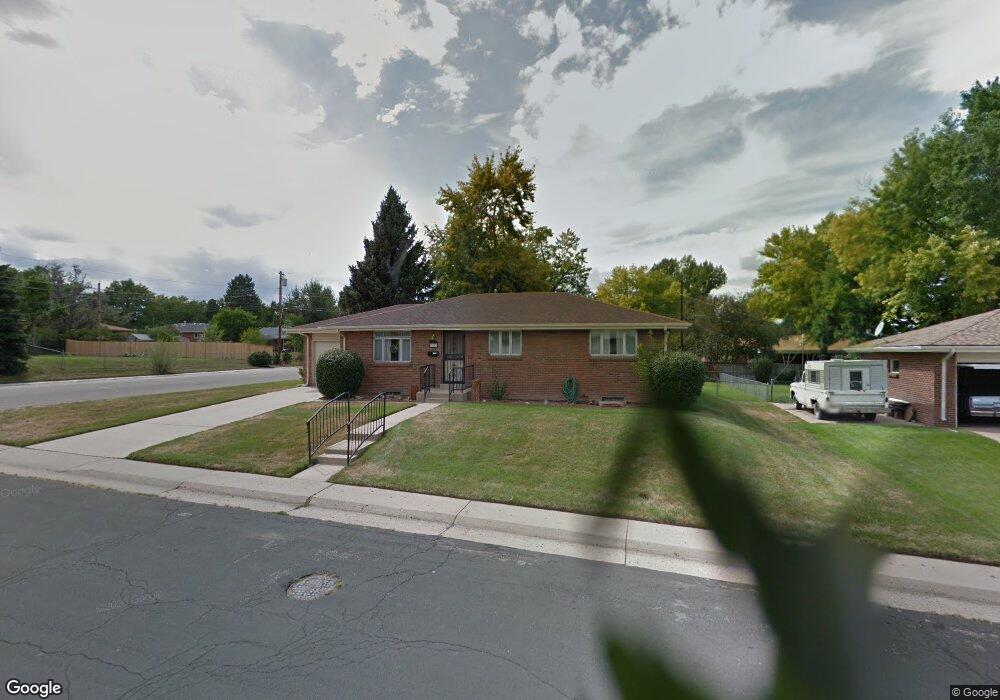
6593 S Grant St Centennial, CO 80121
West Centennial NeighborhoodEstimated Value: $554,268 - $616,000
4
Beds
3
Baths
2,552
Sq Ft
$231/Sq Ft
Est. Value
About This Home
This home is located at 6593 S Grant St, Centennial, CO 80121 and is currently estimated at $590,567, approximately $231 per square foot. 6593 S Grant St is a home located in Arapahoe County with nearby schools including Euclid Middle School, Heritage High School, and Littleton Prep Charter School.
Ownership History
Date
Name
Owned For
Owner Type
Purchase Details
Closed on
Aug 28, 2013
Sold by
Hon Paul J
Bought by
Cohn Timothy C and Cohn China J
Current Estimated Value
Home Financials for this Owner
Home Financials are based on the most recent Mortgage that was taken out on this home.
Original Mortgage
$208,250
Outstanding Balance
$155,464
Interest Rate
4.41%
Mortgage Type
New Conventional
Estimated Equity
$435,103
Purchase Details
Closed on
Jul 4, 1776
Bought by
Conversion Arapco
Create a Home Valuation Report for This Property
The Home Valuation Report is an in-depth analysis detailing your home's value as well as a comparison with similar homes in the area
Home Values in the Area
Average Home Value in this Area
Purchase History
| Date | Buyer | Sale Price | Title Company |
|---|---|---|---|
| Cohn Timothy C | $245,000 | Fidelity National Title Insu | |
| Conversion Arapco | -- | -- |
Source: Public Records
Mortgage History
| Date | Status | Borrower | Loan Amount |
|---|---|---|---|
| Open | Cohn Timothy C | $208,250 |
Source: Public Records
Tax History Compared to Growth
Tax History
| Year | Tax Paid | Tax Assessment Tax Assessment Total Assessment is a certain percentage of the fair market value that is determined by local assessors to be the total taxable value of land and additions on the property. | Land | Improvement |
|---|---|---|---|---|
| 2024 | $3,801 | $35,651 | -- | -- |
| 2023 | $3,801 | $35,651 | $0 | $0 |
| 2022 | $3,340 | $29,482 | $0 | $0 |
| 2021 | $3,338 | $29,482 | $0 | $0 |
| 2020 | $3,214 | $29,186 | $0 | $0 |
| 2019 | $3,040 | $29,186 | $0 | $0 |
| 2018 | $2,519 | $24,271 | $0 | $0 |
| 2017 | $2,324 | $24,271 | $0 | $0 |
| 2016 | $2,058 | $20,672 | $0 | $0 |
| 2015 | $2,060 | $20,672 | $0 | $0 |
| 2014 | -- | $15,984 | $0 | $0 |
| 2013 | -- | $15,490 | $0 | $0 |
Source: Public Records
Map
Nearby Homes
- 6598 S Logan St
- 6616 S Lincoln St
- 6785 S Logan St
- 6683 S Washington St
- 6825 S Penrose Ct
- 100 E Highline Cir Unit 105
- 6691 S Wellington Ct
- 140 E Highline Cir Unit 304
- 6586 S Kit Carson St
- 50 E Highline Cir Unit 101
- 50 E Highline Cir Unit 102
- 309 E Highline Cir Unit 102
- 6840 S Broadway
- 421 E Highline Cir Unit 421
- 236 E Fair Ln
- 190 E Highline Cir Unit 302
- 6142 S Logan Place
- 6928 S Broadway
- 6695 S Ogden St
- 980 E Briarwood Cir N
- 6583 S Grant St
- 6592 S Sherman St
- 6582 S Sherman St
- 6603 S Grant St
- 6590 S Grant St
- 6573 S Grant St
- 6602 S Sherman St
- 6580 S Grant St
- 6572 S Sherman St
- 6610 S Grant St
- 6570 S Grant St
- 6623 S Grant St
- 6562 S Sherman St
- 6612 S Sherman St
- 6563 S Grant St
- 6595 S Sherman St
- 6591 S Logan St
- 6620 S Grant St
- 6585 S Sherman St
- 6560 S Grant St