Estimated Value: $278,419 - $459,000
Studio
1
Bath
1,536
Sq Ft
$229/Sq Ft
Est. Value
About This Home
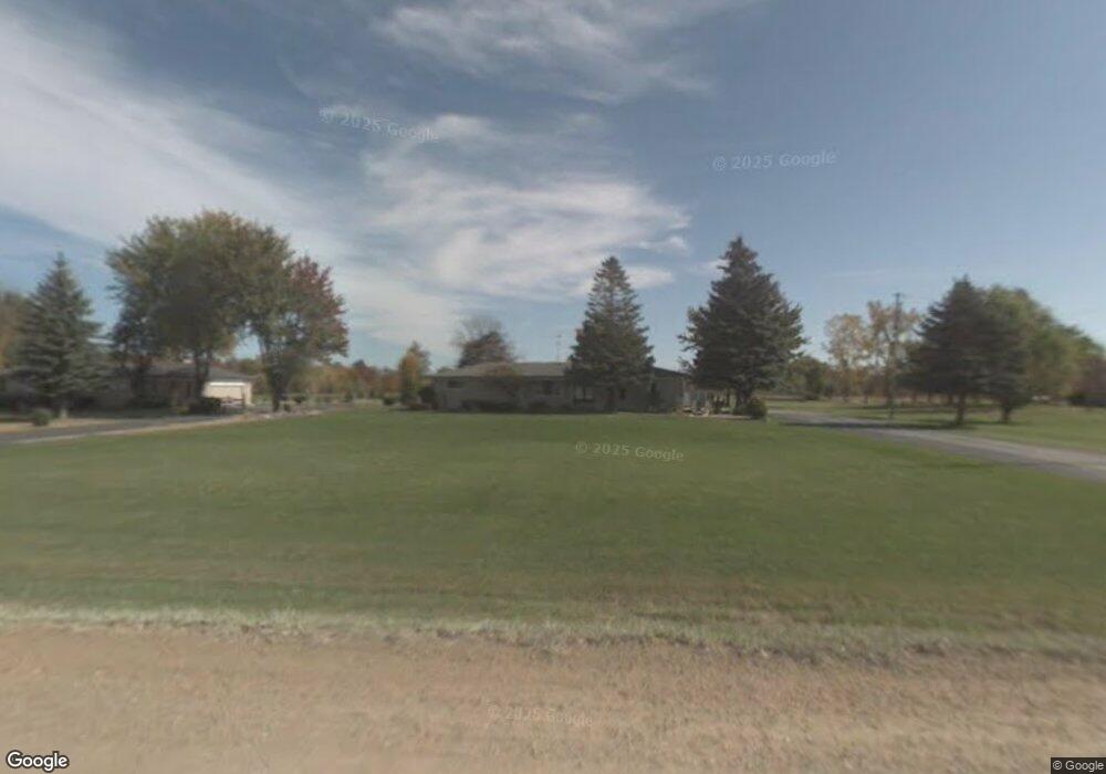
This home is located at 65950 Place Rd, Lenox, MI 48050 and is currently estimated at $351,105, approximately $228 per square foot. 65950 Place Rd is a home located in Macomb County with nearby schools including Orville C. Krause Elementary School, Armada Middle School, and Armada High School.
Ownership History
Date
Name
Owned For
Owner Type
Purchase Details
Closed on
Jan 25, 2024
Sold by
Bantien Robert D and Rose Marie
Bought by
Bantien Robert D and Bantien Rose Marie
Current Estimated Value
Purchase Details
Closed on
Nov 8, 2011
Sold by
Bantien Robert D and Bantien Rose M
Bought by
Bantien Robert D and Bantien Rose Marie
Create a Home Valuation Report for This Property
The Home Valuation Report is an in-depth analysis detailing your home's value as well as a comparison with similar homes in the area
Home Values in the Area
Average Home Value in this Area
Purchase History
| Date | Buyer | Sale Price | Title Company |
|---|---|---|---|
| Bantien Robert D | -- | Land Title | |
| Bantien Robert D | -- | Land Title | |
| Bantien Robert D | -- | None Listed On Document | |
| Bantien Robert D | -- | None Listed On Document | |
| Bantien Robert D | -- | None Available |
Source: Public Records
Tax History
| Year | Tax Paid | Tax Assessment Tax Assessment Total Assessment is a certain percentage of the fair market value that is determined by local assessors to be the total taxable value of land and additions on the property. | Land | Improvement |
|---|---|---|---|---|
| 2025 | $2,115 | $157,100 | $0 | $0 |
| 2024 | $21 | $148,200 | $0 | $0 |
| 2023 | $1,949 | $136,700 | $0 | $0 |
| 2022 | $2,945 | $116,500 | $0 | $0 |
| 2021 | $2,815 | $110,300 | $0 | $0 |
| 2020 | $1,792 | $112,000 | $0 | $0 |
| 2019 | $2,604 | $105,400 | $0 | $0 |
| 2018 | $2,551 | $104,400 | $0 | $0 |
| 2017 | $2,498 | $94,200 | $27,400 | $66,800 |
| 2016 | $2,481 | $94,200 | $0 | $0 |
| 2015 | -- | $97,000 | $0 | $0 |
| 2012 | $237 | $73,720 | $0 | $0 |
| 2011 | $237 | $93,778 | $0 | $0 |
Source: Public Records
Map
Nearby Homes
- 31 Mile Rd
- 63835 Bates Rd
- VAC 32 Mile
- 68788 Place Rd
- 00 S Forest
- 32 Mile Rd
- 23401 29 Mile Rd
- 00 Armada Ridge Parcel 4
- 29988 Armada Ridge Rd
- 67325 Lowe Plank Rd
- 00 Armada Ridge Parcel 6
- 0 29 Mile Rd Unit 50111367
- 0 Bates Rd Unit 50182470
- 59746 Manning Dr
- 34575 31 Mile Rd
- 21901 31 Mile Rd
- 00 Gratiot Ave E Gratiot Ave
- 59740 Havenridge Rd
- 22222 29 Mile Rd
- 000 New Haven
- 65840 Place Rd
- 66000 Place Rd
- 66100 Place Rd
- 65720 Place Rd
- 00 Place Rd Parcel "A"
- 66069 Place Rd
- 65575 Place Rd
- 00 Place Rd Parcel "F"
- 66286 Place Rd
- 00 Place Rd Parcel "B"
- 66283 Place Rd
- 66345 Place Rd
- 65438 Place Rd
- 00 Place Rd Parcel "E"
- 66405 Place Rd
- 00 Place Rd Parcel "C "
- 66481 Place Rd
- 65296 Place Rd
- 28613 30 Mile Rd
- 00 Place Rd Parcel "D"