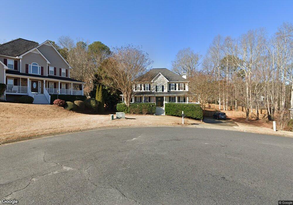
66 Ashland Cir Douglasville, GA 30134
Estimated Value: $367,547 - $421,000
3
Beds
3
Baths
2,338
Sq Ft
$168/Sq Ft
Est. Value
About This Home
This home is located at 66 Ashland Cir, Douglasville, GA 30134 and is currently estimated at $392,387, approximately $167 per square foot. 66 Ashland Cir is a home located in Paulding County with nearby schools including Hal Hutchens Elementary School, Irma C. Austin Middle School, and Hiram High School.
Ownership History
Date
Name
Owned For
Owner Type
Purchase Details
Closed on
Jul 30, 1999
Sold by
Dsst Inc
Bought by
Garrett Donny L and Garrett Jennifer R
Current Estimated Value
Home Financials for this Owner
Home Financials are based on the most recent Mortgage that was taken out on this home.
Original Mortgage
$138,075
Outstanding Balance
$39,833
Interest Rate
7.7%
Mortgage Type
New Conventional
Estimated Equity
$352,554
Create a Home Valuation Report for This Property
The Home Valuation Report is an in-depth analysis detailing your home's value as well as a comparison with similar homes in the area
Home Values in the Area
Average Home Value in this Area
Purchase History
| Date | Buyer | Sale Price | Title Company |
|---|---|---|---|
| Garrett Donny L | $153,500 | -- |
Source: Public Records
Mortgage History
| Date | Status | Borrower | Loan Amount |
|---|---|---|---|
| Open | Garrett Donny L | $138,075 |
Source: Public Records
Tax History Compared to Growth
Tax History
| Year | Tax Paid | Tax Assessment Tax Assessment Total Assessment is a certain percentage of the fair market value that is determined by local assessors to be the total taxable value of land and additions on the property. | Land | Improvement |
|---|---|---|---|---|
| 2024 | $3,894 | $159,796 | $12,000 | $147,796 |
| 2023 | $3,947 | $153,932 | $12,000 | $141,932 |
| 2022 | $3,335 | $129,796 | $12,000 | $117,796 |
| 2021 | $2,784 | $97,676 | $12,000 | $85,676 |
| 2020 | $2,645 | $90,892 | $12,000 | $78,892 |
| 2019 | $2,764 | $93,596 | $12,000 | $81,596 |
| 2018 | $2,477 | $84,068 | $12,000 | $72,068 |
| 2017 | $2,290 | $76,816 | $12,000 | $64,816 |
| 2016 | $2,117 | $71,884 | $12,000 | $59,884 |
| 2015 | $2,138 | $71,324 | $12,000 | $59,324 |
| 2014 | $1,998 | $65,148 | $12,000 | $53,148 |
| 2013 | -- | $55,160 | $12,000 | $43,160 |
Source: Public Records
Map
Nearby Homes
- 611 Warrenton Dr
- 50 Ashland Cir
- 63 Ashland Cir
- 587 Warrenton Dr
- 621 Warrenton Dr
- 51 Ashland Cir
- 575 Warrenton Dr
- 174 Waverly Walk
- 24 Ashland Cir
- 664 Magnolia Dr
- 594 Warrenton Dr
- 642 Magnolia Dr
- 10 Wellington Walk
- 563 Warrenton Dr
- 160 Waverly Walk
- 618 Warrenton Dr
- 180 Waverly Walk
- 17 Ashland Cir
- 572 Warrenton Dr
- 612 Warrenton Dr