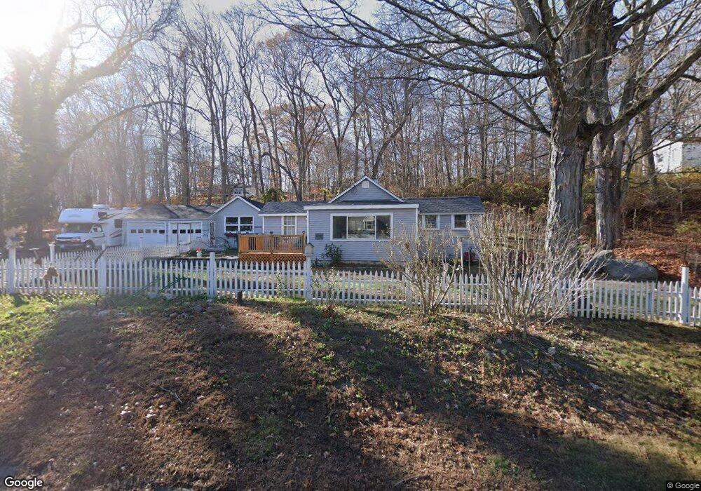
66 Four Mile River Rd Old Lyme, CT 06371
Estimated Value: $303,000 - $337,000
2
Beds
1
Bath
816
Sq Ft
$391/Sq Ft
Est. Value
About This Home
This home is located at 66 Four Mile River Rd, Old Lyme, CT 06371 and is currently estimated at $318,714, approximately $390 per square foot. 66 Four Mile River Rd is a home located in New London County with nearby schools including Mile Creek School, Lyme-Old Lyme Middle School, and Lyme-Old Lyme High School.
Ownership History
Date
Name
Owned For
Owner Type
Purchase Details
Closed on
Aug 16, 2019
Sold by
Rand Steven T
Bought by
Saunders Donald
Current Estimated Value
Home Financials for this Owner
Home Financials are based on the most recent Mortgage that was taken out on this home.
Original Mortgage
$5,600
Outstanding Balance
$4,905
Interest Rate
3.7%
Mortgage Type
Second Mortgage Made To Cover Down Payment
Estimated Equity
$313,809
Create a Home Valuation Report for This Property
The Home Valuation Report is an in-depth analysis detailing your home's value as well as a comparison with similar homes in the area
Home Values in the Area
Average Home Value in this Area
Purchase History
| Date | Buyer | Sale Price | Title Company |
|---|---|---|---|
| Saunders Donald | $160,000 | -- |
Source: Public Records
Mortgage History
| Date | Status | Borrower | Loan Amount |
|---|---|---|---|
| Open | Saunders Donald | $5,600 | |
| Open | Saunders Donald | $157,102 |
Source: Public Records
Tax History Compared to Growth
Tax History
| Year | Tax Paid | Tax Assessment Tax Assessment Total Assessment is a certain percentage of the fair market value that is determined by local assessors to be the total taxable value of land and additions on the property. | Land | Improvement |
|---|---|---|---|---|
| 2025 | $2,749 | $169,400 | $63,100 | $106,300 |
| 2024 | $2,923 | $119,800 | $65,000 | $54,800 |
| 2023 | $2,815 | $119,800 | $65,000 | $54,800 |
| 2022 | $2,815 | $119,800 | $65,000 | $54,800 |
| 2021 | $2,791 | $119,800 | $65,000 | $54,800 |
| 2020 | $2,779 | $119,800 | $65,000 | $54,800 |
| 2019 | $2,499 | $111,500 | $57,800 | $53,700 |
| 2018 | $2,443 | $111,500 | $57,800 | $53,700 |
| 2017 | $2,425 | $111,500 | $57,800 | $53,700 |
| 2016 | $2,364 | $111,500 | $57,800 | $53,700 |
| 2015 | $2,299 | $111,500 | $57,800 | $53,700 |
| 2014 | $2,332 | $118,600 | $57,800 | $60,800 |
Source: Public Records
Map
Nearby Homes
- 14 Colton Rd
- 188 4 Mile River Rd
- 4 Jean Dr
- 15 Freedom Way Unit 92
- 15 Short Hills Rd
- 18 Twin Valley Rd
- 3 Twin Valley Rd
- 16 Twin Valley Rd
- Waramaug Plan at Riverside Reserve
- Highland Plan at Riverside Reserve
- Hayward Plan at Riverside Reserve
- Ashford Plan at Riverside Reserve
- Lillinonah Plan at Riverside Reserve
- 2 Riverdale Landing
- 23 Over Brook Rd
- 57 Spring Rock Rd
- 22 Riverdale Landing
- 40 Spinnaker Dr
- 55 Corey Ln
- 13 Victoria Ln
- 68 Four Mile River Rd
- 66 4 Mile River Rd
- 62 Four Mile River Rd
- 57 4 Mile River Rd
- 57 Four Mile River Rd
- 53 Four Mile River Rd
- 53 Four Mile River Rd
- 60 Four Mile River Rd
- 64B Four Mile River Rd
- 64C Four Mile River Rd
- 58 Four Mile River Rd
- 56 Four Mile River Rd
- 57 Hatchetts Hill Rd Unit 1 A
- 57 Hatchetts Hill Rd
- 49 Four Mile River Rd
- 7 Capitol Dr
- 11 Capitol Dr
- 52 Four Mile River Rd
- 47 4 Mile River Rd
- 47 Four Mile River Rd