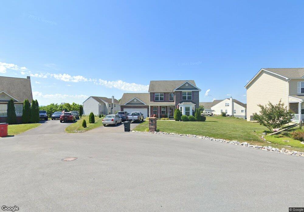
66 Houston Rd Inwood, WV 25428
Estimated Value: $351,051 - $375,000
3
Beds
3
Baths
1,876
Sq Ft
$194/Sq Ft
Est. Value
About This Home
This home is located at 66 Houston Rd, Inwood, WV 25428 and is currently estimated at $364,513, approximately $194 per square foot. 66 Houston Rd is a home with nearby schools including Gerrardstown Elementary School, Mountain Ridge Intermediate School, and Mountain Ridge Middle School.
Ownership History
Date
Name
Owned For
Owner Type
Purchase Details
Closed on
Oct 17, 2011
Sold by
Four Points Construction Inc
Bought by
Castle Michael and Castle Kathleen
Current Estimated Value
Home Financials for this Owner
Home Financials are based on the most recent Mortgage that was taken out on this home.
Original Mortgage
$209,650
Outstanding Balance
$142,008
Interest Rate
4.11%
Estimated Equity
$222,505
Create a Home Valuation Report for This Property
The Home Valuation Report is an in-depth analysis detailing your home's value as well as a comparison with similar homes in the area
Home Values in the Area
Average Home Value in this Area
Purchase History
| Date | Buyer | Sale Price | Title Company |
|---|---|---|---|
| Castle Michael | $220,697 | -- |
Source: Public Records
Mortgage History
| Date | Status | Borrower | Loan Amount |
|---|---|---|---|
| Open | Castle Michael | $209,650 |
Source: Public Records
Tax History Compared to Growth
Tax History
| Year | Tax Paid | Tax Assessment Tax Assessment Total Assessment is a certain percentage of the fair market value that is determined by local assessors to be the total taxable value of land and additions on the property. | Land | Improvement |
|---|---|---|---|---|
| 2025 | $1,776 | $166,080 | $37,320 | $128,760 |
| 2024 | $1,737 | $161,580 | $31,500 | $130,080 |
| 2023 | $1,788 | $161,460 | $31,380 | $130,080 |
| 2022 | $1,539 | $152,280 | $31,380 | $120,900 |
| 2021 | $1,428 | $141,780 | $28,200 | $113,580 |
| 2020 | $1,602 | $136,440 | $28,200 | $108,240 |
| 2019 | $1,533 | $129,660 | $26,880 | $102,780 |
| 2018 | $1,518 | $128,160 | $26,460 | $101,700 |
| 2017 | $1,321 | $110,820 | $15,360 | $95,460 |
| 2016 | $1,319 | $109,680 | $15,360 | $94,320 |
| 2015 | $1,340 | $108,540 | $15,360 | $93,180 |
| 2014 | $1,322 | $106,740 | $13,680 | $93,060 |
Source: Public Records
Map
Nearby Homes
- 156 Reprisal Rd
- 28 Corvair Ln
- 115 Corvair Ln
- 472 Upshur Dr
- 63 Declaration Dr
- 380 Wendover Dr
- 224 Isaac Dr
- 195 Isaac Dr
- 3462 Gerrardstown Rd
- 590 Wendover Dr
- 1250 Mish Rd
- 0 Gerrardstown Rd Unit WVBE2037604
- 0 Mish Rd
- 418 True Apple Way
- 725 Henshaw Rd
- 112 Chimney Dr
- LOT 96 Canning Rd Unit HARRIETT
- 0 Arden Nollville Rd and Interstate 81 Unit WVBE2037020
- 23 Talia Dr
- 9434 Winchester Ave
- 52 Houston Rd
- 70 Houston Rd
- 22 Wabash Rd
- 38 Houston Rd
- 218 Boise Ln
- 55 Houston Rd
- 34 Wabash Rd
- 71 Houston Rd
- 69 Houston Rd
- 0 Wabash Rd Unit 1006814374
- 0 Wabash Rd Unit BE7575852
- 0 Wabash Rd Unit 1000091025
- 148 Boise Rd
- 41 Houston Rd
- 195 Boise Ln
- 25 Wabash Rd
- 90 Reprisal Rd
- 108 Reprisal Rd
- 0 Boise Rd Unit 1007909706
- 0 Boise Rd Unit 1006814368