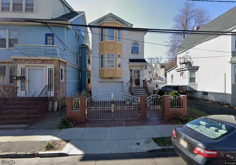
66 Kenmore Ave Newark, NJ 07106
Upper Vailsburg NeighborhoodEstimated Value: $648,233 - $1,021,000
Studio
--
Bath
2,592
Sq Ft
$313/Sq Ft
Est. Value
About This Home
This home is located at 66 Kenmore Ave, Newark, NJ 07106 and is currently estimated at $810,308, approximately $312 per square foot. 66 Kenmore Ave is a home with nearby schools including Lincoln Elementary School, Mt. Vernon School, and Hawthorne Avenue Elementary School.
Ownership History
Date
Name
Owned For
Owner Type
Purchase Details
Closed on
Dec 17, 2007
Sold by
Cys Enterprise Llc
Bought by
Frith Penelope A
Current Estimated Value
Home Financials for this Owner
Home Financials are based on the most recent Mortgage that was taken out on this home.
Original Mortgage
$348,600
Outstanding Balance
$217,614
Interest Rate
6.21%
Mortgage Type
Purchase Money Mortgage
Estimated Equity
$592,694
Purchase Details
Closed on
Jun 22, 2006
Sold by
Macri Luanne
Bought by
Cys Enterprise Llc
Create a Home Valuation Report for This Property
The Home Valuation Report is an in-depth analysis detailing your home's value as well as a comparison with similar homes in the area
Home Values in the Area
Average Home Value in this Area
Purchase History
| Date | Buyer | Sale Price | Title Company |
|---|---|---|---|
| Frith Penelope A | $420,000 | All Jersey Title Llc | |
| Cys Enterprise Llc | $112,000 | -- |
Source: Public Records
Mortgage History
| Date | Status | Borrower | Loan Amount |
|---|---|---|---|
| Open | Frith Penelope A | $348,600 |
Source: Public Records
Tax History
| Year | Tax Paid | Tax Assessment Tax Assessment Total Assessment is a certain percentage of the fair market value that is determined by local assessors to be the total taxable value of land and additions on the property. | Land | Improvement |
|---|---|---|---|---|
| 2025 | $8,858 | $237,600 | $21,300 | $216,300 |
| 2024 | $8,858 | $237,600 | $21,300 | $216,300 |
| 2022 | $8,877 | $237,600 | $21,300 | $216,300 |
| 2021 | $8,872 | $237,600 | $21,300 | $216,300 |
| 2020 | $9,029 | $237,600 | $21,300 | $216,300 |
| 2019 | $8,936 | $237,600 | $21,300 | $216,300 |
| 2018 | $8,775 | $237,600 | $21,300 | $216,300 |
| 2017 | $8,459 | $237,600 | $21,300 | $216,300 |
| 2016 | $8,173 | $237,600 | $21,300 | $216,300 |
| 2015 | $7,862 | $237,600 | $21,300 | $216,300 |
| 2014 | $7,368 | $237,600 | $21,300 | $216,300 |
Source: Public Records
Map
Nearby Homes
- 78 Monticello Ave
- 28-30 Monticello Ave
- 60 Stanley Rd
- 629 Hamilton Rd
- 16 Monticello Ave
- 32 Palm St
- 510 Finlay Place
- 143 Smith St
- 149 Smith St
- 82 Palm St
- 85 Smith St
- 36 Mckay Ave
- 31 Halstead St
- 19 Montrose St
- 194-196 Smith St
- 18 S Stanley Rd
- 513 Sanford Ave
- 20 Stuyvesant Ave
- 20 Rockland Terrace Unit 22
- 106 Halstead St Unit 110
- 68 Kenmore Ave Unit 70
- 62 Kenmore Ave Unit 64
- 72 Kenmore Ave
- 60 Kenmore Ave
- 74 Kenmore Ave Unit 1
- 74 Kenmore Ave Unit 3FL
- 74 Kenmore Ave Unit 2
- 65 Marion Ave Unit 67
- 63 Marion Ave
- 56-58 Kenmore Ave
- 56 Kenmore Ave Unit 58
- 69 Marion Ave Unit 1
- 69 Marion Ave Unit 2
- 69 Marion Ave
- 59 Marion Ave Unit 61
- 76 Kenmore Ave
- 71 Marion Ave Unit 3
- 71 Marion Ave
- 54 Kenmore Ave
- 61 Kenmore Ave Unit 63
Your Personal Tour Guide
Ask me questions while you tour the home.