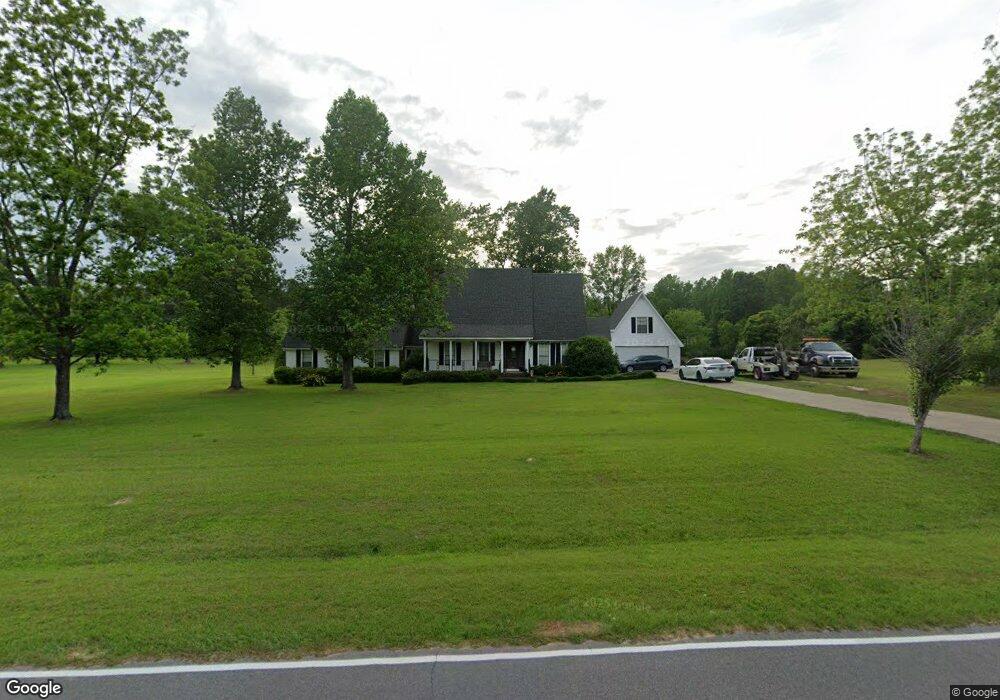
66 Mayfield Rd Laurel, MS 39443
Estimated Value: $173,000 - $374,000
3
Beds
3
Baths
2,946
Sq Ft
$104/Sq Ft
Est. Value
About This Home
This home is located at 66 Mayfield Rd, Laurel, MS 39443 and is currently estimated at $306,969, approximately $104 per square foot. 66 Mayfield Rd is a home located in Jones County.
Ownership History
Date
Name
Owned For
Owner Type
Purchase Details
Closed on
Sep 16, 2020
Sold by
Walker Alison N
Bought by
Andrews William Edward and Andrews Kelly Faye
Current Estimated Value
Home Financials for this Owner
Home Financials are based on the most recent Mortgage that was taken out on this home.
Original Mortgage
$260,200
Outstanding Balance
$230,385
Interest Rate
2.9%
Mortgage Type
Unknown
Estimated Equity
$76,584
Purchase Details
Closed on
Jul 26, 2017
Sold by
Walker Alison N and Walker Jerrel D
Bought by
Ruple Scott Allen
Home Financials for this Owner
Home Financials are based on the most recent Mortgage that was taken out on this home.
Original Mortgage
$138,500
Interest Rate
3.88%
Mortgage Type
New Conventional
Purchase Details
Closed on
Dec 10, 2012
Sold by
Bigler Joe M and Bigler Monica D
Bought by
Walker Alison N and Walker Jerrel D
Home Financials for this Owner
Home Financials are based on the most recent Mortgage that was taken out on this home.
Original Mortgage
$179,200
Interest Rate
2.72%
Mortgage Type
New Conventional
Create a Home Valuation Report for This Property
The Home Valuation Report is an in-depth analysis detailing your home's value as well as a comparison with similar homes in the area
Purchase History
| Date | Buyer | Sale Price | Title Company |
|---|---|---|---|
| Andrews William Edward | -- | -- | |
| Ruple Scott Allen | -- | -- | |
| Walker Alison N | -- | -- |
Source: Public Records
Mortgage History
| Date | Status | Borrower | Loan Amount |
|---|---|---|---|
| Open | Andrews William Edward | $260,200 | |
| Previous Owner | Ruple Scott Allen | $138,500 | |
| Previous Owner | Walker Alison N | $179,200 |
Source: Public Records
Tax History
| Year | Tax Paid | Tax Assessment Tax Assessment Total Assessment is a certain percentage of the fair market value that is determined by local assessors to be the total taxable value of land and additions on the property. | Land | Improvement |
|---|---|---|---|---|
| 2025 | $2,125 | $20,136 | $0 | $0 |
| 2024 | $2,073 | $18,749 | $0 | $0 |
| 2023 | $2,073 | $18,751 | $0 | $0 |
| 2022 | $2,127 | $18,752 | $0 | $0 |
| 2021 | $2,137 | $18,753 | $0 | $0 |
| 2020 | $2,092 | $18,091 | $0 | $0 |
| 2019 | $1,633 | $14,567 | $0 | $0 |
| 2018 | $1,933 | $14,567 | $0 | $0 |
| 2017 | $2,894 | $21,827 | $0 | $0 |
| 2016 | $1,234 | $11,840 | $0 | $0 |
| 2015 | $1,164 | $11,835 | $0 | $0 |
| 2014 | $1,164 | $11,831 | $0 | $0 |
Source: Public Records
Map
Nearby Homes
- 73 Mayfield Rd
- 338 Reedy Creek Rd
- 909 Sharon Moss Rd
- 4398 Sharon Rd
- 0 Sharon Rd
- 1067 Trace Rd
- 24 Dean Matthews Rd
- 363 Sharon Moss Rd
- 00 Graham Dr
- 14 Hoss Dr
- 11 Redbud Dr
- 122 County Road 237
- 0 Sharon Moss Rd Unit 145888
- 4514 Forest Dr
- 1 Loblolly Ln
- 1105 Glenway Dr
- 60 Forest Dr
- 220 County Barn Rd
- 8 Mar - Ree Dr
- 56 Mar Ree Dr
- 65 Mayfield Rd
- 56 Mayfield Rd
- 83 Mayfield Rd
- 84 Mayfield Rd
- 43 Mayfield Rd
- 42 Mayfield Rd
- 104 Mayfield Rd
- 104 Mayfield Rd
- 316 Reedy Creek Rd
- 27 Pressly Dr
- 50 Pressly Dr
- 21 Mayfield Rd
- 324 Reedy Creek Rd
- 39 Pressly Dr
- 34 Mayfield Rd
- 11 Mayfield Rd
- 308 Reedy Creek Rd
- 36 Mayfield Rd
- 336 Reedy Creek Rd
- 26 Mayfield Rd
Your Personal Tour Guide
Ask me questions while you tour the home.