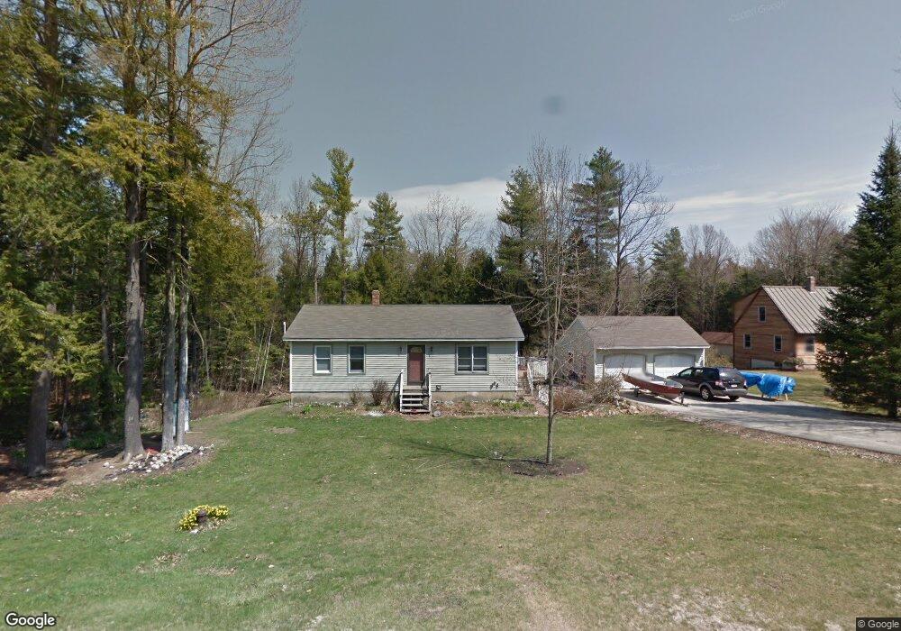
66 Mckenny Dr New Gloucester, ME 04260
Estimated Value: $360,000 - $433,000
2
Beds
1
Bath
1,040
Sq Ft
$379/Sq Ft
Est. Value
About This Home
This home is located at 66 Mckenny Dr, New Gloucester, ME 04260 and is currently estimated at $394,111, approximately $378 per square foot. 66 Mckenny Dr is a home located in Cumberland County with nearby schools including Gray-New Gloucester High School.
Ownership History
Date
Name
Owned For
Owner Type
Purchase Details
Closed on
Oct 5, 2011
Sold by
Kline Deborah R
Bought by
Kline David J
Current Estimated Value
Home Financials for this Owner
Home Financials are based on the most recent Mortgage that was taken out on this home.
Original Mortgage
$120,000
Interest Rate
4.2%
Mortgage Type
Purchase Money Mortgage
Create a Home Valuation Report for This Property
The Home Valuation Report is an in-depth analysis detailing your home's value as well as a comparison with similar homes in the area
Home Values in the Area
Average Home Value in this Area
Purchase History
| Date | Buyer | Sale Price | Title Company |
|---|---|---|---|
| Kline David J | -- | -- |
Source: Public Records
Mortgage History
| Date | Status | Borrower | Loan Amount |
|---|---|---|---|
| Closed | Kline David J | $120,000 | |
| Closed | Kline David J | $30,000 |
Source: Public Records
Tax History Compared to Growth
Tax History
| Year | Tax Paid | Tax Assessment Tax Assessment Total Assessment is a certain percentage of the fair market value that is determined by local assessors to be the total taxable value of land and additions on the property. | Land | Improvement |
|---|---|---|---|---|
| 2025 | $3,148 | $203,466 | $76,800 | $126,666 |
| 2024 | $3,030 | $203,466 | $76,800 | $126,666 |
| 2023 | $2,908 | $203,466 | $76,800 | $126,666 |
| 2022 | $2,808 | $203,466 | $76,800 | $126,666 |
| 2021 | $2,808 | $203,466 | $76,800 | $126,666 |
| 2020 | $2,777 | $203,466 | $76,800 | $126,666 |
| 2019 | $2,697 | $159,600 | $58,800 | $100,800 |
| 2018 | $2,522 | $159,600 | $58,800 | $100,800 |
| 2017 | $2,490 | $159,600 | $58,800 | $100,800 |
| 2016 | $2,346 | $159,600 | $58,800 | $100,800 |
| 2015 | $2,338 | $159,600 | $58,800 | $100,800 |
| 2014 | $2,314 | $159,600 | $58,800 | $100,800 |
| 2013 | $2,147 | $159,600 | $58,800 | $100,800 |
Source: Public Records
Map
Nearby Homes
- 24 Swamp Rd
- 271 Bennett Rd
- 22 Shaw Rd
- 164 Intervale Rd
- TBD Targett Rd
- 10 Cobbs Bridge Rd
- 160 Gloucester Hill Rd
- 155 & 151 Gloucester Hill Rd
- 0018-C Gloucester Hill Rd
- 14 Golden Way
- 29 Rockwood Dr
- 12 Country Charm Ln
- 423 Sabbathday Rd
- 161 Beaver Dam Dr
- 10-56 C&E Bowdoin Way
- 200 Woodman Rd
- 343 Shaker Rd
- 26 Carpenter Rd
- 46-47D Hines Rd & Main St
- 10 Spring Valley Ln