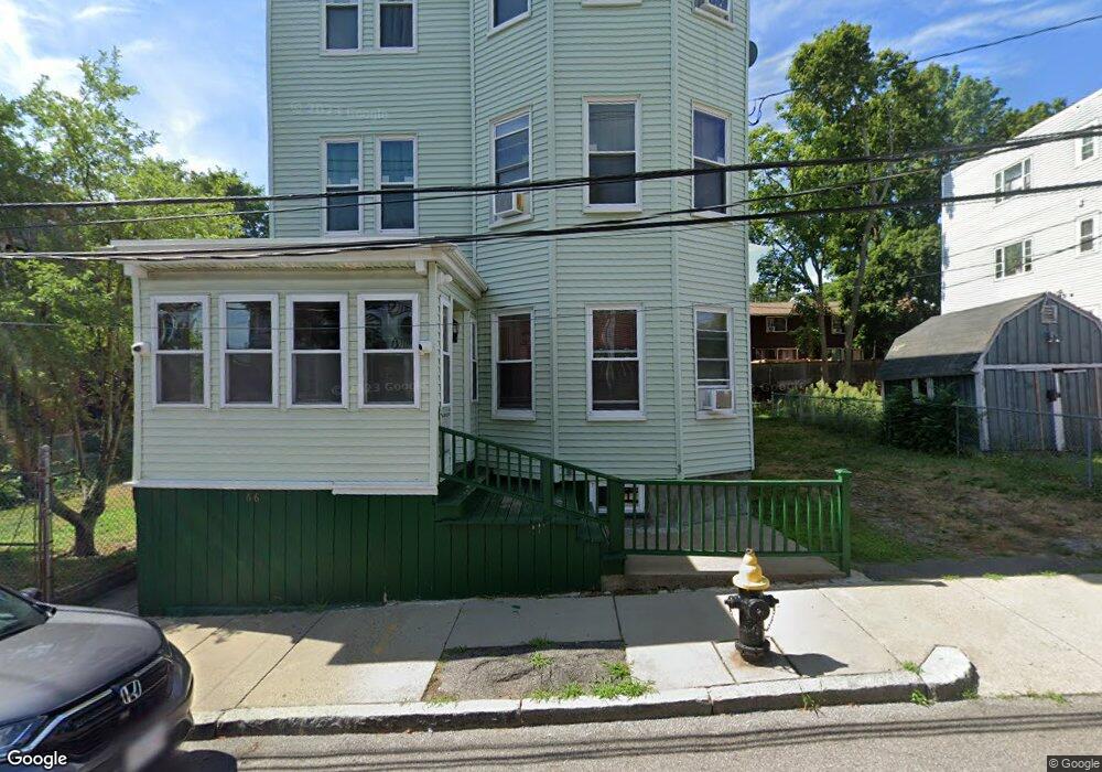
66 Munroe St Roxbury, MA 02119
Washington Park NeighborhoodEstimated Value: $649,000 - $1,194,000
9
Beds
3
Baths
5,052
Sq Ft
$174/Sq Ft
Est. Value
About This Home
This home is located at 66 Munroe St, Roxbury, MA 02119 and is currently estimated at $877,933, approximately $173 per square foot. 66 Munroe St is a home located in Suffolk County with nearby schools including Bridge Boston Charter School and City on a Hill Charter Public School.
Ownership History
Date
Name
Owned For
Owner Type
Purchase Details
Closed on
Jun 15, 2021
Sold by
Gill Beverly B
Bought by
Gill Beverly B and Walcott Jestina R
Current Estimated Value
Purchase Details
Closed on
Oct 26, 2001
Sold by
Smith Mary J
Bought by
Gill Beverly B
Home Financials for this Owner
Home Financials are based on the most recent Mortgage that was taken out on this home.
Original Mortgage
$261,250
Interest Rate
6.86%
Mortgage Type
Purchase Money Mortgage
Create a Home Valuation Report for This Property
The Home Valuation Report is an in-depth analysis detailing your home's value as well as a comparison with similar homes in the area
Home Values in the Area
Average Home Value in this Area
Purchase History
| Date | Buyer | Sale Price | Title Company |
|---|---|---|---|
| Gill Beverly B | -- | None Available | |
| Gill Beverly B | $275,000 | -- |
Source: Public Records
Mortgage History
| Date | Status | Borrower | Loan Amount |
|---|---|---|---|
| Previous Owner | Gill Beverly B | $261,250 | |
| Previous Owner | Gill Beverly B | $180,000 | |
| Previous Owner | Gill Beverly B | $36,000 | |
| Previous Owner | Gill Beverly B | $50,000 |
Source: Public Records
Tax History Compared to Growth
Tax History
| Year | Tax Paid | Tax Assessment Tax Assessment Total Assessment is a certain percentage of the fair market value that is determined by local assessors to be the total taxable value of land and additions on the property. | Land | Improvement |
|---|---|---|---|---|
| 2025 | $8,941 | $772,100 | $234,400 | $537,700 |
| 2024 | $8,981 | $823,900 | $243,900 | $580,000 |
| 2023 | $7,898 | $735,400 | $217,700 | $517,700 |
| 2022 | $7,477 | $687,200 | $203,400 | $483,800 |
| 2021 | $7,051 | $660,800 | $195,600 | $465,200 |
| 2020 | $6,127 | $580,200 | $198,600 | $381,600 |
| 2019 | $5,460 | $518,000 | $146,800 | $371,200 |
| 2018 | $5,168 | $493,100 | $146,800 | $346,300 |
| 2017 | $5,222 | $493,100 | $146,800 | $346,300 |
| 2016 | $4,717 | $428,800 | $146,800 | $282,000 |
| 2015 | $4,103 | $338,800 | $104,300 | $234,500 |
| 2014 | $3,807 | $302,600 | $104,300 | $198,300 |
Source: Public Records
Map
Nearby Homes
- 151 Townsend St
- 99 Harrishof St
- 90 Munroe St
- 28 Wabon St
- 16 Mayfair St
- 4 Wyoming St Unit 2
- 94 Walnut Ave
- 495 Warren St
- 476 Warren St
- 5 Glenburne St
- 12 Weldon St
- 8 Weldon St
- 10 Rockland St Unit 4
- 7 Waumbeck St Unit 3
- 8 Brinton St Unit 2
- 2856 Washington St
- 9 Abbotsford St Unit 1
- 75 Ruthven St
- 4 Ruthven St
- 108 Maywood St Unit 2
- 70 Munroe St
- 72 Munroe St Unit 2
- 62 Munroe St
- 75 Humboldt Ave Unit 6
- 75 Humboldt Ave Unit 5
- 75 Humboldt Ave Unit 4
- 75 Humboldt Ave Unit 3
- 75 Humboldt Ave Unit 2
- 75 Humboldt Ave Unit 1
- 75 Humboldt Ave Unit 75 Humboldt Ave Bost
- 75 Humboldt Ave
- 67 Munroe St
- 69 Munroe St
- 65 Munroe St
- 76 Munroe St
- 65 Humboldt Ave Unit 3
- 71 Munroe St Unit 73
- 75 Munroe St
- 75 Munroe St
- 75 Munroe St Unit 1