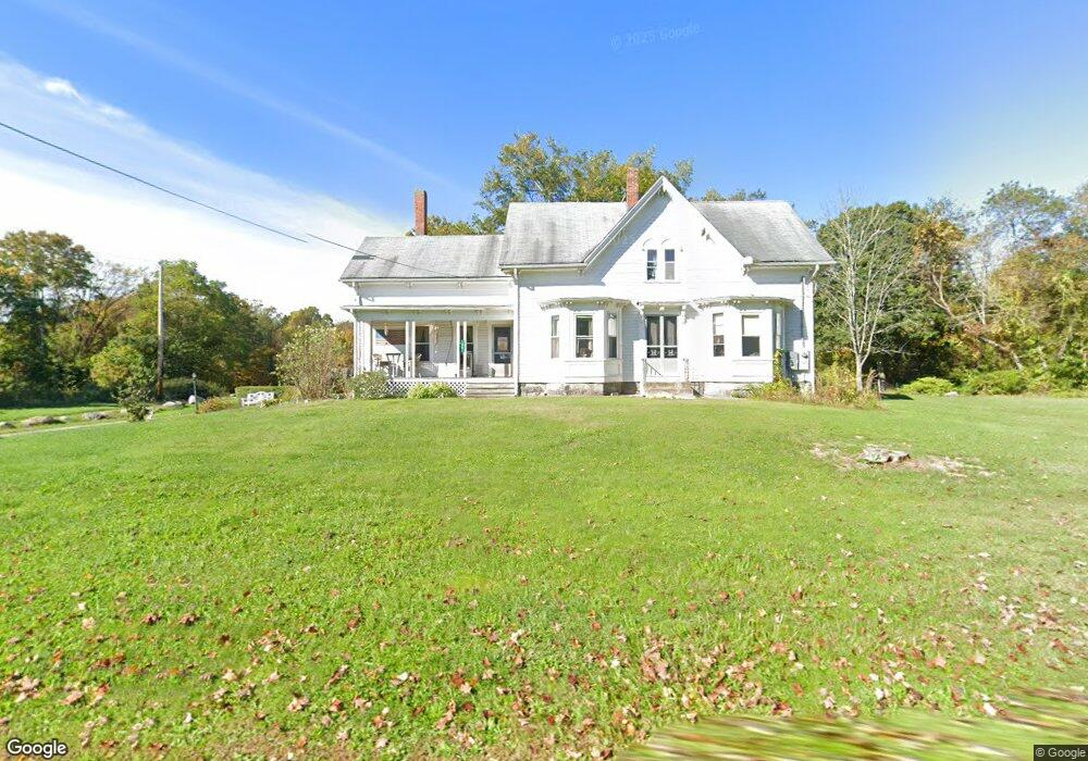
66 New St Rehoboth, MA 02769
Estimated Value: $537,476 - $780,000
4
Beds
2
Baths
2,370
Sq Ft
$275/Sq Ft
Est. Value
About This Home
This home is located at 66 New St, Rehoboth, MA 02769 and is currently estimated at $652,825, approximately $275 per square foot. 66 New St is a home located in Bristol County with nearby schools including Dighton-Rehoboth Regional High School and Cedar Brook School.
Ownership History
Date
Name
Owned For
Owner Type
Purchase Details
Closed on
May 31, 2006
Sold by
Dickinson Christine Jane
Bought by
Dickinson Christine J and Dickinson Steaphen G
Current Estimated Value
Purchase Details
Closed on
Apr 1, 1984
Bought by
Bettencourt Jason A
Create a Home Valuation Report for This Property
The Home Valuation Report is an in-depth analysis detailing your home's value as well as a comparison with similar homes in the area
Home Values in the Area
Average Home Value in this Area
Purchase History
| Date | Buyer | Sale Price | Title Company |
|---|---|---|---|
| Dickinson Christine J | -- | -- | |
| Bettencourt Jason A | -- | -- |
Source: Public Records
Mortgage History
| Date | Status | Borrower | Loan Amount |
|---|---|---|---|
| Previous Owner | Bettencourt Jason A | $123,000 | |
| Previous Owner | Bettencourt Jason A | $120,000 | |
| Previous Owner | Bettencourt Jason A | $98,000 |
Source: Public Records
Tax History
| Year | Tax Paid | Tax Assessment Tax Assessment Total Assessment is a certain percentage of the fair market value that is determined by local assessors to be the total taxable value of land and additions on the property. | Land | Improvement |
|---|---|---|---|---|
| 2025 | $47 | $422,500 | $190,400 | $232,100 |
| 2024 | $4,151 | $365,400 | $190,400 | $175,000 |
| 2023 | $4,185 | $361,400 | $186,400 | $175,000 |
| 2022 | $4,199 | $331,400 | $178,000 | $153,400 |
| 2021 | $4,016 | $303,300 | $161,700 | $141,600 |
| 2020 | $2,059 | $303,300 | $161,700 | $141,600 |
| 2018 | $3,255 | $271,900 | $153,900 | $118,000 |
| 2017 | $3,267 | $260,100 | $153,900 | $106,200 |
| 2016 | $3,160 | $260,100 | $153,900 | $106,200 |
| 2015 | $3,090 | $251,000 | $146,700 | $104,300 |
| 2014 | $2,961 | $238,000 | $139,500 | $98,500 |
Source: Public Records
Map
Nearby Homes
- 24 New St
- 0 Horton St Unit 73333337
- 133 Winthrop St
- 257 Anawan St
- 2713 Horton St
- 2201 Wheeler St
- 10 Muriel Way
- 349 Anawan St
- 58 Peck St
- 23 Bay State Rd
- 0 Winthrop St Unit 73180872
- 1421 Tremont St
- 88 Morgan Dr
- 0 Kimberly Rd
- 0 Monteiro Unit 71870472
- 48 Round Farm Rd
- 52 Round Farm Rd
- 1 Round Farm Rd
- 47 Caroline Dr
- 248 County
Your Personal Tour Guide
Ask me questions while you tour the home.