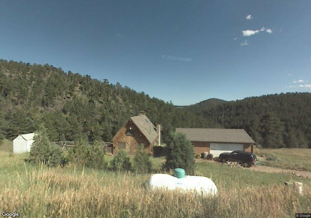
66 Nightshade Dr Boulder, CO 80302
Estimated Value: $622,558 - $811,000
2
Beds
1
Bath
1,239
Sq Ft
$575/Sq Ft
Est. Value
About This Home
This home is located at 66 Nightshade Dr, Boulder, CO 80302 and is currently estimated at $712,890, approximately $575 per square foot. 66 Nightshade Dr is a home located in Boulder County with nearby schools including Nederland Elementary School and Nederland Middle-Senior High School.
Ownership History
Date
Name
Owned For
Owner Type
Purchase Details
Closed on
Jul 27, 2001
Sold by
Tabor Laura F and Kinder Laura F
Bought by
Kinder Laura F
Current Estimated Value
Home Financials for this Owner
Home Financials are based on the most recent Mortgage that was taken out on this home.
Original Mortgage
$44,299
Interest Rate
7.05%
Purchase Details
Closed on
Aug 9, 1996
Sold by
Tabor Douglas B
Bought by
Tabor Laura F
Purchase Details
Closed on
Apr 30, 1984
Bought by
Kinder Laura F
Purchase Details
Closed on
Oct 19, 1981
Bought by
Kinder Laura F
Create a Home Valuation Report for This Property
The Home Valuation Report is an in-depth analysis detailing your home's value as well as a comparison with similar homes in the area
Purchase History
| Date | Buyer | Sale Price | Title Company |
|---|---|---|---|
| Kinder Laura F | -- | -- | |
| Tabor Laura F | -- | -- | |
| Kinder Laura F | $89,000 | -- | |
| Kinder Laura F | $75,000 | -- |
Source: Public Records
Mortgage History
| Date | Status | Borrower | Loan Amount |
|---|---|---|---|
| Closed | Kinder Laura F | $44,299 |
Source: Public Records
Tax History
| Year | Tax Paid | Tax Assessment Tax Assessment Total Assessment is a certain percentage of the fair market value that is determined by local assessors to be the total taxable value of land and additions on the property. | Land | Improvement |
|---|---|---|---|---|
| 2025 | $2,943 | $38,519 | $10,756 | $27,763 |
| 2024 | $2,943 | $38,519 | $10,756 | $27,763 |
| 2023 | $2,892 | $39,677 | $10,419 | $32,944 |
| 2022 | $2,540 | $33,833 | $8,799 | $25,034 |
| 2021 | $2,513 | $34,806 | $9,052 | $25,754 |
| 2020 | $2,223 | $31,288 | $11,011 | $20,277 |
| 2019 | $2,189 | $31,288 | $11,011 | $20,277 |
| 2018 | $2,124 | $23,378 | $7,776 | $15,602 |
| 2017 | $2,070 | $25,846 | $8,597 | $17,249 |
| 2016 | $2,244 | $24,628 | $9,074 | $15,554 |
| 2015 | $2,127 | $24,835 | $8,358 | $16,477 |
| 2014 | $2,247 | $24,835 | $8,358 | $16,477 |
Source: Public Records
Map
Nearby Homes
- 5566 Sugarloaf Rd
- 548 Coughlin Meadows Rd
- 815 Cougar Run
- 3907 Ridge Rd
- 0 Pennsylvania Gulch Rd
- 280 Hummer Dr
- 880 Hummer Dr
- 136 Old Post Office Rd
- 0 Good Friday Rd
- 11320 Gold Hill Rd
- 730 Lost Angel Rd
- 198 Frontier Ln
- 0 Gold Trail
- 2200 Magnolia Rd
- 00 County Rd 89 Unit 237
- 718 Emerson Gulch Rd
- 11780 Gold Hill Rd
- 300 Shining Star Trail
- 300 Shining Star Trail Unit A
- 280 Rim Rd
- 22 Nightshade Dr
- 193 Nightshade Dr
- 221 Nightshade Dr
- 0 Nightshade Dr
- 578 Primos Rd
- 230 Nightshade Dr
- 1111 Primos Rd
- 729 Primos Rd
- 0 Primos Rd
- 577 Primos Rd
- 862 Primos Rd
- 545 Nightshade Dr
- 875 Primos Rd
- 200 Primos Rd
- 465 Nightshade Dr
- 184 Nightshade Dr
- 388 Nightshade Dr
- 579 Primos Rd
- 917 Primos Rd
- 900 Primos Rd
Your Personal Tour Guide
Ask me questions while you tour the home.