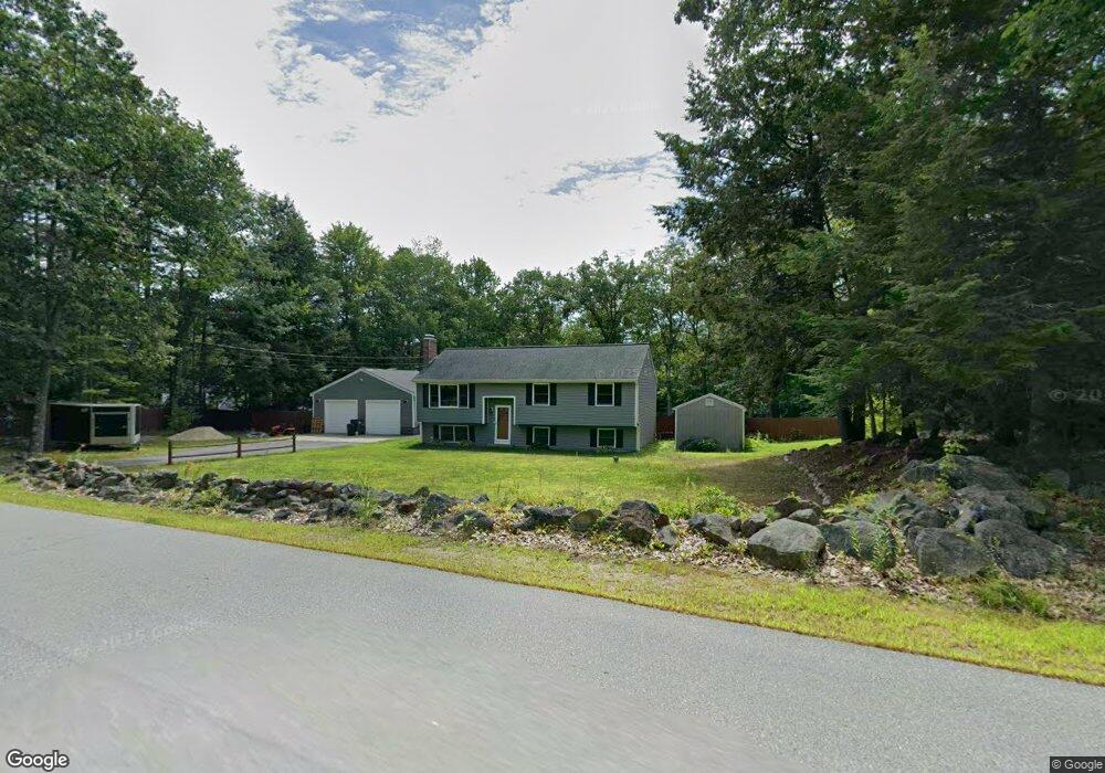
66 Perry Rd Rindge, NH 03461
Estimated Value: $403,000 - $521,000
3
Beds
2
Baths
1,324
Sq Ft
$356/Sq Ft
Est. Value
About This Home
This home is located at 66 Perry Rd, Rindge, NH 03461 and is currently estimated at $471,362, approximately $356 per square foot. 66 Perry Rd is a home located in Cheshire County with nearby schools including Rindge Memorial School, Conant Middle High School, and Conant High School.
Ownership History
Date
Name
Owned For
Owner Type
Purchase Details
Closed on
Jan 24, 2021
Sold by
Barnhart Nicholas J and Barnhart Michelle R
Bought by
Foucher Dustin
Current Estimated Value
Home Financials for this Owner
Home Financials are based on the most recent Mortgage that was taken out on this home.
Original Mortgage
$325,000
Outstanding Balance
$290,172
Interest Rate
2.6%
Mortgage Type
Purchase Money Mortgage
Estimated Equity
$181,190
Purchase Details
Closed on
Feb 9, 2012
Sold by
Doyle Vicki K and Hsbc Bank Usa Na Tr
Bought by
Hsbc Bank Usa Na Tr
Create a Home Valuation Report for This Property
The Home Valuation Report is an in-depth analysis detailing your home's value as well as a comparison with similar homes in the area
Home Values in the Area
Average Home Value in this Area
Purchase History
| Date | Buyer | Sale Price | Title Company |
|---|---|---|---|
| Foucher Dustin | $325,000 | None Available | |
| Foucher Dustin | $325,000 | None Available | |
| Hsbc Bank Usa Na Tr | $118,300 | -- | |
| Hsbc Bank Usa Na Tr | $118,300 | -- |
Source: Public Records
Mortgage History
| Date | Status | Borrower | Loan Amount |
|---|---|---|---|
| Open | Foucher Dustin | $325,000 | |
| Closed | Foucher Dustin | $325,000 | |
| Closed | Hsbc Bank Usa Na Tr | $0 |
Source: Public Records
Tax History
| Year | Tax Paid | Tax Assessment Tax Assessment Total Assessment is a certain percentage of the fair market value that is determined by local assessors to be the total taxable value of land and additions on the property. | Land | Improvement |
|---|---|---|---|---|
| 2024 | $6,059 | $239,400 | $58,600 | $180,800 |
| 2023 | $6,000 | $239,600 | $58,600 | $181,000 |
| 2022 | $5,518 | $239,600 | $58,600 | $181,000 |
| 2021 | $5,427 | $239,600 | $58,600 | $181,000 |
| 2020 | $5,379 | $239,600 | $58,600 | $181,000 |
| 2019 | $5,224 | $188,200 | $50,000 | $138,200 |
| 2018 | $5,176 | $188,200 | $50,000 | $138,200 |
| 2017 | $5,117 | $188,200 | $50,000 | $138,200 |
| 2016 | $5,253 | $188,200 | $50,000 | $138,200 |
| 2015 | $5,151 | $184,700 | $50,000 | $134,700 |
| 2014 | $4,842 | $186,000 | $76,000 | $110,000 |
| 2013 | $4,685 | $184,000 | $76,000 | $108,000 |
Source: Public Records
Map
Nearby Homes
- 420 Old New Ipswich Rd
- 634 Old New Ipswich Rd
- 20 Smith Dr
- 20 Amalia Way
- Unit 1 Willow Ln Unit 1
- 196 Lord Brook Rd
- 78 Colburn Ln
- 518 Main St
- 4 Sportsman Ln
- 28 Saybrook Dr
- Lot 1 Saybrook Dr
- 19 Monomonac Terrace
- Lot 3 Saybrook Dr
- Unit 9 Willow Ln
- 122 Timbertop Rd
- 10 Sun Cliff Dr
- 226 Lakeview Dr
- 98 Perry Rd
- 179 Scenic Dr
- 129 Scenic Dr
- 74 Perry Rd
- 86 Perry Rd
- 56 Perry Rd
- 96 Perry Rd
- 50 Perry Rd
- 107 Perry Rd
- 24 Perry Rd
- 27 Perry Rd
- 132 Perry Rd
- 132 Perry Rd Unit 7/89-2
- 127 Perry Rd
- 136 Perry Rd
- 8 Perry Rd
- 160 Old New Ipswich Rd
- 164 Old New Ipswich Rd
- 174 Old New Ipswich Rd
- 180 Old New Ipswich Rd
- 192 Old New Ipswich Rd
- 171 Old New Ipswich Rd
- 149 Perry Rd
Your Personal Tour Guide
Ask me questions while you tour the home.