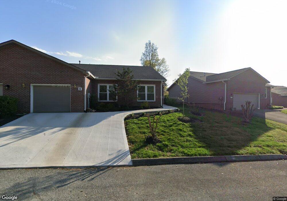
66 Riverview Dr Oak Ridge, TN 37830
Estimated Value: $361,685 - $413,000
3
Beds
2
Baths
1,828
Sq Ft
$216/Sq Ft
Est. Value
About This Home
This home is located at 66 Riverview Dr, Oak Ridge, TN 37830 and is currently estimated at $394,921, approximately $216 per square foot. 66 Riverview Dr is a home located in Anderson County with nearby schools including Glenwood Elementary, Jefferson Middle School, and Oak Ridge High School.
Ownership History
Date
Name
Owned For
Owner Type
Purchase Details
Closed on
Nov 1, 2006
Sold by
Owens William W
Bought by
Springmier Joana
Current Estimated Value
Home Financials for this Owner
Home Financials are based on the most recent Mortgage that was taken out on this home.
Original Mortgage
$50,001
Interest Rate
6.02%
Purchase Details
Closed on
Jul 25, 1994
Bought by
Harry E Minge Const Co Inc
Purchase Details
Closed on
Jul 12, 1994
Bought by
First Bank Of East Tenn
Purchase Details
Closed on
Jan 15, 1993
Bought by
Laneco Builders Inc
Create a Home Valuation Report for This Property
The Home Valuation Report is an in-depth analysis detailing your home's value as well as a comparison with similar homes in the area
Home Values in the Area
Average Home Value in this Area
Purchase History
| Date | Buyer | Sale Price | Title Company |
|---|---|---|---|
| Springmier Joana | $186,000 | -- | |
| Harry E Minge Const Co Inc | $100,000 | -- | |
| First Bank Of East Tenn | $188,000 | -- | |
| Laneco Builders Inc | $450,000 | -- |
Source: Public Records
Mortgage History
| Date | Status | Borrower | Loan Amount |
|---|---|---|---|
| Closed | Laneco Builders Inc | $50,001 |
Source: Public Records
Tax History Compared to Growth
Tax History
| Year | Tax Paid | Tax Assessment Tax Assessment Total Assessment is a certain percentage of the fair market value that is determined by local assessors to be the total taxable value of land and additions on the property. | Land | Improvement |
|---|---|---|---|---|
| 2024 | $1,333 | $54,275 | $10,000 | $44,275 |
| 2023 | $1,333 | $54,275 | $0 | $0 |
| 2022 | $2,589 | $54,275 | $10,000 | $44,275 |
| 2021 | $2,589 | $54,275 | $10,000 | $44,275 |
| 2020 | $2,779 | $54,275 | $10,000 | $44,275 |
| 2019 | $2,844 | $54,125 | $10,000 | $44,125 |
| 2018 | $2,779 | $54,125 | $10,000 | $44,125 |
| 2017 | $2,768 | $54,125 | $10,000 | $44,125 |
| 2016 | $2,768 | $54,125 | $10,000 | $44,125 |
| 2015 | -- | $54,125 | $10,000 | $44,125 |
| 2014 | -- | $54,125 | $10,000 | $44,125 |
| 2013 | -- | $50,150 | $0 | $0 |
Source: Public Records
Map
Nearby Homes
- 14 Rivers Ct
- 42 Palisades Pkwy
- 126 Atlanta Rd
- 103 Albany Rd
- 110 Balsam Rd
- 109 Balsam Rd
- 243 Bunch Ln
- 131 Clifton Cir
- 114 Aspen Ln
- 0 Bunch Ln Unit LotWP001 24583488
- 0 Bunch Ln
- 219 Bunch Ln
- 119 Aspen Ln
- 119 W Arrowwood Rd
- 112 Chestnut Hill Rd
- 117 California Ave
- 146 Lake Hills Dr
- 115 Euclid Cir
- 116 Baltimore Dr
- 114 Canterbury Rd