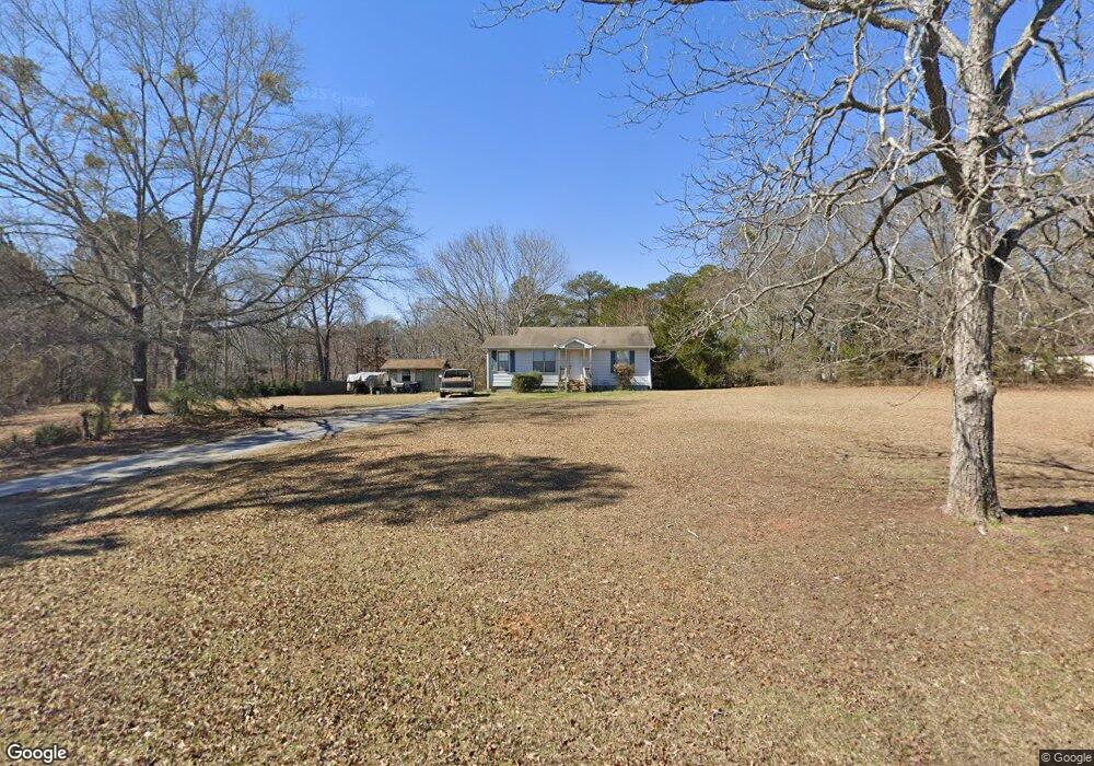
66 S Barnes Dr Locust Grove, GA 30248
Estimated Value: $164,000 - $207,000
2
Beds
1
Bath
912
Sq Ft
$199/Sq Ft
Est. Value
About This Home
This home is located at 66 S Barnes Dr, Locust Grove, GA 30248 and is currently estimated at $181,661, approximately $199 per square foot. 66 S Barnes Dr is a home located in Henry County with nearby schools including Locust Grove Elementary School, Locust Grove Middle School, and Locust Grove High School.
Ownership History
Date
Name
Owned For
Owner Type
Purchase Details
Closed on
Mar 1, 2012
Sold by
Secretary Of Housing And U
Bought by
Wells Davis
Current Estimated Value
Purchase Details
Closed on
Sep 6, 2011
Sold by
Wells Fargo Bank Na
Bought by
Secretary Of Housing And Urban
Purchase Details
Closed on
Feb 25, 2005
Sold by
Gifford Steven C and Gifford Beverly
Bought by
Smallwood Larry P
Home Financials for this Owner
Home Financials are based on the most recent Mortgage that was taken out on this home.
Original Mortgage
$77,287
Interest Rate
5.61%
Mortgage Type
VA
Purchase Details
Closed on
Aug 27, 2001
Sold by
Barnes D Marie
Bought by
Gifford Steven C and Gifford Beverly
Home Financials for this Owner
Home Financials are based on the most recent Mortgage that was taken out on this home.
Original Mortgage
$55,000
Interest Rate
7.02%
Create a Home Valuation Report for This Property
The Home Valuation Report is an in-depth analysis detailing your home's value as well as a comparison with similar homes in the area
Home Values in the Area
Average Home Value in this Area
Purchase History
| Date | Buyer | Sale Price | Title Company |
|---|---|---|---|
| Wells Davis | $24,030 | -- | |
| Secretary Of Housing And Urban | $75,597 | -- | |
| Wells Fargo Bank Na | $75,597 | -- | |
| Smallwood Larry P | $78,500 | -- | |
| Gifford Steven C | $55,000 | -- |
Source: Public Records
Mortgage History
| Date | Status | Borrower | Loan Amount |
|---|---|---|---|
| Previous Owner | Smallwood Larry P | $77,287 | |
| Previous Owner | Gifford Steven C | $55,000 |
Source: Public Records
Tax History Compared to Growth
Tax History
| Year | Tax Paid | Tax Assessment Tax Assessment Total Assessment is a certain percentage of the fair market value that is determined by local assessors to be the total taxable value of land and additions on the property. | Land | Improvement |
|---|---|---|---|---|
| 2025 | $2,351 | $59,884 | $15,160 | $44,724 |
| 2024 | $2,351 | $56,840 | $13,680 | $43,160 |
| 2023 | $1,967 | $53,720 | $13,160 | $40,560 |
| 2022 | $1,478 | $39,840 | $12,160 | $27,680 |
| 2021 | $1,152 | $30,760 | $10,440 | $20,320 |
| 2020 | $972 | $25,800 | $9,800 | $16,000 |
| 2019 | $892 | $23,200 | $9,320 | $13,880 |
| 2018 | $0 | $19,760 | $8,600 | $11,160 |
| 2016 | $667 | $16,360 | $6,400 | $9,960 |
| 2015 | $571 | $13,440 | $7,200 | $6,240 |
| 2014 | $535 | $12,360 | $7,200 | $5,160 |
Source: Public Records
Map
Nearby Homes
- 143 Massey Ln
- 231 Ferguson Ave
- 239 Ferguson Ave
- 50 Grove Rd
- 1064 Lear Dr
- 4 Skyland Dr W
- 565 Carleton Place
- 501 Grove Park Dr
- 36 Highpoint Ln
- 65 Grove Creek Dr
- 1537 Jackson St
- 149 Pristine Dr
- 26 Skyland Dr W
- 155 Skyland Dr E
- 878 Jackson St
- 0 Locust Rd Unit 10495072
- 0 Locust Rd Unit 19967321
- 1119 Saint Phillips Ct
- 0 Jackson St Unit 10554689
- 176 Rockwood Ln
- S S Barnes Dr
- 129 Barnes Dr
- 46 S Barnes Dr
- 140 Barnes Dr
- 127 Barnes Dr
- 55 S Barnes Dr
- 57 S Barnes Dr
- 53 S Barnes Dr
- 96 S Barnes Dr
- 22 S Barnes Dr
- 107 Barnes Dr
- 33 S Barnes Dr
- 59 S Barnes Dr
- 108 Massey Ln
- 106 Massey Ln
- 112 Massey Ln
- 144 Massey Ln Unit (LOT 8)
- 61 S Barnes Dr
- 114 Massey Ln
- 104 Massey Ln