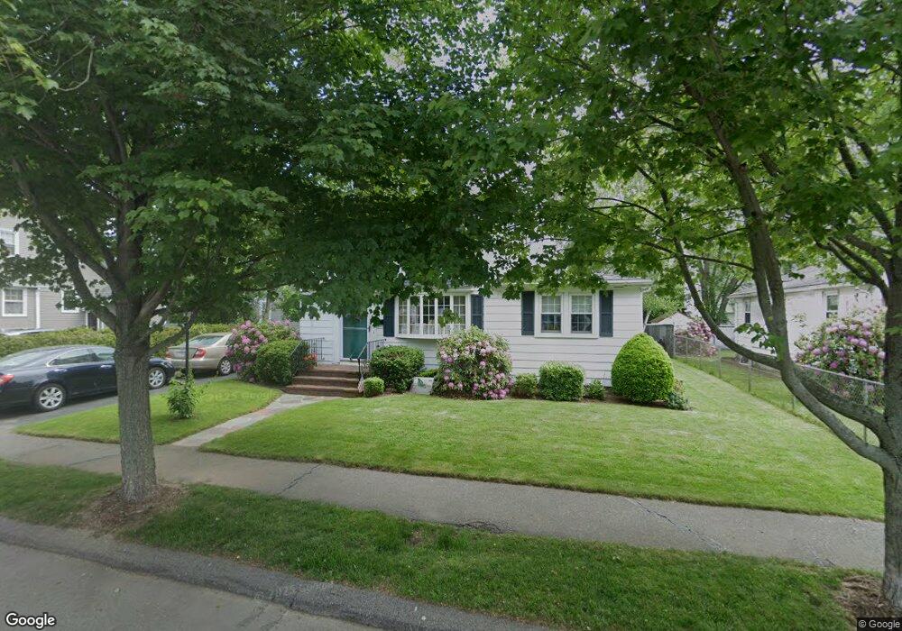
66 Sherman Rd Dedham, MA 02026
The Manor NeighborhoodEstimated Value: $626,565 - $639,000
3
Beds
1
Bath
1,302
Sq Ft
$485/Sq Ft
Est. Value
About This Home
This home is located at 66 Sherman Rd, Dedham, MA 02026 and is currently estimated at $630,891, approximately $484 per square foot. 66 Sherman Rd is a home located in Norfolk County with nearby schools including Greenlodge Elementary School, Dedham Middle School, and Dedham High School.
Create a Home Valuation Report for This Property
The Home Valuation Report is an in-depth analysis detailing your home's value as well as a comparison with similar homes in the area
Home Values in the Area
Average Home Value in this Area
Tax History
| Year | Tax Paid | Tax Assessment Tax Assessment Total Assessment is a certain percentage of the fair market value that is determined by local assessors to be the total taxable value of land and additions on the property. | Land | Improvement |
|---|---|---|---|---|
| 2025 | $7,182 | $569,100 | $320,900 | $248,200 |
| 2024 | $6,833 | $546,600 | $291,100 | $255,500 |
| 2023 | $6,206 | $483,300 | $263,600 | $219,700 |
| 2022 | $5,857 | $438,700 | $247,600 | $191,100 |
| 2021 | $5,447 | $398,500 | $229,200 | $169,300 |
| 2020 | $5,651 | $411,900 | $229,200 | $182,700 |
| 2019 | $5,231 | $369,700 | $199,300 | $170,400 |
| 2018 | $5,044 | $346,700 | $176,300 | $170,400 |
| 2017 | $4,810 | $325,900 | $165,300 | $160,600 |
| 2016 | $4,917 | $317,400 | $153,000 | $164,400 |
| 2015 | $4,690 | $295,500 | $146,700 | $148,800 |
| 2014 | $4,798 | $298,400 | $144,000 | $154,400 |
Source: Public Records
Map
Nearby Homes
- 88 Durham Rd
- 86 Durham Rd
- 44 Holmes Rd
- 2 Leominster Rd
- 397 Sprague St
- 391 Sprague St
- 51 Lancaster Rd
- 18 Greensboro Rd
- 22 Azalea Cir
- 72 Crane St
- 24 Prescott St Unit 3
- 241 Neponset Valley Pkwy Unit 241
- 15 Yuill Cir Unit 2
- 13 W Milton Place
- 45 Circuit Rd
- 50 Sprague St
- 45 Como Rd
- 51 Como Rd
- 000 Danny Rd
- 12 Blossom St
Your Personal Tour Guide
Ask me questions while you tour the home.