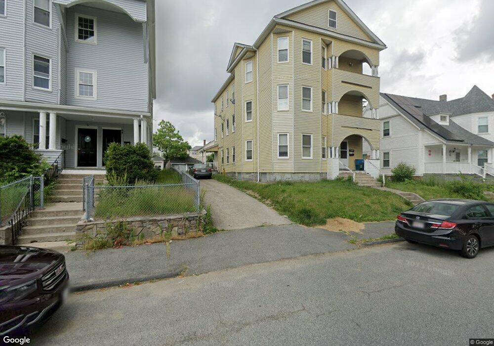
66 Stockton St Worcester, MA 01610
Vernon Hill NeighborhoodEstimated Value: $497,000 - $841,000
9
Beds
3
Baths
4,212
Sq Ft
$166/Sq Ft
Est. Value
About This Home
This home is located at 66 Stockton St, Worcester, MA 01610 and is currently estimated at $700,000, approximately $166 per square foot. 66 Stockton St is a home located in Worcester County with nearby schools including Vernon Hill Elementary School, Jacob Hiatt Magnet School, and Chandler Magnet.
Ownership History
Date
Name
Owned For
Owner Type
Purchase Details
Closed on
Oct 31, 2025
Sold by
64 Stockton St Llc
Bought by
Gordon Emmanuel
Current Estimated Value
Home Financials for this Owner
Home Financials are based on the most recent Mortgage that was taken out on this home.
Original Mortgage
$800,000
Outstanding Balance
$798,481
Interest Rate
6.26%
Mortgage Type
New Conventional
Estimated Equity
-$98,481
Purchase Details
Closed on
Jan 14, 2025
Sold by
Shade Steven T Est and Shade
Bought by
First Landing Invs Llc
Home Financials for this Owner
Home Financials are based on the most recent Mortgage that was taken out on this home.
Original Mortgage
$533,800
Interest Rate
6.69%
Mortgage Type
Commercial
Purchase Details
Closed on
Jan 13, 2025
Sold by
First Landing Invs Llc
Bought by
64 Stockton St Llc
Home Financials for this Owner
Home Financials are based on the most recent Mortgage that was taken out on this home.
Original Mortgage
$533,800
Interest Rate
6.69%
Mortgage Type
Commercial
Purchase Details
Closed on
Dec 31, 1990
Sold by
Rawan Roseann L
Bought by
Shade Steven T
Create a Home Valuation Report for This Property
The Home Valuation Report is an in-depth analysis detailing your home's value as well as a comparison with similar homes in the area
Home Values in the Area
Average Home Value in this Area
Purchase History
| Date | Buyer | Sale Price | Title Company |
|---|---|---|---|
| Gordon Emmanuel | $850,000 | -- | |
| First Landing Invs Llc | $400,000 | None Available | |
| 64 Stockton St Llc | $482,000 | None Available | |
| Shade Steven T | $147,000 | -- |
Source: Public Records
Mortgage History
| Date | Status | Borrower | Loan Amount |
|---|---|---|---|
| Open | Gordon Emmanuel | $800,000 | |
| Previous Owner | First Landing Invs Llc | $533,800 | |
| Previous Owner | Shade Steven T | $145,500 | |
| Previous Owner | Shade Steven T | $127,950 | |
| Previous Owner | Shade Steven T | $2,000 |
Source: Public Records
Tax History
| Year | Tax Paid | Tax Assessment Tax Assessment Total Assessment is a certain percentage of the fair market value that is determined by local assessors to be the total taxable value of land and additions on the property. | Land | Improvement |
|---|---|---|---|---|
| 2025 | $8,022 | $608,200 | $97,700 | $510,500 |
| 2024 | $7,415 | $539,300 | $97,700 | $441,600 |
| 2023 | $7,097 | $494,900 | $84,900 | $410,000 |
| 2022 | $6,180 | $406,300 | $68,000 | $338,300 |
| 2021 | $5,522 | $339,200 | $54,300 | $284,900 |
| 2020 | $5,120 | $301,200 | $54,000 | $247,200 |
| 2019 | $4,552 | $252,900 | $47,100 | $205,800 |
| 2018 | $4,461 | $235,900 | $47,100 | $188,800 |
| 2017 | $4,196 | $218,300 | $47,100 | $171,200 |
| 2016 | $3,967 | $192,500 | $33,300 | $159,200 |
| 2015 | $3,863 | $192,500 | $33,300 | $159,200 |
| 2014 | $3,761 | $192,500 | $33,300 | $159,200 |
Source: Public Records
Map
Nearby Homes
- 64 Stockton St Unit 2
- 64 Stockton St Unit 3
- 68 Stockton St Unit 2
- 70 Stockton St
- 70 Stockton St Unit 2
- 70 Stockton St Unit 3
- 70 Stockton St Unit 1
- 68 Stockton St
- 68 Stockton St Unit 1
- 68 Stockton St Unit 3
- 22 Stockton St
- 28 Stockton St
- 18 Stockton St
- 19 Fairbanks St
- 21 Ames St
- 23 Fairbanks St
- 25 Ames St
- 23 Ames St
- 23 Ames St Unit 2
- 52 Stockton St
Your Personal Tour Guide
Ask me questions while you tour the home.