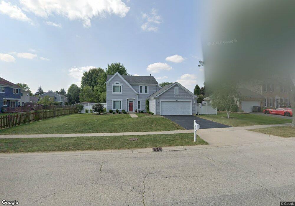
660 Covered Bridge Dr Unit 1 Elgin, IL 60124
Providence NeighborhoodEstimated Value: $375,507 - $393,000
3
Beds
3
Baths
1,747
Sq Ft
$220/Sq Ft
Est. Value
About This Home
This home is located at 660 Covered Bridge Dr Unit 1, Elgin, IL 60124 and is currently estimated at $384,377, approximately $220 per square foot. 660 Covered Bridge Dr Unit 1 is a home located in Kane County with nearby schools including Howard B. Thomas Grade School, Prairie Knolls Middle School, and Central Middle School.
Ownership History
Date
Name
Owned For
Owner Type
Purchase Details
Closed on
Apr 1, 2016
Sold by
Zafiropoulos Dina I and Estate Of John K Zafiropoulos
Bought by
Zafiropoulos Dina and The Zafiropoulos Revocable Tr
Current Estimated Value
Purchase Details
Closed on
Oct 23, 1996
Sold by
Stoskus Joseph and Stoskus Kelly
Bought by
Zafiropoulos John K and Zafiropoulos Dina A
Home Financials for this Owner
Home Financials are based on the most recent Mortgage that was taken out on this home.
Original Mortgage
$116,000
Outstanding Balance
$10,869
Interest Rate
8.32%
Estimated Equity
$373,508
Create a Home Valuation Report for This Property
The Home Valuation Report is an in-depth analysis detailing your home's value as well as a comparison with similar homes in the area
Home Values in the Area
Average Home Value in this Area
Purchase History
| Date | Buyer | Sale Price | Title Company |
|---|---|---|---|
| Zafiropoulos Dina | -- | None Available | |
| Zafiropoulos John K | $145,000 | 1St American Title |
Source: Public Records
Mortgage History
| Date | Status | Borrower | Loan Amount |
|---|---|---|---|
| Open | Zafiropoulos John K | $116,000 |
Source: Public Records
Tax History
| Year | Tax Paid | Tax Assessment Tax Assessment Total Assessment is a certain percentage of the fair market value that is determined by local assessors to be the total taxable value of land and additions on the property. | Land | Improvement |
|---|---|---|---|---|
| 2024 | $8,093 | $100,157 | $28,317 | $71,840 |
| 2023 | $7,737 | $90,484 | $25,582 | $64,902 |
| 2022 | $7,329 | $82,505 | $23,326 | $59,179 |
| 2021 | $7,076 | $77,136 | $21,808 | $55,328 |
| 2020 | $4,561 | $73,638 | $20,819 | $52,819 |
| 2019 | $4,657 | $70,144 | $19,831 | $50,313 |
| 2018 | $4,709 | $66,080 | $18,682 | $47,398 |
| 2017 | $4,813 | $62,469 | $17,661 | $44,808 |
| 2016 | $5,197 | $57,955 | $16,385 | $41,570 |
| 2015 | -- | $53,121 | $15,018 | $38,103 |
| 2014 | -- | $48,554 | $14,833 | $33,721 |
| 2013 | -- | $49,835 | $15,224 | $34,611 |
Source: Public Records
Map
Nearby Homes
- 593 Covered Bridge Dr
- 611 Woodbridge Dr
- 500 S Randall Rd
- 647 Tuscan View
- 651 Lancaster Cir
- 821 Red Barn Ln
- 571 Lismore Cir
- 581 Lismore Cir
- 585 Lismore Cir
- 549 Arye Dr
- 587 Lismore Cir
- 589 Lismore Cir
- 2038 College Green Dr
- 592 Lismore Cir
- 552 Arye Dr
- 2060 Muirfield Cir
- 591 Lismore Cir
- 594 Lismore Cir
- 593 Lismore Cir
- 596 Lismore Cir
- 650 Covered Bridge Dr Unit 1
- 2500 College Green Dr Unit 1
- 640 Covered Bridge Ct
- 2510 College Green Dr Unit 1
- 2520 College Green Dr
- 667 Covered Bridge Dr
- 661 Covered Bridge Dr
- 655 Covered Bridge Dr
- 675 Covered Bridge Dr
- 638 Covered Bridge Ct
- 645 Covered Bridge Dr
- 2530 College Green Dr
- 630 Covered Bridge Ct
- 635 Covered Bridge Dr
- 632 Covered Bridge Ct
- 2480 College Green Dr
- 636 Covered Bridge Ct
- 2499 College Green Dr
- 2505 College Green Dr
- 625 Covered Bridge Dr
Your Personal Tour Guide
Ask me questions while you tour the home.