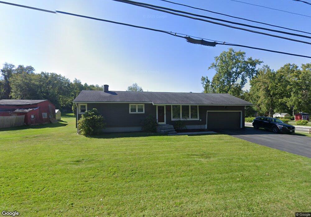
660 Dalton Division Rd Pittsfield, MA 01201
Estimated Value: $302,000 - $329,256
3
Beds
3
Baths
1,175
Sq Ft
$270/Sq Ft
Est. Value
About This Home
This home is located at 660 Dalton Division Rd, Pittsfield, MA 01201 and is currently estimated at $317,564, approximately $270 per square foot. 660 Dalton Division Rd is a home located in Berkshire County with nearby schools including Williams Elementary School, Theodore Herberg Middle School, and Pittsfield High School.
Ownership History
Date
Name
Owned For
Owner Type
Purchase Details
Closed on
Oct 30, 2009
Sold by
Higgins John B and Higgins Mary A
Bought by
Zaslavsky Vadim
Current Estimated Value
Home Financials for this Owner
Home Financials are based on the most recent Mortgage that was taken out on this home.
Original Mortgage
$120,000
Outstanding Balance
$78,595
Interest Rate
5.06%
Mortgage Type
Purchase Money Mortgage
Estimated Equity
$238,969
Create a Home Valuation Report for This Property
The Home Valuation Report is an in-depth analysis detailing your home's value as well as a comparison with similar homes in the area
Home Values in the Area
Average Home Value in this Area
Purchase History
| Date | Buyer | Sale Price | Title Company |
|---|---|---|---|
| Zaslavsky Vadim | $150,000 | -- | |
| Zaslavsky Vadim | $150,000 | -- | |
| Zaslavsky Vadim | $150,000 | -- |
Source: Public Records
Mortgage History
| Date | Status | Borrower | Loan Amount |
|---|---|---|---|
| Open | Zaslavsky Vadim | $20,000 | |
| Open | Zaslavsky Vadim | $120,000 | |
| Closed | Zaslavsky Vadim | $120,000 |
Source: Public Records
Tax History Compared to Growth
Tax History
| Year | Tax Paid | Tax Assessment Tax Assessment Total Assessment is a certain percentage of the fair market value that is determined by local assessors to be the total taxable value of land and additions on the property. | Land | Improvement |
|---|---|---|---|---|
| 2025 | $4,584 | $255,500 | $66,200 | $189,300 |
| 2024 | $4,347 | $235,600 | $66,200 | $169,400 |
| 2023 | $4,038 | $220,400 | $66,200 | $154,200 |
| 2022 | $2,979 | $160,500 | $66,200 | $94,300 |
| 2021 | $2,991 | $155,400 | $66,200 | $89,200 |
| 2020 | $3,002 | $152,300 | $66,200 | $86,100 |
| 2019 | $3,193 | $164,400 | $71,200 | $93,200 |
| 2018 | $3,120 | $155,900 | $66,200 | $89,700 |
| 2017 | $2,827 | $144,000 | $57,700 | $86,300 |
| 2016 | $2,733 | $145,700 | $57,700 | $88,000 |
| 2015 | $2,631 | $145,700 | $57,700 | $88,000 |
Source: Public Records
Map
Nearby Homes
- 2 Caratina Ave
- 225 Karen Dr
- 0 Dalton Division Rd
- 210 Pine Grove Dr
- 215 Pine Grove Dr
- 204 Harryel St
- 165 Harryel St
- 171 Harryel St
- 989 Williams St
- 387 Dalton Division Rd
- 64 Elaine Dr
- 932 Williams St
- 26 Filomena Dr
- 240 Kirchner Rd
- 787 Williams St
- 59 Joan Dr
- 4 Filomena Dr
- 59 Bellmore Dr
- 50 Bellmore Dr
- 350 Washington Mountain Rd
- 17 April Ln
- 664 Dalton Division Rd
- 658 Dalton Division Rd
- 25 April Ln
- 668 Dalton Division Rd
- 18 April Ln
- 656 Dalton Division Rd
- 33 April Ln
- 670 Dalton Division Rd
- 654 Dalton Division Rd
- 676 Dalton Division Rd
- 639 Dalton Division Rd
- 601 Dalton Division Rd
- 629 Dalton Division Rd
- 659 Dalton Division Rd
- 601 Dalton Division Rd
- 680 Dalton Division Rd
- 26 Caratina Dr
- 24 Caratina Dr
- 22 Caratina Dr