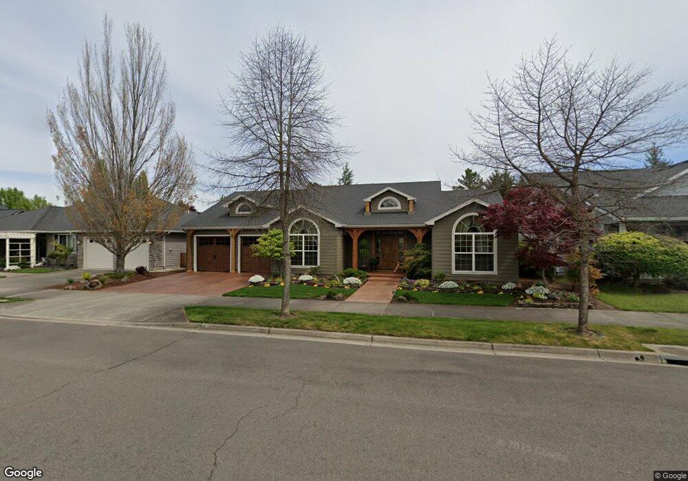
660 Silver Creek Dr Central Point, OR 97502
Estimated Value: $503,627 - $547,000
3
Beds
2
Baths
2,078
Sq Ft
$254/Sq Ft
Est. Value
About This Home
This home is located at 660 Silver Creek Dr, Central Point, OR 97502 and is currently estimated at $527,907, approximately $254 per square foot. 660 Silver Creek Dr is a home located in Jackson County with nearby schools including Richardson Elementary School, Scenic Middle School, and Crater High School.
Ownership History
Date
Name
Owned For
Owner Type
Purchase Details
Closed on
Aug 21, 2003
Sold by
W L Moore Construction Llc
Bought by
Mosttler Eddie S and Mosttler Bonnie M
Current Estimated Value
Home Financials for this Owner
Home Financials are based on the most recent Mortgage that was taken out on this home.
Original Mortgage
$232,000
Outstanding Balance
$91,931
Interest Rate
4.25%
Mortgage Type
Purchase Money Mortgage
Estimated Equity
$435,976
Create a Home Valuation Report for This Property
The Home Valuation Report is an in-depth analysis detailing your home's value as well as a comparison with similar homes in the area
Home Values in the Area
Average Home Value in this Area
Purchase History
| Date | Buyer | Sale Price | Title Company |
|---|---|---|---|
| Mosttler Eddie S | $250,902 | Ticor Title | |
| W L Moore Construction Llc | $55,000 | Ticor Title |
Source: Public Records
Mortgage History
| Date | Status | Borrower | Loan Amount |
|---|---|---|---|
| Open | Mosttler Eddie S | $232,000 |
Source: Public Records
Tax History Compared to Growth
Tax History
| Year | Tax Paid | Tax Assessment Tax Assessment Total Assessment is a certain percentage of the fair market value that is determined by local assessors to be the total taxable value of land and additions on the property. | Land | Improvement |
|---|---|---|---|---|
| 2025 | $4,776 | $287,240 | $126,090 | $161,150 |
| 2024 | $4,776 | $278,880 | $122,420 | $156,460 |
| 2023 | $4,622 | $270,760 | $118,850 | $151,910 |
| 2022 | $4,514 | $270,760 | $118,850 | $151,910 |
| 2021 | $4,385 | $262,880 | $115,390 | $147,490 |
| 2020 | $4,409 | $255,230 | $112,030 | $143,200 |
| 2019 | $4,482 | $240,590 | $105,600 | $134,990 |
| 2018 | $4,345 | $233,590 | $102,520 | $131,070 |
| 2017 | $4,245 | $233,590 | $102,520 | $131,070 |
| 2016 | $4,108 | $220,190 | $96,640 | $123,550 |
| 2015 | $3,901 | $220,190 | $96,640 | $123,550 |
| 2014 | $3,558 | $207,560 | $91,080 | $116,480 |
Source: Public Records
Map
Nearby Homes
- 626 Griffin Oaks Dr
- 407 Silver Creek Dr
- 1134 Steamboat Dr
- 1135 Shake Dr
- 619 Palo Verde Way
- 0 Boulder Ridge St
- 1159 Rustler Peak St
- 1167 Boulder Ridge St
- 905 Comet Ave
- 526 Stone Pointe Dr
- 629 Bridge Creek Dr
- 349 Cascade Dr
- 342 Hazel St
- 420 Mayberry Ln
- 1317 River Run St
- 1407 Rustler Peak St
- 4626 N Pacific Hwy
- 349 W Pine St
- 55 Crater Ln
- 429 Mayberry Ln
- 652 Silver Creek Dr
- 668 Silver Creek Dr
- 649 Oakley St Unit 2
- 639 Oakley St
- 659 Oakley St
- 544 Silver Creek Dr
- 767 Griffin Oaks Dr
- 661 Silver Creek Dr
- 529 Oakley St
- 653 Silver Creek Dr
- 669 Oakley St
- 545 Silver Creek Dr Unit 2
- 536 Silver Creek Dr
- 779 Silver Creek Dr
- 519 Oakley St
- 663 Silver Creek Dr
- 655 Silver Creek Dr
- 648 Oakley St
- 671 Silver Creek Dr
- 537 Silver Creek Dr