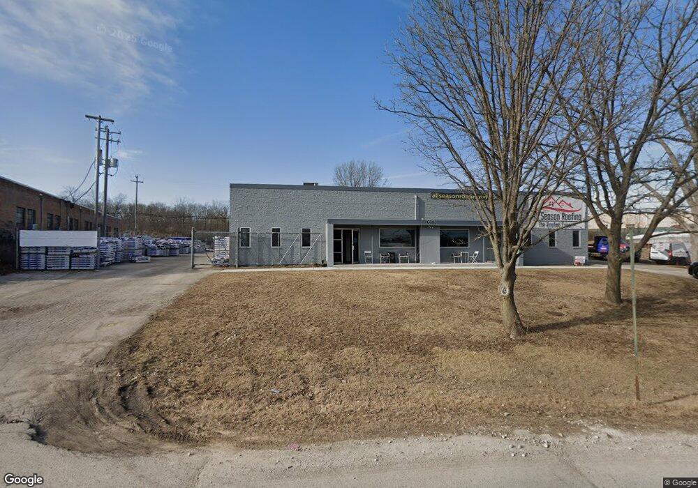
6600 Industrial Loop Greendale, WI 53129
Estimated Value: $1,196,536
Studio
--
Bath
--
Sq Ft
1.31
Acres Lot
About This Home
This home is located at 6600 Industrial Loop, Greendale, WI 53129 and is currently estimated at $1,196,536. 6600 Industrial Loop is a home located in Milwaukee County with nearby schools including Canterbury Elementary School, Greendale Middle School, and Greendale High School.
Ownership History
Date
Name
Owned For
Owner Type
Purchase Details
Closed on
Jul 26, 2023
Sold by
B & H Holdings Llc
Bought by
Massimo Property Investment Llc
Current Estimated Value
Home Financials for this Owner
Home Financials are based on the most recent Mortgage that was taken out on this home.
Original Mortgage
$920,000
Outstanding Balance
$898,564
Interest Rate
6.69%
Mortgage Type
New Conventional
Estimated Equity
$297,972
Purchase Details
Closed on
Mar 1, 2000
Sold by
Goelz Robert W and Goelz Carol L
Bought by
B & H Holdings Llc
Create a Home Valuation Report for This Property
The Home Valuation Report is an in-depth analysis detailing your home's value as well as a comparison with similar homes in the area
Home Values in the Area
Average Home Value in this Area
Purchase History
We collect this data history from publicly available records. To have your information removed, we recommend requesting removal directly through your county’s website.
| Date | Buyer | Sale Price | Title Company |
|---|---|---|---|
| Massimo Property Investment Llc | $1,150,000 | First American Title | |
| B & H Holdings Llc | $379,600 | -- |
Source: Public Records
Mortgage History
We collect this data history from publicly available records. To have your information removed, we recommend requesting removal directly through your county’s website.
| Date | Status | Borrower | Loan Amount |
|---|---|---|---|
| Open | Massimo Property Investment Llc | $920,000 |
Source: Public Records
Tax History
| Year | Tax Paid | Tax Assessment Tax Assessment Total Assessment is a certain percentage of the fair market value that is determined by local assessors to be the total taxable value of land and additions on the property. | Land | Improvement |
|---|---|---|---|---|
| 2024 | $11,522 | $630,800 | $94,100 | $536,700 |
| 2023 | $11,816 | $598,300 | $94,100 | $504,200 |
| 2022 | $11,861 | $598,300 | $94,100 | $504,200 |
| 2021 | $13,718 | $527,900 | $84,000 | $443,900 |
| 2020 | $13,532 | $527,900 | $84,000 | $443,900 |
| 2019 | $13,563 | $527,900 | $84,000 | $443,900 |
| 2018 | $13,775 | $527,900 | $84,000 | $443,900 |
| 2017 | $11,677 | $456,400 | $84,000 | $372,400 |
| 2016 | $11,619 | $456,400 | $84,000 | $372,400 |
| 2015 | $11,696 | $440,000 | $84,000 | $356,000 |
| 2014 | $11,672 | $440,000 | $84,000 | $356,000 |
| 2013 | $11,876 | $440,000 | $84,000 | $356,000 |
Source: Public Records
Map
Nearby Homes
- 6009 Oriole Ln
- 6909 Darnell Ln
- 6190 W Loomis Rd
- 5864 Ramona Dr
- 5890 Lakeview Dr
- 5782 Rustic Ln
- 5544 Oakwood St
- 5616 Beaver Ct
- 7693 Overlook Dr
- Lt 0 S 76th St
- 5620 Euston St
- 5564 Angle Ln
- 5633 Bentwood Ln
- 8221 Fairmont Ln
- 7405 Eaton Ln
- 5302 Lakeview Dr
- 5429 W Yale Dr
- 5922 Sycamore St
- 5319 Lakeside Dr
- 6748 S Yale Dr
- 6700 Industrial Loop
- 6209 Industrial Ct
- 6169 Industrial Ct
- 6250 Industrial Ct
- 6300 Industrial Loop
- 6180 Industrial Ct
- 6789 Industrial Loop
- 6330 Industrial Loop
- 6100 Industrial Ct
- 6800 Industrial Loop
- 6801 Industrial Loop
- 6901 Industrial Loop
- 6951 Industrial Loop
- 6400 Industrial Loop
- 6555 Radburn Ln
- 6573 Radburn Ln
- 6571 Radburn Ln
- 6591 Radburn Ln
- 6589 Radburn Ln Unit 6589
- 6044 Oakwood Lane West Ln W
Your Personal Tour Guide
Ask me questions while you tour the home.