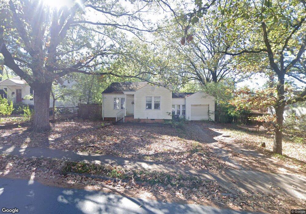
6601 Hawthorne Rd Little Rock, AR 72207
Kingwood NeighborhoodEstimated Value: $198,420 - $277,000
--
Bed
1
Bath
676
Sq Ft
$332/Sq Ft
Est. Value
About This Home
This home is located at 6601 Hawthorne Rd, Little Rock, AR 72207 and is currently estimated at $224,605, approximately $332 per square foot. 6601 Hawthorne Rd is a home located in Pulaski County with nearby schools including Jefferson Elementary School, Pulaski Heights Middle School, and Central High School.
Ownership History
Date
Name
Owned For
Owner Type
Purchase Details
Closed on
Apr 21, 2005
Sold by
Reznick Greg W and Reznick Sherry M
Bought by
Lucy Walter Hebron
Current Estimated Value
Home Financials for this Owner
Home Financials are based on the most recent Mortgage that was taken out on this home.
Original Mortgage
$72,000
Interest Rate
5.93%
Mortgage Type
Fannie Mae Freddie Mac
Create a Home Valuation Report for This Property
The Home Valuation Report is an in-depth analysis detailing your home's value as well as a comparison with similar homes in the area
Home Values in the Area
Average Home Value in this Area
Purchase History
| Date | Buyer | Sale Price | Title Company |
|---|---|---|---|
| Lucy Walter Hebron | $90,000 | American Abstract & Title Co |
Source: Public Records
Mortgage History
| Date | Status | Borrower | Loan Amount |
|---|---|---|---|
| Closed | Lucy Walter Hebron | $72,000 |
Source: Public Records
Tax History Compared to Growth
Tax History
| Year | Tax Paid | Tax Assessment Tax Assessment Total Assessment is a certain percentage of the fair market value that is determined by local assessors to be the total taxable value of land and additions on the property. | Land | Improvement |
|---|---|---|---|---|
| 2025 | $2,545 | $48,280 | $36,600 | $11,680 |
| 2024 | $2,181 | $48,280 | $36,600 | $11,680 |
| 2023 | $2,181 | $48,280 | $36,600 | $11,680 |
| 2022 | $1,999 | $48,280 | $36,600 | $11,680 |
| 2021 | $1,829 | $25,950 | $19,000 | $6,950 |
| 2020 | $1,817 | $25,950 | $19,000 | $6,950 |
| 2019 | $1,783 | $25,950 | $19,000 | $6,950 |
| 2018 | $1,646 | $25,950 | $19,000 | $6,950 |
| 2017 | $1,509 | $25,950 | $19,000 | $6,950 |
| 2016 | $1,371 | $19,590 | $7,000 | $12,590 |
| 2015 | $1,373 | $19,590 | $7,000 | $12,590 |
| 2014 | $1,373 | $19,586 | $7,000 | $12,586 |
Source: Public Records
Map
Nearby Homes
- 6612 Hawthorne Rd
- 6700 Hawthorne Rd
- 6600 Waverly Dr
- 2219 & 2221 Blackwood Rd
- 2408 Blackwood Rd
- 109 Schoolwood Ln
- 723 Pine Valley Rd
- 2100 Durwood Rd
- 6613 Brentwood Rd
- 6717 Kavanaugh Place
- 1824 N Hughes St
- 6224 Brentwood Rd
- 6712 Longwood Rd
- 6615 Kenwood Rd
- 201 S Ridge Rd
- 2908 Crouchwood Rd
- 208 S Ridge Rd
- 6320 Cantrell Rd
- 2 Shannon Dr
- 6523 Cantrell Rd
- 0 Hawthorne Rd
- 6513 Hawthorne Rd
- 6605 Hawthorne Rd
- 6509 Hawthorne Rd
- 6609 Hawthorne Rd
- 6600 Westover Dr
- 6604 Westover Dr
- 6512 Westover Dr
- 6608 Westover Dr
- 6508 Westover Dr
- 6505 Hawthorne Rd
- 6613 Hawthorne Rd
- 6600 Hawthorne Rd
- 6530 Hawthorne Rd
- 6604 Hawthorne Rd
- 6528 Hawthorne Rd
- 6608 Hawthorne Rd
- 6612 Westover Dr
- 6504 Westover Dr
- 6426 Hawthorne Rd